Land Records

United States Bureau of Land Management Tract Books, 1800-c. 1955

3,907 land management tract books containing official records of the land status and transactions involving surveyed public lands arranged by state and then by township and range. These books indicate who obtained the land, and include a physical description of the tract and where the land is located. The type of transaction is also recorded such as cash entry, credit entry, homesteads, patents (deeds) granted by the Federal Government, and other conveyances of title such as Indian allotments, internal improvement grants (to states), military bounty land warrants, private land claims, railroad grants, school grants, and swamp grants. Additional items of information included in the tract books are as follows: number of acres, date of sale, purchase price, land office, entry number, final Certificate of Purchase number, and notes on relinquishments and conversions.

Iowa Atlases, Farm Directories, and Plat Books

This collection contains digital atlases, farm directories, and plat books for all 99 Iowa counties. We have collated these from a variety of online sources, and provide them here as a single source for all online Iowa County Atlases, Farm Directories, and Plat Books.

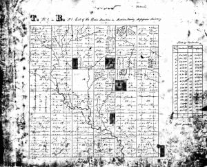
Early Land Ownership and Township Plats, 1785-1898

These township plat maps began with the Public Lands Survey in the United States initiated by the Land Ordinance Act of 1785, and this collection includes maps for all or parts of Alabama, Illinois, Indiana, Iowa, Kansas, Mississippi, Missouri, Ohio, Oklahoma, Oregon, Washington, and Wisconsin. Maps were prepared from survey field notes taken by deputy surveyors and can include physical details and man-made improvements. They also indicate township and section lines, section numbers, acreage of holdings, and sometimes names of landholders.

York County Maine Registry of Deeds 1642-1737

At a meeting of the Maine Historical Society, held in Portland on the 23d of December, 1882, a communication was received from Mr. John T. Hull, proposing to publish the early volumes in the York registry of deeds and asking for the cooperation of the society. Messrs. Edward H. Elwell, James P. Baxter and William Goold were thereupon appointed a committee to present the matter to the legislature of Maine. The fruition of their collaboration are the following 20 volumes of York County Maine Registry of Deeds.

Dillard Love – Land Record

Dillard Love conveyed to Mary E. Love, daughter of Robert C. Love, Ninety-one acres of land in Cherokee District, Washington County, Tennessee, the consideration for same being LOVE and AFFECTION. Note-This was done by Dillard Love because the said Mary Love was destitute. Deed dated 1843, and on file in the Jonesboro Records-F.D. Love.

Township 20-28 North, Range 12 East, Indian Meridian

Exhibit D The list of land filed with the Commission to the Five Civilized Tribes, December 16, 1902, and amended January 23, 1903, by Walter S. Logon, claiming to be the attorney for the Delaware Indians, is found as indicated below, from the Commission’s records, to be claimed and occupied by Delaware Citizens of the …

Township 20-28 North, Range 12 East, Indian Meridian Read More »

Township 22-27 North, Range 16 East, Indian Meridian

Exhibit D The list of land filed with the Commission to the Five Civilized Tribes, December 16, 1902, and amended January 23, 1903, by Walter S. Logon, claiming to be the attorney for the Delaware Indians, is found as indicated below, from the Commission’s records, to be claimed and occupied by Delaware Citizens of the …

Township 22-27 North, Range 16 East, Indian Meridian Read More »

Township 24-27 North, Range 17 East, Indian Meridian

Exhibit D The list of land filed with the Commission to the Five Civilized Tribes, December 16, 1902, and amended January 23, 1903, by Walter S. Logon, claiming to be the attorney for the Delaware Indians, is found as indicated below, from the Commission’s records, to be claimed and occupied by Delaware Citizens of the …

Township 24-27 North, Range 17 East, Indian Meridian Read More »

Land selected and occupied by deceased registered Delaware and now in possession of their descendant

December 31, 1903 The following described land of the Cherokee Nation is hereby segregated as the Delaware segregation of said nation, in accordance with section 23 of the Cherokee agreement (Public—No. 241), approved by the President July 1, 1902, and ratified by the Cherokee Nation August 7, 1902; and this list is in substitution or …

Land selected and occupied by deceased registered Delaware and now in possession of their descendant Read More »

Land in Adams and Logon list which has been claimed by Cherokee Citizens of Delaware blood

Exhibit C Land in Adams and Logon list which has been claimed by Cherokee Citizens of Delaware blood, claiming under their Cherokee right as shown by attempts to file thereon. Where same land is claimed by two applicants, only the original claim is shown NOTE: After you find your ancestor listed on this page, you …

Land in Adams and Logon list which has been claimed by Cherokee Citizens of Delaware blood Read More »

Township 20-28 North, Range 13 East, Indian Meridian

Exhibit D The list of land filed with the Commission to the Five Civilized Tribes, December 16, 1902, and amended January 23, 1903, by Walter S. Logon, claiming to be the attorney for the Delaware Indians, is found as indicated below, from the Commission’s records, to be claimed and occupied by Delaware Citizens of the …

Township 20-28 North, Range 13 East, Indian Meridian Read More »

Township 22-29 North, Range 14 East, Indian Meridian

Exhibit D The list of land filed with the Commission to the Five Civilized Tribes, December 16, 1902, and amended January 23, 1903, by Walter S. Logon, claiming to be the attorney for the Delaware Indians, is found as indicated below, from the Commission’s records, to be claimed and occupied by Delaware Citizens of the …

Township 22-29 North, Range 14 East, Indian Meridian Read More »

Township 23-28 North, Range 15 East, Indian Meridian

Exhibit D The list of land filed with the Commission to the Five Civilized Tribes, December 16, 1902, and amended January 23, 1903, by Walter S. Logon, claiming to be the attorney for the Delaware Indians, is found as indicated below, from the Commission’s records, to be claimed and occupied by Delaware Citizens of the …

Township 23-28 North, Range 15 East, Indian Meridian Read More »

Pin It on Pinterest

Scroll to Top