Captains entitled to the additional half section, Mushulatubbe’s district

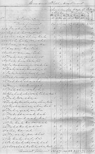
MUSHULATUBBE A list of the Captains entitled to the additional half section, under the nineteenth article of the treaty, in Mushulatubbe’s district Names. Number of acres cultivated Entitled as Captains Total number of Acres Holabe 14 320 480 Adam Fulsom 20 320 640 Joseph Kincade 22 320 640 Suba, or Horse 9 320 320 Talking Warrior 12 320 480 Pistabe 10 320 320 Koehoma 14 320 490 Tanahacho 6 320 320 Isaac James 20 320 640 Sockatubbee 15 320 480 Hoshehoma 12 320 480 Immeleche 14 320 480 Atamemastubbe 12 320 480 Holba 15 320 480 Nashbanawa 12 320 480 … Read more

Captains entitled to the additional half section, Leflore District

English names listed on the 1831 “list of claims allowed under the treaty in Greenwood Leflore district”. These are “persons that have relinquished their land. Laflore District A list of the Captains entitled to the additional half section under the nineteenth article of treaty. No    Names Number of Acres Cultivated Entitled as Captains Total number of acres 1 Thomas Leflore 12 320 480 2 James Shields 21 320 640 3 Okchia 2 320 400 4 Anthony Turnbull 40 320 800 5 Lewis Durant 8 320 400 6 Cullashubbee 14 320 480 7 Minta 4 320 400 8 Mihiachubbee 2 320 … Read more

Choctaws Who Served in 1794

Choctaws who served a campaign under General Anthony Wayne in 1794 Mungoohemeter In Leflore’s district Ishlomakahacho Mushulatubbee’s district Atokoli Mushulatubbee’s district Tishlerwelblue Mushulatubbee’s district Achuckmatibi Mushulatubbee’s district Tishumiko Mushulatubbee’s district Hikatibi Mushulatubbee’s district Shikopoomma Mushulatubbee’s district Hepoe Mushulatubbee’s district Pashitunabi Mushulatubbee’s district Pashistubi Mushulatubbee’s district Hollabbee Mushulatubbee’s district Shophanchobi Mushulatubbee’s district Yakkaya Mushulatubbee’s district Jishkeatoka Mushulatubbee’s district Lanchebi Mushulatubbee’s district John Locus Mushulatubbee’s district Hanothomma Mushulatubbee’s district Japenahomma Mushulatubbee’s district Locka Mushulatubbee’s district Falasner Mushulatubbee’s district Okloha Mushulatubbee’s district Hikatibi Mushulatubbee’s district Aholhtina Mushulatubbee’s district Total number now living is 24, and only 20 are provided for.

Trail of Tears Evaluation

The Treaty of Dancing Rabbit Creek contains a long list of individuals (3547) receiving land reservations and positively recognizes these people as members of the tribe in a legally binding fashion. Many of these land recipients are elsewhere identified as countrymen or mixed bloods. There can be little doubt that they were accepted as leaders and members of the tribe. The various claims to land and claims for other reasons are found in American State Papers and offer positive identification of mixed bloods in individual cases. They also help pinpoint the location of mixed-blood land holdings.

Roll of Captain John Stuarts Company

An effective Roll of Captain John Stuarts Company Working at Fort Loudoun July 11th, 1757 John Stuart Captain James Adamson Lieutenant John Miller, Sergeant Jacob Glaughenberg,  Sergeant John Roberts,  Corp Arch, Watson,  Dr Lawrence Masterson John Bower Archibald Watson Senr. Jacob Rough Joseph Velts George Swaggart George Moan Henry Volk Thomas Kelly James Read George Hefser Thomas Coyle Henrye Jinceller Stephen Terrey Joseph Vert Martin Miller Bryan Rourk Michael Shecklin Henry Maxwell John Shults Joseph Vennegan William Campbell Adam Kellar John Purcell James Moon Tobias Holmes Thomas Mills Martin Herter Edward Manahan William Buttler Patrick Campbell Thomas Abrahood Gaspar Dickinson … Read more

1757, July 6, Roll of Captain John Postells Company

An Effective Roll of Captain John Postells Company July 6th 1757 Captain John Postell Lieutenant Maurice Anderson Ensign Joseph Lloyd Anthony Holsendorf  Serj. Thomas Turner Corp. Andrew Black Drum George Ulrick  Solomon Witham Jacob Bowrly Frederick Hoof Peter Sandwell William Busby Frederick Houx John Simonds Jacob Connor ThomasHodge William Starky Lewis Committer Solomon Holmes Gosper Starky Leonard Campbell Geroge Holsinger William McFall Lewis Colson Robert Jefferson William Strawthers Frederick Dore SamuelJackson George Strawthers Peter Designer Joseph Lambert Nicholas Thorne Nicholas Fritts Emanuel Miller Elias Tage Thomas Hill John Nagerly Henry Tilmore Henry Hammond Gosper Oth Frederick Ulmore Tobias Hartshog George … Read more

English Names from Greenwood Leflore District

With the passage by the U.S. Congress of the Indian Removal Act that same year, the legal mechanisms were put in place for President Andrew Jackson to negotiate with Indian groups for their deportation. The Choctaws, Mississippi’s largest Indian group, were the first southeastern Indians to accept removal with the Treaty of Dancing Rabbit Creek in September 1830. The treaty provided that the Choctaws would receive land west of the Mississippi River in exchange for the remaining Choctaw lands in Mississippi. The Choctaws were given three years to leave Mississippi. English names listed on the 1831 “list of claims allowed … Read more

Mushulatubbee District, English Names

With the passage by the U.S. Congress of the Indian Removal Act that same year, the legal mechanisms were put in place for President Andrew Jackson to negotiate with Indian groups for their deportation. The Choctaws, Mississippi’s largest Indian group, were the first southeastern Indians to accept removal with the Treaty of Dancing Rabbit Creek in September 1830. The treaty provided that the Choctaws would receive land west of the Mississippi River in exchange for the remaining Choctaw lands in Mississippi. The Choctaws were given three years to leave Mississippi. English names listed on the1831 “list of claims allowed under … Read more

Nitachacha District, English Names

With the passage by the U.S. Congress of the Indian Removal Act that same year, the legal mechanisms were put in place for President Andrew Jackson to negotiate with Indian groups for their deportation. The Choctaws, Mississippi’s largest Indian group, were the first southeastern Indians to accept removal with the Treaty of Dancing Rabbit Creek in September 1830. The treaty provided that the Choctaws would receive land west of the Mississippi River in exchange for the remaining Choctaw lands in Mississippi. The Choctaws were given three years to leave Mississippi. English names listed on the1831 “list of claims allowed under … Read more

Wallace Roll

Freedmen Notice

The Wallace Roll of Cherokee Freedmen in Indian Territory was created due to the citizenship of many ex-slaves (freedmen) being disputed by the Cherokee Tribe. To the freedmen, the ability to establish their status was important, not only for the sharing of the Cherokee lands, but also the payments and annuities the Cherokee Tribe was to receive in the future. A series of investigations were conducted by John W. Wallace, 1889-1890; Leo E. Bennett, 1891-92; Marcus D. Shelby, 1893; James G. Dickson, 1895-96; William Clifton, William Thompson, and Robert H. Kern, 1896-97. These investigations resulted in the Cherokee Freedmen Rolls known as the Wallace Roll, and the Kern-Clifton Roll.

Understanding the 1817 Reservation Roll

A help guide explaining the 1817 Reservation Roll of Cherokee Indians. The Reservation Roll is a listing of Cherokee Indians applying for a 640 acre tract in the East in lieu of removing to Arkansas.

Understanding the Armstrong Rolls

A guide created to assist a descendant of a Mississippi Choctaw to better understand the Armstrong Rolls and how it may apply to their ancestor.

1842 Census Roll of Osage Indians

page162

Submitted by William Armstrong Acting Superintendent, Western Territory, 1842. This census was taken for the purpose of an annuity payment. Census lists a number, name, number of males and females and total numbers.  Males and females are listed as under 10, 10-40, and over 40.

McKennon Roll Index

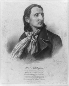
P.P. Pitchlynn, Speaker of the National Council of the Choctaw Nation and Choctaw delegate to the government of the United States

The McKennon Rolls were a specific list created by the Dawes Commission; a group responsible for identifying members of the Choctaw tribe in Mississippi. These rolls were supposed to include all the people who were officially recognized as Choctaw by the government in 1913.

Guion Miller Roll

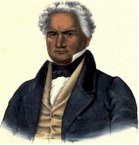
Major Ridge

The Guion Miller Roll index includes the names of all persons applying for compensation arising from the judgment of the United States Court of Claims on May 28, 1906, for the Eastern Cherokee tribe. While numerous individuals applied, not all the claims were allowed. The information included on the index is the application number, the name of the applicant, and the State or Territory in which the individual resided at the time the application was filed. The name being there does not mean the person was admitted.

Cooper Rolls

The Cooper Rolls are a Census Roll of Choctaw Families residing East of the Mississippi River and in the States of Mississippi, Louisiana and Alabama made by Douglas H. Cooper, US Agent for Choctaws, in conformity with Order of Commissioner of Indian Affairs dated May the 23rd, 1855.

Understanding the Final Rolls

AscOff

When starting your search of the Final Rolls (Dawes Rolls) it can and will be confusing.  To make this process simpler for the researcher who visits our pages I suggest you look at the information provided on the Final Rolls like a book, Index, Content, and Bibliography. The Index tells you what and where you will find the information in the book.  In this case the name, tribe and roll number.  On our pages you will find this listed as Final Roll Index.  This search produced the following: Page Roll Surname First Blood 397 26758 Swift Frank T. Cherokee by … Read more

Trail of Tears Roll

Trail of Tears Map

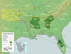
The Trail of Tears Roll is the name given by researchers to two different lists, both individually important, which provide an early glimpse into the Cherokees who went west in the early 1830’s. Lending to the confusion is the fact that both lists were created in 1835.