1871 Rocky Mountain Directory and Colorado Gazetteer

1871 Rocky Mountain Directory and Colorado Gazetteer

1871 Rocky Mountain Directory and Colorado Gazetteer, comprising a brief history of Colorado up to 1871 … together with a complete and accurate directory and history of Denver, Golden City, Black Hawk, Central City, Nevada, Idaho, and Georgetown.

Geography of the Ocmulgee-Altamaha River Basin

Altamaha Watershed

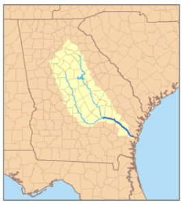
Along with the Oconee River, the Ocmulgee River is a major tributary of the Altamaha River System. Although little known outside of Georgia, the Altamaha is the third largest river on the Atlantic Coast. The Ocmulgee is 225 miles long from its beginning in the Georgia Piedmont to its confluence with the Oconee River in Southeast Georgia near Lumber City. The Altamaha continues another 140 miles to the coast at the old colonial port of Darien. The largest tributaries of the Ocmulgee begin on the eastern edge of the Atlanta Metropolitan Area. They include the Alcovy, South and Yellow Rivers … Read more

Geographical Names of the Norwich VT Locality

Of the little settlements in the township of Norwich which seem to be existing in the sunset of their former glory, may be mentioned Beaver Meadow, or West Norwich. This place presents a notable instance of that decline in population and decay of business interests in a rural community, of which Vermont affords many examples since the advent of railroads and the fever of western emigration set in. For more than thirty years population, wealth, and enterprise have been drifting away from that section of the town. Probably the settlement reached the height of its prosperity previous to 1840. During … Read more

Map of part of North America from Cape Charles to the Mouth of the River Mississipi

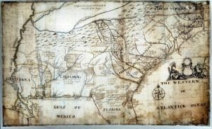
1721 Barnwell Map of Southeast America

Captain John Barnwell, otherwise known as Tuscarora Jack, was a well known frontier settler who was active in the 1711 Tuscarora War. His travels throughout the Southeast enabled him to draw a relatively accurate map of the area of his travels and exploration, some from second hand information, but most from first hand. For researchers of the Southeast this map is critical, and never before seen online in such a large form as to be able to read the hand writing and personal descriptions and historical details as outlined by Barnwell. In order to view this map in a form that made it legible you had to travel to one of the two locations the actual versions exist.

Sauthier’s 1779 Map of New York

Sauthier’s map of New York summarizes much of the British military mapping done in the years preceding the revolution. Sautier himself typifies the multi-cultural staff of the British corps of engineers. Born in Strasbourg, Sautier practiced surveying in his native Alsace. He was eventually employed by Governor Tyron in 1776, and appointed surveyor for the Province of New York in 1773. As surveyor for New York he was involved in determining the disputed boundaries of the province.  After 1776 he was employed as a military surveyor. In compiling this map Sauthier drew on his detailed surveys, as well as on … Read more

Map of Zwaanendael

Vinckeboons Map of Delaware-Bay

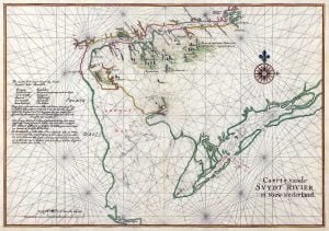
Nautical chart of Zwaanendael (“Swanendael”) and Godyn’s Bay in New Netherland. Zwaanendael was a patroonship founded by Samuel Godyn, a director of the Dutch West India Company, in 1629. Godyn made his land claim to the West India Company under jurisdiction of the Charter of Freedoms and Exemptions. After a short time, the initial 32 inhabitants were murdered by local Indians and Godyn sold his land back to the West India Company. The West India Company kept the names of the local area, including Godyn’s Bay, which eventually became Delaware Bay. The text in Dutch at left side of the … Read more

Ancient Southeastern Maps

1747 Bowen Map of the Southeast

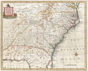
A gallery of historical Southeastern maps along with an analysis of their importance in identification of early Native American Tribes.

Map Making, from Majorca to Appalachia

From the moment that Europeans learned that a New World existed across the waters of the Atlantic, map makers in Western Europe began turning maps of that New World. At first these maps were grossly inaccurate and assumed the either the Americas were part of the Orient or merely consisted of islands off the shores of Asia. As more and more log books and navigation charts were returned to Spain, Portugal, France and England by explorers, the maps grew more precise.

John Mitchell’s Map

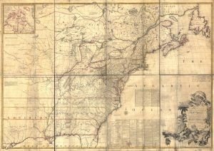
1755 Mitchell Map

The Mitchell Map remained the most detailed map of North America available in the later eighteenth century. Various impressions (and also French copies) were directly used to help establish the boundaries of the new United States of America by diplomats at the Treaty of Paris (1783) that ended the American Revolutionary War. The map’s inaccuracies subsequently led to a number of border disputes, such as in Maine. Its supposition that the Mississippi extended north to the 50th parallel (into British territory) resulted in the treaty using it as a landmark for a geographically impossible definition of the border in that … Read more

Historical Maps of the United States

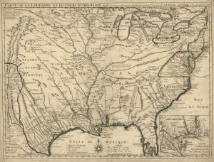
1718 De Lisle Map

Other then adding a splash of color to a web page, maps provide the researcher valuable clues to historic why’s. Here at AccessGenealogy we believe early maps play a valuable role in identifying the location and names of Indian villages and towns. While not always accurate as to the actual placement of villages (especially the early American ones), maps do shed light on the tribal affiliations, the identification of the tribe by various government entities (mainly French, Spanish and British), and approximate locations. Historical Maps of the United States 1640 Virginiae et Floridae Map 1718 de L’Isle Map 1755 Mitchell … Read more

A Geospatial Analysis

Etowah 750 AD

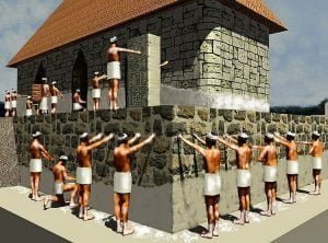
As stated in Part Three, the Stratum Unlimited, LLC report in 2001 (Other Missing Stone Archaeological Sites) virtually ignored the Native American communities in northern Georgia. Almost all were contemporary with the occupation of the Track Rock Terraces. This omission was particularly inexcusable for the town sites that were adjacent to the two creeks, which flow off of Track Rock Gap, Town Creek and Arkaqua Creek.  In 1930s and 1940s, archaeologist George Wauchope found evidence of long term occupancy at these sites that apparently began before the Track Rock terraces were constructed, and sometimes continued into the Federal Period. It … Read more

The Southern Longleaf Pine Tree

The 160 mile long Shenandoah Valley is located in northwestern Virginia and the eastern panhandle of West Virginia. Ten counties are located in this famous valley. They are (south to north) Rockbridge, Augusta, Rockingham, Page, Shenandoah, Warren, Frederick and Clarke Counties in Virginia, plus Berkeley and Jefferson Counties in West Virginia. The main Shenandoah River is formed by the North Fork of the Shenandoah and South Fork of the Shenandoah that join in Front Royal, VA. They are created by tributaries in the central mountains of Virginia. The Shenandoah River and all its tributaries flow northeastward through the Great Appalachian … Read more

Elahsa

Elahsa (‘village of the great willows’). A former Hidatsa village on the north bank of Knife River, North Dakota, about 3 miles from Missouri River. Alternate Spellings: Biddahtsi-Awatiss – Maxmillian, Voy. dans l’int de l’Am. III, 3, 1843. Eláh-sá – Maxmillian, Trav., 178, 1843. Hidatsa – Matthews, Ethnog. Hidatsa, 38, 1877.

Aucocisco

The name of the territory about Casco Bay and Presumpscot River, in the area now included in Cumberland County, Maine. It was also sometimes applied to those Abnaki Indians by whom it was occupied. Since the section was settled at an early date by the whites, the name soon dropped out of use as applied to the Indians, or rather it was changed to “Casco,” but this was a mere local designation, not a tribal distinction, as the Indians referred to were Abnaki. The proper form of the word is given by Willis as Uh-kos-is-co, ‘crane’ or ‘heron,’ the first … Read more

Kosotshe

Kosotshe. A former village of the Tututni, identified by Dorsey with the Luckkarso nation of Lewis and Clark, who placed them on the Oregon coast south of the Kusan territory in 1805, and estimated their population at 1,200.  Fifty years later Kautz said their village was on Flores Creek, Oregon. Dorsey fixed their habitat north of Rogue River between Port Orford and Sixes Creek. The Shalalahs, of whom we know nothing except their numbers, which are computed at 1,200 souls. Then follow: The Luckasos , of about the same number; and The Hannakalals, whom we estimate at 600 souls. Lukkarso, … Read more

Guacata

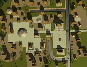
Wakata Town Plan

Guacata – An inland Calusa village on Lake “Mayaimi” or Okechobee, south Florida, about 1570. Elsewhere in his memoir Fontaneda refers to it as a distinct but subordinate tribe. Guacata, Cuacata – In one place Fontaneda speaks of this as a town on Lake Mayaimi (Okeechobee) and elsewhere as one of the provinces of the east coast. A Spanish document in the Lowery collection gives it as a place “in the land of Ays.” It is possible that these people lived on St. Lucie River and camped farther inland than most of the coast people. In that case they would … Read more

Incha Tribe

Incha. An unidentified tribe said to have lived where there were Spanish settlements and to have been at war with the Mantons (Mento) of Arkansas River in 1700. Alternate Spellings: Icca – Iberville (1702) in Margry, Déc., IV, 561, 1880. Incha – Ibid., 599.  

Itomapa Tribe

Itomapa. Mentioned by Martin as a tribe, on the west side of the lower Mississippi, which sent a deputation to the village of the Acolapissa in 1717 to meet Bienville. Consult: Ibitoupa Tribe

Inchi

Inchi (In′tci, ‘stone lodge’). A village occupied by the Kansa in their migration up Kansas River. J. O. Dorsey, inf’n, 1882.

Native American Town of Imaha

Imaha – A Quapaw village mentioned by La Metairie in 1682 and by Iberville in 1699, and visited by La Harpe in 1719. It was situated on a south west branch of Arkansas River. In the wars and contentions of the 18th and 19th centuries some of the Quapaw tribe fled from their more northerly villages and took refuge among the Caddo, finally becoming a recognized division of the confederacy. These were called Imaha, but whether the people composing this division were from the village Imaha, mentioned by the early French travelers, is not absolutely known. The people of the … Read more