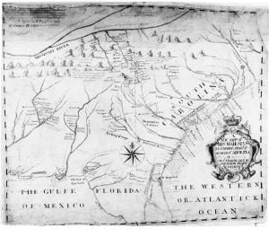
From the moment that Europeans learned that a New World existed across the waters of the Atlantic, map makers in Western Europe began turning maps of that New World. At first these maps were grossly inaccurate and assumed the either the Americas were part of the Orient or merely consisted of islands off the shores of Asia. As more and more log books and navigation charts were returned to Spain, Portugal, France and England by explorers, the maps grew more precise.
Originally, some of the best cartographers in the world were on the island of Majorca (Balearic Islands) in the Mediterranean Sea, east of Iberia. 1 Their advancements made possible the Age of Discovery. They also manufactured navigational instruments, such as the astrolabe, when these were unknown in most of Medieval Europe. Most these cartographers were Sephardic Jews. They had been attracted to Majorca, while it was under the rule of the Emirate of Cordoba that was tolerant of Jews. Being in the middle of major sea lanes, Majorca was in a natural position to promote advancements in cartography. There was a ready demand both in the Muslim and Christian worlds for their products.
Later, North African Muslim regimes were far less enlightened and treated Jews as barely tolerated second-class citizens. The islands were re-conquered by the Kingdom of Aragon in 1230 AD. Initially, the Jewish cartographers welcomed the removal of repressive North African caliphs and renewed ties with Europe. However, in 1290 the King of Aragon began persecuting the Jews because of pressure from Roman Catholic officials in Rome. 2 Jewish cartographers were forced either to convert or migrate to a Muslim country.
Those Sephardic Jews who moved from Majorca to Tripoli became the catalysis for great advancements in navigation and ship building along the Barbary Coast, which soon resulted in the infamous “Barbary Pirates.” 3 In fact, several of the commanders of Barbary fleets that ravaged Christian merchant fleets for centuries, were Sephardic Jews.

In the 1320s, King John II of Portugal began inviting the best naval architects, cartographers, mathematicians and astronomers that he could find to improve the maritime skills of Portugal. 4 Portugal was suffering terribly from Muslim slave raids. These raids would depopulate entire villages. He invited the best Jewish cartographers of Majorca to Portugal. He promised them freedom to practice Judaism, if they so chose, but told the Pope that all his Jewish scholars had converted to Christianity.
Portuguese cartographers became the most skilled in the world under the leadership of Prince Henry the Navigator during the 1400s. 5 Prince Henry’s mother was English. He was named after his uncle, King Henry IV of England. Close ties between Portugal and England during this period enabled English navigators to also advance rapidly in their skills.
In 1580 Spain annexed Portugal. Immediately, the Sephardic cartographers and instrument makers became second-class citizens again. 6 In 1586 the Inquisition was installed in Portugal, when it became clear to Roman Catholic officials that socioeconomic discrimination would not force the Jews into their fold. The Jewish cartographers, instrument makers and naval architects emigrated en masse to either Protestant sections of France or directly to the Netherlands.
Many Sephardic Jews in France changed their family name to French ones and at least superficially became known as French Huguenots. It is a little known fact that those names included Lafitte (Jean Lafitte the pirate,) Alexander, Grizzard, Bonnet, David, Dreyfus, Duran, Sevier, Massell, Morel, Moser, Rosser, Rich, Lyon, Henriques (Henricks,) Morris, Lamar, Lanier, Parris and Croquette (as in David Crockett.) These names would become famous in Southeastern history. Many French Sephardic Huguenots later migrated to Scotland and England, where their names were thoroughly Anglicized.
Within a decade or so, Amsterdam and Antwerp became the international centers of mapmaking and ship-building. 7 Sephardic naval architects made vast improvements in the design and construction of Dutch ships and cannon. Dependable, inexpensive iron cannon were developed in the Netherlands at this time. The Dutch fluyt was also developed during this period. 8 It was a fast, economical, easy to build, merchant ship that Dutch shipyards learned how to mass produce. Within two decades after the arrival of the Sephardi, the Netherlands dominated European waters.
The concentration of knowledge of geography, access to advanced sailing ships and wealth in the Sephardic communities of the Netherlands during the 1600s gave them an advantage in colonizing the New World. While many Sephardic families in the Netherlands had no need to emigrate, they were in a special position to direct their fellow Sephardi, who were being persecuted, where there were safe places to live. The areas of Southeastern North America outside the grasp of the Spanish Inquisition were some of those places.
Citations:
- Rey Pastor and García Camarero, La Cartografía Mallorquina, 1960, pp. 56-61.[
]
- Cecil Roth, The Jewish Contribution to Civilization. New York: Harper Press, 1940; pp. 69-72.[
]
- Kritzler, Edward, Jewish Pirates of the Caribbean. New York: Anchor, 2009; pp. 59-60[
]
- “Zacuto, Abraham” in Glick, T., S. J. Livesy and F. Williams, editors, (2005) Medieval science, technology, and medicine: an encyclopedia, New York: Routledge.[
]
- Russell, Peter E., Prince Henry the Navigator: a Life, New Haven: Yale University Press, 2000.[
]
- Glick, Thomas F., (1998). “On Converso and Marrano Ethnicity”. In Gampel, Benjamin. Crisis and Creativity in the Sephardic World (1391-1648), New York: Columbia University Press; pp. 59-76.[
]
- Glick, Thomas F., (1998). “On Converso and Marrano Ethnicity”. In Gampel, Benjamin. Crisis and Creativity in the Sephardic World (1391-1648), New York: Columbia University Press; pp. 59-76.[
]
- Boxer, CR., The Dutch Seaborne Empire 1600-1800. Alfred A. Knopf, 1965, p. 68.[
]
