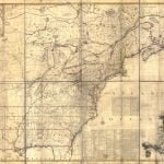
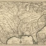
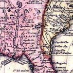
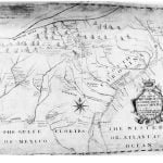
1640 – The America Septentrio map was typical of those printed in mainland Europe between 1580 and 1684. The general public’s knowledge of the Appalachian Mountains was limited to the verbal descriptions published by René de Laudonniére in 1578. All of the maps of this era scatter the town names mentioned by Hernando de Soto’s chroniclers across the region. Most place an elaborate rendering for the Appalachian Mountains that state that they are gold-bearing and were claimed by France. Near the location of the temporary Charlesfort colony on the coast is a note that in 1562, René de Laudonniére went from Charlesfort to discover the Appalachian Mountains. De Laudonniére’s memoir states that he never went there, but in 1564 and 1565 he dispatched small groups of explorers from Fort Caroline, who paddled up the May (Altamaha) River to the Foothills of the Appalachians, then walked into the mountains. Here they traded with the Apalache Indians.
The 1640 map differs from earlier maps, because it contained more precise channels for the Chattahoochee and Savannah Rivers and also named towns along the Chattahoochee River that were not mentioned by De Soto’s chroniclers. This is strong evidence that Frenchmen went into the interior after those dispatched by René de Laudonniére. There was no mention of the Cherokee or Creek Indians. All of these maps mention towns named Chicasa (Chickasaw) and Chisca.
1669 – Johann Lederer prepared a sketch map to accompany his book on a journey down the east face of the Blue Ridge Mountains. The only Native Americans that he showed living in the SW Virginia Mountains and the NW North Carolina Mountains were the Rickohockens. The towns of Sara and Sitteree were shown in the North Carolina Piedmont. There was no mention of the Cherokee, Creek or even Apalache Indians. Lederer also did not mention encounters with Spaniards, Portuguese or Africans.
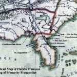
1684 – Jean-Baptiste Louis Franquelin published his Carte de la Louisiane. The map stated that an explorer named Maztilla? (barely legible) went all the way to the source of the Apalachee River in 1672. French maps called the Chattahoochee River the Apalachee River until adopting the Chattahoochee name given by the British. There was no mention of the Cherokee Indians, Creek Indians or Spanish settlers.
The map showed the Apalache Indians living near the source of the Apalachee (Chattahoochee) River and the Cofitache living north of the source of the Flint River. The Kusate were shown to the west of the Apalache and the Shawnee to the northeast.
In this map, the Tennessee River is named the Caskenampo River, which means “Many Warriors” in Koasate. The names of the towns on the Upper Tennessee River were Caskenampo, an illegible name and Taskeke (Tuskegee). There was no mention of the Cherokee Indians, Creek Indians or Spanish settlers in the Southern Highlands.
1701 – French cartographer Guillaume DeLisle published Carte Contenant le Royaume du Mexique et la Floridie. This map contained the first detailed information about the ethnic groups in eastern Tennessee and western North Carolina. The Chickasaws occupied the middle section of the Caskenampo (Tennessee) River. Progressively upstream were the Tongaria (Yuchi), Tali, Caskenampo, Taskegi and in the North Carolina Mountains, the Shawnee. The Shawnee were also shown in the Foothills of South Carolina and along the Savannah River. This was the first map to show the Koweta Creeks along the middle Chattahoochee River. Although this map labeled all the principal branches of the Creek Indians, it did not use the word, Creek, Muskogee or Cherokee.
The Kusate were shown living around the Coosawattee and Conesauga Rivers in northwest and north-central Georgia. The Conchakee (Apalachicola) are living along the Etowah River in northwestern Georgia. The Cofitache (Catawba) are living roughly in the region between Atlanta and Gainesville, GA. There are two Apalache provinces. The largest includes all of the Chattahoochee River Basin and most of the Georgia Mountains. The map does not mention the Rickohockens, Cherokees or Spanish settlers.
1703 – French cartographer Guillaume DeLisle published Carte du Mexique & Florida. A note on the map stated that French explorers paddled up the Tennessee River to its source in Carolina. The only other significant difference between this map and the 1701 map is the addition of the ethnic group, the Chalaque’s in northeastern South Carolina. In later maps, DeLisle showed separate locations for the Chalaque and the Charaqui.
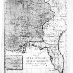
1718 – French cartographer Guillaume DeLisle published Carte de la Louisiane et du cours du Mississippi. This map contained slight changes to the courses of rivers in Georgia, Tennessee and Alabama. It contains the first mention of the Cherokees on an official European map. , They were called Charaqui’s by DeLisle. A large cluster of Charaqui towns were shown above the confluence of the Tennessee and Little Tennessee Rivers. At this time Muskogeans and Yuchi still occupied the Little Tennessee Basin. A large concentration of Koweta towns was shown on the Chattahoochee River in the vicinity of present day Columbus, GA. The words Creek and Muskogee were not used on the map. There was no mention of Spanish settlers living in the Appalachian Mountains. The Chalaque were shown to now live in southeastern Georgia in lands formerly occupied by the Yamasee Confederacy.
1725 – In this year, John Herbert, Commissioner of Indian Trade for the Province of South Carolina first published A new mapp of his maiestys flourishing province of South Carolina : shewing ye settlements of ye English, French and Indian nation. The Herbert map was the first official map to use the actual word, Cherokee. It was the first map to show the names of all the major Cherokee and Creek towns, plus most of the major ethnic groups in the lower Southeast. However, the words Creek and Muscogee were not used on the map. The map does not mention Spanish settlers in the mountains and contains no information on the mountains of North Carolina north of the Pigeon River, northern Georgia, northeastern Tennessee or southwestern Virginia. Herbert labeled the Tennessee River to be the Mississippi River.
Earlier in 1725, Colonel George Chicken had met with representatives of numerous Native American towns in the Carolina Mountains that spoke several languages and dialects. He persuaded them to form a “Cherokee Tribe” and elect a “king.” The British government manipulated the new Cherokee Tribe into existence in order to have a powerful Native ally to thwart the expansion of France and Spain in North America. Simultaneously, they wanted a single leader whom they could bribe and manipulate rather than the numerous egalitarian town chiefs that currently demanded equal treatment. The Shawnee in western North Carolina continued to be allies of France, while the relative few Apalache and Kataapa in north-central Georgia apparently continued to be allies of Spain. Eventually, they would join the Creek Confederacy.
Upper Creeks who were allied with France, still occupied southeastern Tennessee. At this time, there were no Cherokee towns in Georgia outside its extreme northeastern tip, or in Tennessee, southwest of the Little Tennessee River. The map does not tell the viewer that there were still Creek, Shawnee and Yuchee towns in the North Carolina Mountains, north and east of the Pigeon River. Contemporary Cherokees have assumed that even though these areas did not contain members of the new Cherokee Alliance, the Cherokees lived there. That was not the case. The blank areas were occupied by neutrals, plus allies of either France or Spain. France claimed all of western North Carolina.
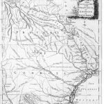
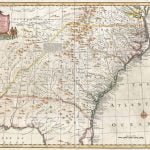
1748 – Emanuel Bowen, Royal Geographer, published a detailed map in 1748 entitled, A New Map of Georgia, with Part of Carolina, Florida and Louisiana. It is the first official British map to use the words Creek Indians, although in the late 1730s and early 1740s, some unofficial colonial maps had used those words. The channel of the Savannah River was fairly accurate, but those of the Ogeechee, Altamaha, Chattahoochee and Coosa River Systems were not. The map shows all of the major Creek Confederacy towns, but vaguely labels the Southern Appalachians as being occupied by the Cherokee Indians. At this time, South Carolina claimed all of northern Georgia, north of Macon. That region included the modern cities of Atlanta and Augusta. The map stated that Creek, Chickasaw, Apalachee and Cherokee Indians lived in the northeast tip of what the Province of Georgia claimed was its territory.
The mid-1730s probably marked the zenith of Cherokee population and power. The formal alliance between the eastern part of the Creek Confederacy, led by the town of Koweta, and the Province of Georgia also began at that time.
1755 – In that year, botanist John Mitchell, a former resident of Virginia, published his Map of the British and French Dominions in North America. It is considered the most accurate colonial era map and was used in the negotiations during the formulation of the Treaty of Paris, to determine the boundaries of the United States and its states. Numerous internet references state that John Mitchell was a professor at the University of North Carolina. He was not. That person was Dr. Elisha Mitchell, who measured the height of Mount Mitchell.
Mitchell’s map is particularly intriguing because across the region formerly occupied by the Valley Cherokee towns in North Carolina and Georgia are the large words, “Deserted Cherakee Settlements.” In 1754 soldiers from the Creek town of Koweta had recaptured all of the territory of the “Kingdom of Apalache” lost in 1715, when the Chorakees of NW South Carolina invited all of the Creek leaders in western North Carolina, northern Georgia and South Carolina to a friendly diplomatic conference at Tugaloo, then murdered them in their sleep. At least 32 Cherokee town chiefs were captured and executed by the Kowetas. Several were burned at the stake on the banks of the Chattahoochee River near Koweta. This military feat ended the 40 year long Creek-Cherokee War with a dramatic victory for the Creeks. Virtually all contemporary history books state that “the Cherokees won all of northern Georgia in 1754 (or 1755) at the Battle of Taliwa.” This battle is a myth which never happened.
Equally intriguing, but in much smaller letters are such words as a label over the upper Cumberland River in Tennessee, “Settled since 1750. ” The most northerly Cherokee village was located at the confluence of the Holston and French Broad Rivers at that time. There are labels that state that the Holston River was “settled” and extreme southwestern Virginia was “well settled” at this time. Almost all the stream names in northeastern and north-central Tennessee are English words. Also, the entire New River Valley in North Carolina and Virginia is shown to be settled by non-Indians and have stream names that are English words.
This information completely conflicts with official American history in textbooks and the Cherokee history told to tourists. According to official American and Tennessee state history, the first “white settlers” did not enter Tennessee until the late 1760s or early 1770s, and they were few in number. These books state that the first village was the “Watauga Settlement” in 1776. Supposedly the “Cherokees” living around the Watauga Settlement laughed at the new whites in their midst because they were so inept at survival in the mountains. This is obviously another tall tale like the “Great victory at the Battle of Taliwa, where the Cherokees won all of northern Georgia.”
After 1750, North-central Tennessee, northeast Tennessee, southeast Kentucky, northwest North Carolina and southwest Virginia were not occupied by Cherokees, even the though literature given to tourists says otherwise. The Cherokees claimed the region, however, because in 1772 representatives of the Watauga Settlement traveled to Chota, to obtain a 10 year lease. There were already hundreds, if not thousands of people living in this region who had olive to dark complexions, non-British features, and whose ancestors had been living in the same location for many generations. Who were these people? The Cherokee Nation apparently considered them “tenants-at-will”, allies or else old-timers, whose claim to the land preceded theirs.
1760 – The London Magazine in 1760 published, A New Map of the Cherokee Nation with the Names of the Towns & Rivers They are Situated on No. Lat. From 34 to 36. The map was engraved by Thomas Kitchin from sketch maps furnished him by the British Army. Kitchin was an assistant of Emanuel Bowen. What is most interesting about this map is that the Cherokee villages were concentrated in a relatively narrow band from the Tennessee River southeastward to the northwestern tip of South Carolina. There is no Great Cherokee Nation whose towns covered seven future states. The Cherokees claimed that region, but it was not settled with Cherokee villages. The section of the Great Smoky and Unaka Mountains southwest of the Little Tennessee River were labeled “Enemy Mountains.” This means that even in 1760 the extreme western tip of North Carolina was held by either Creek or Yuchi Indians, who were hostile to the Cherokees.
The map contains no information about who was living in northern Georgia, southeastern Tennessee, northeastern Tennessee, or even in North Carolina, east of the Pigeon River. It should be noted that no European or American map ever showed the Asheville, NC area being in Cherokee Territory. Mid-18th century North Carolina maps show the Asheville-Hendersonville-Brevard area occupied by Shawnee and Creek Indians. Even though, Cherokee history books claim that the Cherokee village of Long Swamp Creek was founded on the ruins of the captured Creek town of Taliwa in Pickens County, GA, neither word appears on this map. That location actually is covered by a letter in the words “Upper Creeks.”
1780 – As military operations began against the colonial rebels in Georgia, the British Army ordered its engineering officers to prepare an accurate, detailed map. It was named A New and Accurate Map of the Province of Georgia. The map shows a corridor along the Sawakehatchee (Raccoon People River in Creek) or Broad River, which has been declared neutral hunting grounds for both the Creeks and the Cherokees. This corridor was part of the territory recaptured by Koweta in 1754. The only Cherokee Indian village in Georgia was Naguchee, which contained an estimated 25 males of military age. The Chattahoochee River about two miles west of this village marked the boundary between the Cherokees and Creeks. Brasstown Bald and Track Rock Gap were in Upper Creek territory. There were Coosa (Upper Creek) villages immediately to the west of their along Coosa Creek.
In subsequent sections, long forgotten archives will illustrate how little the British actually knew about the people living on the interior of Georgia, in the mountains and upper Piedmont. Although their ancestors had been living in the Southeast, much longer than the British, they were not Native Americans.
Gallery of Ancient Southeastern Maps

