The Tribes West of the Mississippi – Indian Wars

Numerous Indian tribes were relocated west of the Mississippi through treaties, leading to significant declines in their populations. The Sioux, Blackfeet, Crows, and Pawnees remain dominant western tribes, often engaged in conflict. A notable battle occurred in June 1845 between the Crows and Blackfeet, highlighting the ongoing dangers faced by settlers. While tribes like the Sacs and Foxes maintain their warlike heritage, others, such as the Choctaws and Cherokees, have embraced agriculture and peace, adapting to the changes brought by colonization.

The Spaniards in Alabama and Mississippi

History of Alabama and incidentally of Georgia and Mississippi, from the earliest period

Following the American Revolution, England ceded territories in the south to Spain, including West Florida, while the U.S. was granted rights to navigate the Mississippi River. However, Spain occupied lands included in the new American boundaries, fostering tension. Amidst escalating conflicts over land and treaties, particularly involving Colonel McGillivray and the Creek Nation, the Georgians attempted to secure these territories, which led to significant disputes. The Creeks sought protection from Spain and engaged in diplomacy to safeguard their hunting grounds against encroachments by settlers.

Extreme Perils and Suffering of the Natchez Refugees

History of Alabama and incidentally of Georgia and Mississippi, from the earliest period

During the siege of Pensacola in 1781, a group of royalists from Natchez, believing they could seize Fort Panmure, faced dire consequences. After a brief victory leading to the fort’s surrender, news of a British defeat forced them to flee into the wilderness. Their harrowing journey through hostile territories and relentless hardships, including lack of water and food, resulted in great suffering. Ultimately, they reached the Creek nation where they received aid, but many faced imprisonment and loss of property due to their rebellion.

Governor George M. Troup and the McIntosh Family

History of Alabama and incidentally of Georgia and Mississippi, from the earliest period

The narrative recounts the historical significance of McIntosh Bluff in Alabama, notably as the birthplace of Governor George M. Troup. His lineage traces back to Captain John McIntosh, a British officer awarded land for his service, and includes colorful family figures like Roderick McIntosh, known for his bold character and military exploits. While some McIntosh family members aligned with the British during the Revolution, others, like General Lachlan McIntosh, fought for American independence, establishing a complex legacy of loyalty and valor.

Journey of Bartram Through Alabama

History of Alabama and incidentally of Georgia and Mississippi, from the earliest period

William Bartram traveled through the Creek Nation and Mobile, where he observed a town with a mix of inhabited and abandoned structures, primarily occupied by the French and British settlers. He noted the prominent Indian trade conducted by Swanson and McGillivray and described the well-managed plantations along the Tensaw River. In Pensacola, Bartram received warm hospitality from local officials. His journey also included visits to various plantations and Indian towns, culminating with his return to Mobile and further travels into the Creek territory with a caravan of traders.

Eyewitnesses who were never called to the witness stand

Between 1585 and 1600, a catastrophic event in the Southern Highlands led to the abandonment of major indigenous towns and the cessation of mound building, particularly in places like northwest Georgia and southeastern Tennessee. Archaeological evidence suggests a European invasion, possibly accompanied by deadly pathogens, decimated the native population. Following the 1976 adoption of a Cherokee-centric historical narrative, many archaeological interpretations misidentified other tribes, particularly failing to recognize the Shawnee and Muskogean presence in the region. Accurate identity verification remains essential in understanding the area’s complex past.

Native American History of Autauga County, Alabama

Autauga County, Alabama, named after the Tawasee town of Atagi, has a rich Native American history marked by the presence of the Creek Confederacy. Established in 1818 from lands ceded by the Creeks, the region features numerous archaeological sites along the Alabama River, including burial mounds from various Native cultures. Indigenous groups such as the Toasi and Alabama occupied the area for centuries, with significant cultural changes influenced by European exploration. The Red Stick War (1813-1814) led to severe land loss, altering the Native landscape profoundly.

The Seminole War of 1816 and 1817 – Indian Wars

colonel clinch

In the aftermath of the War of 1812, British agents Edward Nicholls and James Woodbine rallied Indigenous and Black groups in Florida to challenge U.S. expansion. They fortified a stronghold that Colonel Clinch besieged, resulting in the fort’s destruction and a significant enemy casualty count. Following further conflicts and the rise of General Jackson, who captured key territories, the U.S. ultimately took control of Florida in 1819, resolving lingering tensions with Spain and concluding the Seminole War for the time being.

The Creek War – Indian Wars

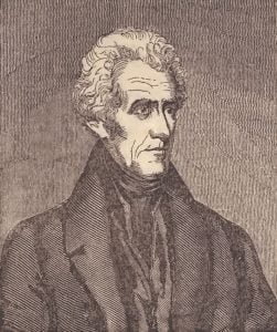
general jackson

In the spring of 1812, Tecumseh inspired Southern tribes, including the Creeks, to join hostilities against American settlers. Despite initial reluctance, the Creeks engaged in violent raids, culminating in the surprise attack on Fort Mimms in August 1814, resulting in significant casualties. General Andrew Jackson led retaliatory campaigns, ultimately defeating the Creeks at the Battle of Tohopeka in March 1815. The conflict ended with the Treaty of Hickory Ground, marking the subjugation of the Creek nation and their relocation east of the Coosa River.

The Tippecanoe War of 1812 – Indian Wars

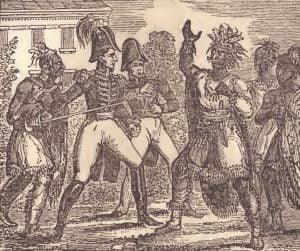
council vincennes

The Tippecanoe War of 1812 was ignited by British influence and the ambitions of Tecumseh and his brother, the Prophet. They sought to unite various Indian tribes against white settlers, aiming to reclaim territory. Following tensions over the Treaty of Fort Wayne, Tecumseh confronted Governor Harrison with armed warriors, leading to hostilities. On November 7, 1811, a surprise attack on Harrison’s camp resulted in a fierce battle, with heavy casualties on both sides but a significant defeat for the Indian forces, weakening their coalition and belief in the Prophet’s visions.

Native Americans in the Revolutionary War

colonelzebulonbutler

During the Revolutionary War, Native Americans found themselves in a complex position, with both the British and American sides vying for their allegiance. While the British secured many tribes through established relationships and resources, the Americans attempted to win their favor through treaties and gifts, ultimately failing to make significant impacts. Notably, tribes like the Cherokees and the Six Nations often sided with the British, resulting in violent conflicts and retaliatory expeditions by American forces. The war brought unprecedented cruelty, with massacres affecting both sides and deepening animosities.

The English In Georgia

History of Alabama and incidentally of Georgia and Mississippi, from the earliest period

The post details the establishment of Georgia, led by philanthropist James Oglethorpe, who sought to provide a new home for the impoverished and indebted English citizens. After embarking with the first group of settlers, Oglethorpe negotiated peace treaties with local Creek tribes and implemented plans for agricultural development. Despite conflicts with Spanish forces and the complexities of governing a diverse population, Oglethorpe’s leadership advanced the colony’s prosperity and security. Key figures, such as the Methodist Wesleys, contributed to the colony’s early religious and social fabric, facing various challenges in this fledgling settlement.

Parsons and Abbott Roll

Alabama Land Cession Map

The Parsons and Abbott Roll, created in 1833, is a crucial document for genealogical research on the Creek Tribe. Following the 1832 treaty where the Creek Tribe ceded their land east of the Mississippi River to the United States, Benjamin S. Parsons and Thomas J. Abbott conducted a detailed census of Creek Indian heads of families. This census, organized by town and including the number of males, females, and slaves in each family, serves as the most comprehensive pre-removal record. It is a vital resource for identifying Creek ancestors and is foundational for numerous subsequent documents related to Creek claims through the 1960s. The roll also includes entries for some free blacks who gained freedom and citizenship within the Creek Tribe, making it an essential reference for diverse genealogical inquiries.

1832 Creek Census – Wewoakkar Town

By a treaty of March 24, 1832, the Creek Indians ceded to the United States all of their land east of the Mississippi River. Heads of families were entitled to tracts of land, which, if possible, were to include their improvements. In 1833 Benjamin S. Parsons and Thomas J. Abbott prepared a census of Creek Indian heads of families, which gave their names and the number of males, females, and slaves in each family. The entries were arranged by town and numbered; these numbers were used for identification in later records. This is the 1832 Creek census for the town of Wewoakkar.

1832 Creek Census – Weogufka Town

By a treaty of March 24, 1832, the Creek Indians ceded to the United States all of their land east of the Mississippi River. Heads of families were entitled to tracts of land, which, if possible, were to include their improvements. In 1833 Benjamin S. Parsons and Thomas J. Abbott prepared a census of Creek Indian heads of families, which gave their names and the number of males, females, and slaves in each family. The entries were arranged by town and numbered; these numbers were used for identification in later records. This is the 1832 Creek census for the town of Weogufka.

1832 Creek Census – Ufaula Town

By a treaty of March 24, 1832, the Creek Indians ceded to the United States all of their land east of the Mississippi River. Heads of families were entitled to tracts of land, which, if possible, were to include their improvements. In 1833 Benjamin S. Parsons and Thomas J. Abbott prepared a census of Creek Indian heads of families, which gave their names and the number of males, females, and slaves in each family. The entries were arranged by town and numbered; these numbers were used for identification in later records. This is the 1832 Creek census for the town of Ufaula.

1832 Creek Census – Tuskeega Town

By a treaty of March 24, 1832, the Creek Indians ceded to the United States all of their land east of the Mississippi River. Heads of families were entitled to tracts of land, which, if possible, were to include their improvements. In 1833 Benjamin S. Parsons and Thomas J. Abbott prepared a census of Creek Indian heads of families, which gave their names and the number of males, females, and slaves in each family. The entries were arranged by town and numbered; these numbers were used for identification in later records. This is the 1832 Creek census for the town of Tuskeega.

1832 Creek Census – Tuckabatcha Town

By a treaty of March 24, 1832, the Creek Indians ceded to the United States all of their land east of the Mississippi River. Heads of families were entitled to tracts of land, which, if possible, were to include their improvements. In 1833 Benjamin S. Parsons and Thomas J. Abbott prepared a census of Creek Indian heads of families, which gave their names and the number of males, females, and slaves in each family. The entries were arranged by town and numbered; these numbers were used for identification in later records. This is the 1832 Creek census for the town of Tuckabatcha.

1832 Creek Census – Tolowarthlocko Town

By a treaty of March 24, 1832, the Creek Indians ceded to the United States all of their land east of the Mississippi River. Heads of families were entitled to tracts of land, which, if possible, were to include their improvements. In 1833 Benjamin S. Parsons and Thomas J. Abbott prepared a census of Creek Indian heads of families, which gave their names and the number of males, females, and slaves in each family. The entries were arranged by town and numbered; these numbers were used for identification in later records. This is the 1832 Creek census for the town of Tolowarthlocko.

1832 Creek Census – Toakpafkar Town

By a treaty of March 24, 1832, the Creek Indians ceded to the United States all of their land east of the Mississippi River. Heads of families were entitled to tracts of land, which, if possible, were to include their improvements. In 1833 Benjamin S. Parsons and Thomas J. Abbott prepared a census of Creek Indian heads of families, which gave their names and the number of males, females, and slaves in each family. The entries were arranged by town and numbered; these numbers were used for identification in later records. This is the 1832 Creek census for the town of Toakpafkar.