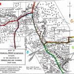
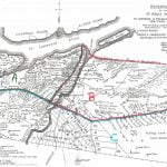
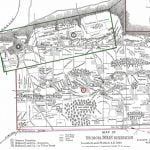
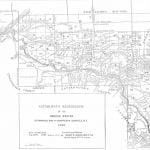
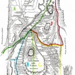
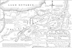
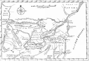
The accompanying map was prepared in 1771 under the direction of William Tryon, captain general and governor in chief of the province of New York, and is as nearly suggestive of the then recognized boundary of the Six Nations as any that has had official sanction. In 1851 Lewis H. Morgan, assisted by Ely S. Parker, a Seneca chief; and afterward an efficient staff Officer of General Grant, and the Commissioner of Indian Affairs, prepared a map for a volume entitled League of the Iroquois, which aimed to define the villages, trails, and boundaries of the Five Nations as they existed in 1.720. Indian names were assigned to all lakes, watercourses, and villages, and the various trails from village to village as far as the Ne-ah-ga (Niagara) River. Unfortunately, the work was not stereotyped, and the book itself is a rare possession. Another map, so ancient as to almost crumble at the touch, represents the territory of Michigan as visited by the Five Nations, and by a footnote relates the visit of 80 Ne-car-ri-a-ges, besides men, women, and children, who came from “Misilmackinac” May 30, 1823, asking to be admitted as a seventh nation into the league, just as the Tuscaroras had been adopted as a sixth. It has some data as to “carrying places” which are not upon the Governor Tryon map. The latter has historic value from its description of “the country of the Six Nations, with part of the adjacent colonies”, recognizing at the time the independent relations which they sustained to Great Britain. The vast tract then controlled by the Seneca Indians is clearly defined, and the changes of 120 years appear more impressive when the boundaries and condition of the present representatives of the former Six Nations are brought into close relation to the facts of today.
The maps of the existing reservations, as defined in 1890, locate each family, watercourse, and road, developing, as if by accident, in the clustering of their homes, the differences between those of each nation who “hold to the tradition of the father” and those who welcome the civilization and Christianity of the white man.
No reservations for the Oneida and Cayuga tribes are shown, as they no longer retain their ancestral homes in New York.
Various treaties between the Oneida Nation and the state of New York gradually reduced their land area until now (1890) a small remnant of that people retain but about 350 acres, which they hold as citizens and in severalty. The following data explain the process of their loss of land:
- By treaty of Fort Herkimer, June 28, 1785, the Oneidas joined the Tuscaroras in selling their lands between the Chenango and Unadilla Rivers to the state of New York. Consideration, $11,500 in money and goods.
- In September 1788, other lands were sold to the state of New York for cash, clothing, provisions, a mill, and an annuity of $600; excepting certain reservations in Madison and Oneida Counties.
- September 15, 1795, the Oneidas sold to the state of New York another portion for $2,952 in cash and an annuity of the same amount, and another portion for 3 cents per acre, to be paid annually.
- June 1, 1798, the Oneidas sold additional lands for $300 and an annuity of $700.
- March 5, 1802, the Oneidas sold to the state of New York certain small parcels of land for $900 and an annuity of $300.
- In 1805 the conflicting parties among the Oneidas, pagan and Christians settled their jealousies by a subdivision of their lands in Madison and Oneida Counties.
- In 1846, after 11 successive treaties with the state of New York, the main part of the nation removed to Wisconsin, leaving to the remaining fragment of the band the tract of 350 acres, before referred to.
- In 1843 the legislature of New York authorized these lands to be held in severalty, as at present.
Of the Oneidas 106 now reside on the several reservations of the Six Nations, and 106 in the counties of Madison and Oneida, in the state of New York; in all al They have no separate reservation.
The Oneidas are scattered, gaining a livelihood by basket making or day’s labor, and are less comfortably settled than a majority of reservation Indians. Two groups of small houses, in each of which are 7 families, constitute their representative settlements, viz, Orchard, in Oneida County, about 4 miles south from the city of Oneida, and Windfall; in Madison County. In the former the school has been abandoned, and the 13 children of these families do not attend any school. Some think the schoolhouse over the hill too far. At Mud Creek, between the 2 villages, are 2 houses of Indians. At Windfall, a widow is allowed to live out her days in the house of her deceased husband, the mortgage which he gave having cost her the title. Alexander Burning, a chief, lives at Oneida. The total number of all ages, scattered over the original Oneida reservation and the country thereabout, who draw annuities of cloth from the United States, is 106.
These Indians are honest and well behaved, but without sufficient ambition or sympathy to insure much progress. Preaching is attended semimonthly, but all signs conform to their own frank statement that “before long there won’t be any of us left”. The few who accept any work they can get and forget that they are Indians assimilate rapidly with their white neighbors. Those who remained in New York were too few for combined, mutually supporting industry, and the experiment of holding land in severalty only hastened their dissolution, without elevating their industry or their condition. Visitors who ride through Windfall, the larger of the 2 villages, should understand that these are no longer Indian villages, and should not confuse any signs of general improvement with ideas of Indian thrift and progress, which do not exist.
The Cayugas number 183 and reside on 4 of the reservations of the Six Nations, having no separate reservation.
Organization of the Six Nation Reservations
The Allegany and Cattaraugus reservations are organized and incorporated under the laws of New York as “The Seneca Nation”, with a constitutional system giving them large independent powers. This constitution as amended October 22, 1868, provides for a council of 16 members, of whom 8 shall be elected annually for each reservation on the first Tuesday of May every year. A quorum consists of 10, and the affirmative vote of 10 shall be necessary to appropriate public moneys. Expenditures of more than $500 require the sanction of a Majority vote at a popular election duly ordered. The president, also elected annually, is the executive officer of the nation, has a casting vote upon a tie in the council, fills vacancies until the next election thereafter, decides cases of impeachment, and is authorized to initiate by his recommendation any measures he may deem for the good of the nation not inconsistent with the true spirit and intent of the laws of the state of New York. A peacemaker court On each reservation for 3 years, one-third of the peacemakers being elected annually, has jurisdiction in all matters relating to wills, estates, real estate, and divorces, with forms of process and proceedings similar to those of justices of the peace in New York. An appeal lies to the national council, to which the evidence taken below is certified, and a quorum of the council is competent to decide the case upon arguments submitted, or, upon due application of either true party in interest, to submit the facts to a jury. A treaty, however, must be ratified by three-fourths of the legal voters, namely, “males above 21 years of age who have not been convicted of felony”, and also by the consent of three-fourths of the mothers of the nation. A clerk, treasurer, and 2 marshals, 1 from each reservation, are provided for. The salaries of these officers are determined by the council, and are not to be enlarged or diminished during their term of office. Provision is made for amendment of the constitution and for the enactment of any laws not inconsistent with the constitution of the nation or the constitutions of the United States and the state of New York.
Section 13 of the constitution of the nation contains the following provision:
The laws heretofore enacted by the legislature of the state of New York for the protection and improvement of the Seneca Nation of Indians, also all laws and regulations heretofore adopted by the council of the nation, shall continue in fall force and effect, as heretofore, until the statutes of the state of New York shall be repealed or amended by the councilors, to the extent, and in the manner, as the attorney of the nation shall deem lawful and proper.
No provision is made whereby the nation may exercise its choice of an attorney, the plain purpose being that they are to have the disinterested advice of competent legal counsel at the expense of the state. All other officials are chosen by them. No people are more approachable if their confidence be won. However slow to change old customs and dull to forecast the future, they are suspicions of outside advice, if it be not entirely free from any possible antagonism to their own business and social relations.
The present council consists of the following members:
From Allegany, Sackett Redeye (Plover), age 49; Dwight Jimerson, 32; George Gordon (Deer), 47; Stephen Ray (Hawk), 50; Alfred Logan (Bear), 50; Abram Huff (Turtle), 40; Cyrus Crouse (Bear), 59; Marsh Pierce (Beaver), 69.
From Cattaraugus, David. Stevens, age 73; Chauncey Green, 45; John Lay, jr. (Heron), 15; Howard Jimerson (Wolf), 30; Elijah Turkey (Hawk), 34; Lester Bishop (Wolf), 41; Robert Halftown (Snipe), 45; Thomas Patterson (Turtle), 36.
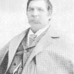
Andrew John, jr. (Gar-stea-o-de, Standing Rock), elected president in May 1889, is of the pagan party. He presides over the council with self-possession. Frequent journeys to Washington and back have given him a large but varying influence with both parties. He is a steadfast upholder of his nation. This is his third term of office, but not consecutively.
A number of men prominent in the affairs of the nation are educated and progressive; their judgment and experience are helpful for the prosperity and peace of the people.
The Cornplanter Senecas of Warren County, Pennsylvania, belonging to the Seneca Nation, vote with them for officers and have a representative in the nation’s council.
Onondaga Reservation in Onondaga County, New York
Onondaga Reservation, An old wampum of 1608, representing the Iroquois confederacy, has for its “center house”, to indicate the rank of the Onondagas, a heart. On either side are joined 2 sister nations, and, although fewer in numbers at present than others, the Onondagas are given the first place in illustration of the Six Nations in 1890.
Tonawanda Reservation in the Counties of Genesee, Erie and Niagara New York
Tonawanda Reservation, The Tonawanda reservation, in the counties of Erie, Genesee, and Niagara, New York, as originally surveyed in 1799, and as reserved by the treaty at Big Tree, covered 71 square miles. Coincident with a treaty between the United States and this band of Seneca Indians, March 31, 1859, promulgated November 5, 1859, the claim of the Ogden Land Company was extinguished, and the present reservation limits embrace 7,549.73 acres, lying partly in each of the counties of Erie, Genesee, and Niagara.
Allegany Indian Reservation of the Seneca Nation Cattaraugus County, New York, 1890
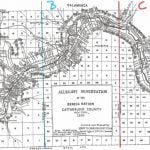
Allegany Reservation, This reservation, lying in Cattaraugus County, New York, has remarkable features in very respect, and of great social and political concern. Besides resting under the burden of the Ogden Land Company pre-emption right to purchase whenever the Seneca Nation shall agree to sell its lands, it is already occupied in part by white people, who, in large numbers, hold duly legalized leases, running until May, 1892, and subject by recent act of Congress to renewal upon the consent of the parties thereto for a term not exceeding 99 years. Upon location of the New York, Lake Erie and Western and then of the Atlantic and Great Western railroads through the Allegany reservation, leases were obtained from the Indian owners of the soil. By a decision of the supreme court of the state of New York these leases were declared to be illegal and void. By act of Congress approved February 19, 1875, all leases to said railroad companies were ratified and confirmed.
Oil Springs Reservation in Cattaraugus County, New York
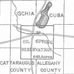
Oil Spring reservation, in Cattaraugus County, New York, as indicated on the Allegany reservation map, contains 640 acres in 2 towns and counties. It was by oversight included in the treaty made at Big Tree, in the sale by the Seneca nation of 3,500,000 acres to Robert Morris, and passed with his title to the Holland Land Company, A suit for the recovery of this land was brought in 1856, and resulted in favor of the Seneca Nation. On the trial Governor Blacksnake, as he was named by Washington when he visited the capital in company with Cornplanter, testified, at the advanced age of 107 years, to being present at the treaty of Big Tree in 1797, and that, when the exception was missed upon the public reading of the treaty. Thomas Morris, attorney for Robert Morris, gave to Pleasant Lake, a prominent sachem of the Seneca Nation, a separate paper, declaring that the Oil Spring tract was not included in the sale.
Cornplanter Reservation Warren County, Pennsylvania
This reservation, in Warren County, Pennsylvania, nominally a tract of 640 acres, owned by Cornplatter’s heirs, lies on both sides of the Allegheny River, and is about 2 miles long and half a mile wide, including Liberty and Donation Islands, which are formed by the forking of the river. The land surface, including the riverbed and some worthless shoals, contains about 760 acres. It was a donation to the celebrated chief Gy-ant-wa-hia, “The Cornplanter”, March 16, 1796, by the state of Pennsylvania, in consideration, states Judge Sherman, “for his many valuable services to the white people, and especially that most important one, in preventing the Six Nations of New York from joining the confederacy of western Indians in 17907-1791”. The war ended in the victory of General Wayne in 1794. In 1871 under act of May 16, partition or allotment of these lands was made to the descendants of Cornplanter and recorded in Warren County by the court having jurisdiction, special commissioners having been appointed by the state June 10, 1871, to effect the distribution. The power to sell the lands thus allotted is limited to the heirs of Cornplanter and other Seneca Indians. These Indians also have an interest in the Allegany and Cattaraugus lands of the Seneca Nation, and draw annuities with them.
The record of the orphans’ court of Warren county, Pennsylvania, gives the names of Cornplanter’s heirs, 23 in number, including grandchildren, and many of these names, appear upon the Allegany reservation map, suggestive of their association with this distinguished Indian character. Among these are the names of Logan, Silverheels, Titus, Blacksnake, Jacobs, Plummer, O’Bail, Abram, Hotbread, Thompson, and Pierce, all of which are still family names on both reservations, and generally among their kindred Senecas. One granddaughter still survives at Allegany at an advanced age, and Solomon O’Bail, also very old, lives at Cattaraugus.
The original name of the town was Ju-ni-sas ha-da-ga, in Elk township, Warren County, Pennsylvania, 15 miles above Warren, and the original deed to the “Planters’ field” bears the signature of Thomas Mifflin, governor of Pennsylvania.
Cattaraugus Indian Reservation of the Seneca Nation in Cattaraugus, Erie and Chautauqua Counties, New York
Cattaraugus Reservation, This reservation, in Cattaraugus, Chautauqua, and Erie Counties, New York, as delineated on the map, occupies both sides of Cattaraugus creek. It is 9.5 miles long on a direct east and west line, averages 3 miles in width at the center, dropping at is eastern line an additional rectangle of 2 by 3 miles. A 6-mile strip on the north and 2 “mile blocks” at diagonal corners are occupied by white people, and litigation is pending as to their rights and responsibilities. The Seneca Nation claims that the permit or grant under which said lands were occupied and improved was never legally authorized or executed by the nation. A long and practically undisturbed possession leaves the main question, one of ground rent or quitclaim, upon terms just to all parties, the improvements to remain with the occupants of the soil without appraisement.
Tuscarora Reservation in Niagara County, New York, Located and Platted A.D. 1890
Tuscarora Reservation, The Tuscarora, reservation, in Niagara County, New York, is formed from 3 adjoining tracts successively acquired, as indicated on the map. Their early antecedents as kinsmen of the Iroquois, their wanderings westward to the Mississippi, and their final lodgment at the head waters of the rivers Neuse and Tar, in North Carolina, are too much enveloped in tradition to be formulated as history, but courageous, self supporting, and-independent, after long residence upon lands owned by them in that colony, they first came into collision with white people, then with other tribes of that section, until finally, overpowered by numbers, they surrendered their lands upon the Neuse and Tar rivers, and by a treaty with the state of North Carolina removed to the banks of the Roanoke, The white people gave them no peace in their new home, and from 1715 to 1722 they removed to New York, near Oneida lake, and were admitted by their kinsmen of the Five Nations into the Iroquois Confederacy, thereafter known as the Six Nations.
St. Regis Reservation in St. Lawrence & Franklin Counties, New York, 1890
The St. Regis Indians are the successors of the ancient Mohawks, and reside on their reservation in Franklin and St. Lawrence counties, New York, which is 7.3 miles long o upon the south line and about 3 miles wide, except where purchases made by the state of New York in 1824 and.1825, as indicated on the map, modify the shape. The original tract was estimated as the equivalent of 6 miles square, or 23,040 acres, and the present acreage, computed by official reports without survey, is given as 14,640 acres.

