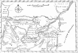
Reservations of the Six Nations in New York and Pennsylvania, 1723-1890
The accompanying map was prepared in 1771 under the direction of William Tryon, captain general and governor in chief of the province of New York, and is as nearly suggestive of the then recognized boundary of the Six Nations as any that has had official sanction. In 1851 Lewis H. Morgan, assisted by Ely S. Parker, a Seneca chief; and afterward an efficient staff Officer of General Grant, and the Commissioner of Indian Affairs, prepared a map for a volume entitled League of the Iroquois, which aimed to define the villages, trails, and boundaries of the Five Nations as they … Read more

