1832 Creek Census – Oswichee Town

By a treaty of March 24, 1832, the Creek Indians ceded to the United States all of their land east of the Mississippi River. Heads of families were entitled to tracts of land, which, if possible, were to include their improvements. In 1833 Benjamin S. Parsons and Thomas J. Abbott prepared a census of Creek Indian heads of families, which gave their names and the number of males, females, and slaves in each family. The entries were arranged by town and numbered; these numbers were used for identification in later records. This is the census for the town of Oswichee.

1832 Creek Census – Oselarneby Town

By a treaty of March 24, 1832, the Creek Indians ceded to the United States all of their land east of the Mississippi River. Heads of families were entitled to tracts of land, which, if possible, were to include their improvements. In 1833 Benjamin S. Parsons and Thomas J. Abbott prepared a census of Creek Indian heads of families, which gave their names and the number of males, females, and slaves in each family. The entries were arranged by town and numbered; these numbers were used for identification in later records. This is the census for the town of Oselarneby.

1832 Creek Census – Oaktawsarsey Town

By a treaty of March 24, 1832, the Creek Indians ceded to the United States all of their land east of the Mississippi River. Heads of families were entitled to tracts of land, which, if possible, were to include their improvements. In 1833 Benjamin S. Parsons and Thomas J. Abbott prepared a census of Creek Indian heads of families, which gave their names and the number of males, females, and slaves in each family. The entries were arranged by town and numbered; these numbers were used for identification in later records. This is the census for the town of Oaktawsarsey.

1832 Creek Census – Oakchoy Town

By a treaty of March 24, 1832, the Creek Indians ceded to the United States all of their land east of the Mississippi River. Heads of families were entitled to tracts of land, which, if possible, were to include their improvements. In 1833 Benjamin S. Parsons and Thomas J. Abbott prepared a census of Creek Indian heads of families, which gave their names and the number of males, females, and slaves in each family. The entries were arranged by town and numbered; these numbers were used for identification in later records. This is the census for the town of Oakchoy.

1832 Creek Census – Luchipoga Town

By a treaty of March 24, 1832, the Creek Indians ceded to the United States all of their land east of the Mississippi River. Heads of families were entitled to tracts of land, which, if possible, were to include their improvements. In 1833 Benjamin S. Parsons and Thomas J. Abbott prepared a census of Creek Indian heads of families, which gave their names and the number of males, females, and slaves in each family. The entries were arranged by town and numbered; these numbers were used for identification in later records. This is the census for the town of Luchipoga.

1832 Creek Census – Kohomutskigartskar Town

By a treaty of March 24, 1832, the Creek Indians ceded to the United States all of their land east of the Mississippi River. Heads of families were entitled to tracts of land, which, if possible, were to include their improvements. In 1833 Benjamin S. Parsons and Thomas J. Abbott prepared a census of Creek Indian heads of families, which gave their names and the number of males, females, and slaves in each family. The entries were arranged by town and numbered; these numbers were used for identification in later records. This is the census for the town of Kohomutskigartskar.

1832 Creek Census – Kiamulga Town

By a treaty of March 24, 1832, the Creek Indians ceded to the United States all of their land east of the Mississippi River. Heads of families were entitled to tracts of land, which, if possible, were to include their improvements. In 1833 Benjamin S. Parsons and Thomas J. Abbott prepared a census of Creek Indian heads of families, which gave their names and the number of males, females, and slaves in each family. The entries were arranged by town and numbered; these numbers were used for identification in later records. This is the census for the town of Kiamulga.

1832 Creek Census – Kialege Town

By a treaty of March 24, 1832, the Creek Indians ceded to the United States all of their land east of the Mississippi River. Heads of families were entitled to tracts of land, which, if possible, were to include their improvements. In 1833 Benjamin S. Parsons and Thomas J. Abbott prepared a census of Creek Indian heads of families, which gave their names and the number of males, females, and slaves in each family. The entries were arranged by town and numbered; these numbers were used for identification in later records. This is the census for the town of Kialege.

1832 Creek Census – Hotallehoyarnar Town

By a treaty of March 24, 1832, the Creek Indians ceded to the United States all of their land east of the Mississippi River. Heads of families were entitled to tracts of land, which, if possible, were to include their improvements. In 1833 Benjamin S. Parsons and Thomas J. Abbott prepared a census of Creek Indian heads of families, which gave their names and the number of males, females, and slaves in each family. The entries were arranged by town and numbered; these numbers were used for identification in later records. This is the census for the town of Hotallehoyarnar.

1832 Creek Census – Hitchopartarga Town

By a treaty of March 24, 1832, the Creek Indians ceded to the United States all of their land east of the Mississippi River. Heads of families were entitled to tracts of land, which, if possible, were to include their improvements. In 1833 Benjamin S. Parsons and Thomas J. Abbott prepared a census of Creek Indian heads of families, which gave their names and the number of males, females, and slaves in each family. The entries were arranged by town and numbered; these numbers were used for identification in later records. This is the census for the town of Hitchopartarga.

1930 Ponca Census Extraction

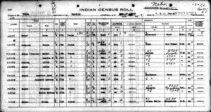
Ponca Census Image

An extraction of the 1930 Indian Census for the Ponca tribe of the Ponca Reservation in South Dakota. In 1930 there were 398 members that fell under the jurisdiction of the Yankton Agency. Most of them still resided within the Ponca Reservation, but some had moved elsewhere and are so indicated within the actual census images. This extraction provides their given names, surnames, sometimes the maiden name, age, and sex of each tribal member.

1832 Creek Census – Hitchetee Town

By a treaty of March 24, 1832, the Creek Indians ceded to the United States all of their land east of the Mississippi River. Heads of families were entitled to tracts of land, which, if possible, were to include their improvements. In 1833 Benjamin S. Parsons and Thomas J. Abbott prepared a census of Creek Indian heads of families, which gave their names and the number of males, females, and slaves in each family. The entries were arranged by town and numbered; these numbers were used for identification in later records. This is the census for the town of Hitchetee.

1832 Creek Census – Hillabee Town

By a treaty of March 24, 1832, the Creek Indians ceded to the United States all of their land east of the Mississippi River. Heads of families were entitled to tracts of land, which, if possible, were to include their improvements. In 1833 Benjamin S. Parsons and Thomas J. Abbott prepared a census of Creek Indian heads of families, which gave their names and the number of males, females, and slaves in each family. The entries were arranged by town and numbered; these numbers were used for identification in later records. This is the census for the town of Hillabee.

1832 Creek Census – Hihaje Town

By a treaty of March 24, 1832, the Creek Indians ceded to the United States all of their land east of the Mississippi River. Heads of families were entitled to tracts of land, which, if possible, were to include their improvements. In 1833 Benjamin S. Parsons and Thomas J. Abbott prepared a census of Creek Indian heads of families, which gave their names and the number of males, females, and slaves in each family. The entries were arranged by town and numbered; these numbers were used for identification in later records. This is the census for the town of Hihaje.

1832 Creek Census – High Log Town

By a treaty of March 24, 1832, the Creek Indians ceded to the United States all of their land east of the Mississippi River. Heads of families were entitled to tracts of land, which, if possible, were to include their improvements. In 1833 Benjamin S. Parsons and Thomas J. Abbott prepared a census of Creek Indian heads of families, which gave their names and the number of males, females, and slaves in each family. The entries were arranged by town and numbered; these numbers were used for identification in later records. This is the census for the town of High … Read more

1832 Creek Census – Hickory Ground Town

By a treaty of March 24, 1832, the Creek Indians ceded to the United States all of their land east of the Mississippi River. Heads of families were entitled to tracts of land, which, if possible, were to include their improvements. In 1833 Benjamin S. Parsons and Thomas J. Abbott prepared a census of Creek Indian heads of families, which gave their names and the number of males, females, and slaves in each family. The entries were arranged by town and numbered; these numbers were used for identification in later records. This is the census for the town of Hickory … Read more

1832 Creek Census – Hatchet Creek Town

By a treaty of March 24, 1832, the Creek Indians ceded to the United States all of their land east of the Mississippi River. Heads of families were entitled to tracts of land, which, if possible, were to include their improvements. In 1833 Benjamin S. Parsons and Thomas J. Abbott prepared a census of Creek Indian heads of families, which gave their names and the number of males, females, and slaves in each family. The entries were arranged by town and numbered; these numbers were used for identification in later records. This is the census for the town of Hatchet … Read more

1832 Creek Census – Hatcheechubba Town

By a treaty of March 24, 1832, the Creek Indians ceded to the United States all of their land east of the Mississippi River. Heads of families were entitled to tracts of land, which, if possible, were to include their improvements. In 1833 Benjamin S. Parsons and Thomas J. Abbott prepared a census of Creek Indian heads of families, which gave their names and the number of males, females, and slaves in each family. The entries were arranged by town and numbered; these numbers were used for identification in later records. This is the census for the town of Hatcheechubba.

1832 Creek Census – Fish Pond Town

By a treaty of March 24, 1832, the Creek Indians ceded to the United States all of their land east of the Mississippi River. Heads of families were entitled to tracts of land, which, if possible, were to include their improvements. In 1833 Benjamin S. Parsons and Thomas J. Abbott prepared a census of Creek Indian heads of families, which gave their names and the number of males, females, and slaves in each family. The entries were arranged by town and numbered; these numbers were used for identification in later records. This is the census for the town of Fish … Read more

1832 Creek Census – Eufaula Town

By a treaty of March 24, 1832, the Creek Indians ceded to the United States all of their land east of the Mississippi River. Heads of families were entitled to tracts of land, which, if possible, were to include their improvements. In 1833 Benjamin S. Parsons and Thomas J. Abbott prepared a census of Creek Indian heads of families, which gave their names and the number of males, females, and slaves in each family. The entries were arranged by town and numbered; these numbers were used for identification in later records. This is the census for the town of Eufaula.