1832 Creek Census – Euchee Town

By a treaty of March 24, 1832, the Creek Indians ceded to the United States all of their land east of the Mississippi River. Heads of families were entitled to tracts of land, which, if possible, were to include their improvements. In 1833 Benjamin S. Parsons and Thomas J. Abbott prepared a census of Creek Indian heads of families, which gave their names and the number of males, females, and slaves in each family. The entries were arranged by town and numbered; these numbers were used for identification in later records. This is the census for the town of Euche … Read more

1832 Creek Census – Emarhe Town

By a treaty of March 24, 1832, the Creek Indians ceded to the United States all of their land east of the Mississippi River. Heads of families were entitled to tracts of land, which, if possible, were to include their improvements. In 1833 Benjamin S. Parsons and Thomas J. Abbott prepared a census of Creek Indian heads of families, which gave their names and the number of males, females, and slaves in each family. The entries were arranged by town and numbered; these numbers were used for identification in later records. This is the census for the town of Emarhe.

1832 Creek Census – Ekundutske Town

By a treaty of March 24, 1832, the Creek Indians ceded to the United States all of their land east of the Mississippi River. Heads of families were entitled to tracts of land, which, if possible, were to include their improvements. In 1833 Benjamin S. Parsons and Thomas J. Abbott prepared a census of Creek Indian heads of families, which gave their names and the number of males, females, and slaves in each family. The entries were arranged by town and numbered; these numbers were used for identification in later records. This is the census for the town of Ekundutske.

1832 Creek Census – Cussetaw Town

By a treaty of March 24, 1832, the Creek Indians ceded to the United States all of their land east of the Mississippi River. Heads of families were entitled to tracts of land, which, if possible, were to include their improvements. In 1833 Benjamin S. Parsons and Thomas J. Abbott prepared a census of Creek Indian heads of families, which gave their names and the number of males, females, and slaves in each family. The entries were arranged by town and numbered; these numbers were used for identification in later records. This is the census for the town of Cussetaw.

1832 Creek Census – Cubihatcha Town

By a treaty of March 24, 1832, the Creek Indians ceded to the United States all of their land east of the Mississippi River. Heads of families were entitled to tracts of land, which, if possible, were to include their improvements. In 1833 Benjamin S. Parsons and Thomas J. Abbott prepared a census of Creek Indian heads of families, which gave their names and the number of males, females, and slaves in each family. The entries were arranged by town and numbered; these numbers were used for identification in later records. This is the census for the town of Cubihatcha.

1832 Creek Census – Cowyka Town

By a treaty of March 24, 1832, the Creek Indians ceded to the United States all of their land east of the Mississippi River. Heads of families were entitled to tracts of land, which, if possible, were to include their improvements. In 1833 Benjamin S. Parsons and Thomas J. Abbott prepared a census of Creek Indian heads of families, which gave their names and the number of males, females, and slaves in each family. The entries were arranged by town and numbered; these numbers were used for identification in later records. This is the census for the town of Cowyka.

1832 Creek Census – Coweta Towns

By a treaty of March 24, 1832, the Creek Indians ceded to the United States all of their land east of the Mississippi River. Heads of families were entitled to tracts of land, which, if possible, were to include their improvements. In 1833 Benjamin S. Parsons and Thomas J. Abbott prepared a census of Creek Indian heads of families, which gave their names and the number of males, females, and slaves in each family. The entries were arranged by town and numbered; these numbers were used for identification in later records. This is the census for the town of Coweta.

1832 Creek Census – Corn House Town

By a treaty of March 24, 1832, the Creek Indians ceded to the United States all of their land east of the Mississippi River. Heads of families were entitled to tracts of land, which, if possible, were to include their improvements. In 1833 Benjamin S. Parsons and Thomas J. Abbott prepared a census of Creek Indian heads of families, which gave their names and the number of males, females, and slaves in each family. The entries were arranged by town and numbered; these numbers were used for identification in later records. This is the census for the town of Corn … Read more

1832 Creek Census – Coosawda Town

By a treaty of March 24, 1832, the Creek Indians ceded to the United States all of their land east of the Mississippi River. Heads of families were entitled to tracts of land, which, if possible, were to include their improvements. In 1833 Benjamin S. Parsons and Thomas J. Abbott prepared a census of Creek Indian heads of families, which gave their names and the number of males, females, and slaves in each family. The entries were arranged by town and numbered; these numbers were used for identification in later records. This is the census for the town of Coosawda.

1832 Creek Census – Conchartetie Town

By a treaty of March 24, 1832, the Creek Indians ceded to the United States all of their land east of the Mississippi River. Heads of families were entitled to tracts of land, which, if possible, were to include their improvements. In 1833 Benjamin S. Parsons and Thomas J. Abbott prepared a census of Creek Indian heads of families, which gave their names and the number of males, females, and slaves in each family. The entries were arranged by town and numbered; these numbers were used for identification in later records. This is the census for the town of Conchartetie.

1832 Creek Census – Clewalla Town

By a treaty of March 24, 1832, the Creek Indians ceded to the United States all of their land east of the Mississippi River. Heads of families were entitled to tracts of land, which, if possible, were to include their improvements. In 1833 Benjamin S. Parsons and Thomas J. Abbott prepared a census of Creek Indian heads of families, which gave their names and the number of males, females, and slaves in each family. The entries were arranged by town and numbered; these numbers were used for identification in later records. This is the census for the town of Clewalla.

1832 Creek Census – Chockolocko Town

By a treaty of March 24, 1832, the Creek Indians ceded to the United States all of their land east of the Mississippi River. Heads of families were entitled to tracts of land, which, if possible, were to include their improvements. In 1833 Benjamin S. Parsons and Thomas J. Abbott prepared a census of Creek Indian heads of families, which gave their names and the number of males, females, and slaves in each family. The entries were arranged by town and numbered; these numbers were used for identification in later records. This is the census for the town of Chockolocko.

1832 Creek Census – Chehawah Town

By a treaty of March 24, 1832, the Creek Indians ceded to the United States all of their land east of the Mississippi River. Heads of families were entitled to tracts of land, which, if possible, were to include their improvements. In 1833 Benjamin S. Parsons and Thomas J. Abbott prepared a census of Creek Indian heads of families, which gave their names and the number of males, females, and slaves in each family. The entries were arranged by town and numbered; these numbers were used for identification in later records. This is the census for the town of Chehawah.

1832 Creek Census – Chehaw Town

By a treaty of March 24, 1832, the Creek Indians ceded to the United States all of their land east of the Mississippi River. Heads of families were entitled to tracts of land, which, if possible, were to include their improvements. In 1833 Benjamin S. Parsons and Thomas J. Abbott prepared a census of Creek Indian heads of families, which gave their names and the number of males, females, and slaves in each family. The entries were arranged by town and numbered; these numbers were used for identification in later records. This is the census for the town of Chehaw.

1832 Creek Census – Chearhaw Town

By a treaty of March 24, 1832, the Creek Indians ceded to the United States all of their land east of the Mississippi River. Heads of families were entitled to tracts of land, which, if possible, were to include their improvements. In 1833 Benjamin S. Parsons and Thomas J. Abbott prepared a census of Creek Indian heads of families, which gave their names and the number of males, females, and slaves in each family. The entries were arranged by town and numbered; these numbers were used for identification in later records. This is the census for the town of Chearhaw.

1832 Creek Census – Chattoksofke Town

By a treaty of March 24, 1832, the Creek Indians ceded to the United States all of their land east of the Mississippi River. Heads of families were entitled to tracts of land, which, if possible, were to include their improvements. In 1833 Benjamin S. Parsons and Thomas J. Abbott prepared a census of Creek Indian heads of families, which gave their names and the number of males, females, and slaves in each family. The entries were arranged by town and numbered; these numbers were used for identification in later records. This is the census for the town of Chattoksofke.

1832 Creek Census – Arbiccooche Town

By a treaty of March 24, 1832, the Creek Indians ceded to the United States all of their land east of the Mississippi River. This is the census for the town of Arbiccooche.

Guide to Using the Final Rolls

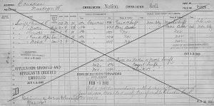
Frank T. Swift Enrollment Card

This is a guide to searching our Final Rolls, also known as the Dawes Rolls. The Final Rolls database can be searched to discover an enrollee’s name, age, sex, blood degree, type, census card number and roll number. These suggestions are offered with the hope of making your search more fruitful.

1850 Census of Lawrence County, Mississippi

The 1850 census of Lawrence County, MS was extracted by Dennis Partridge in 2011. The extraction provides basic information such as the names, ages, sex, and occupation of each resident of the county. For space purposes and speed, I have chosen not to do a complete extraction, but may choose at a later date to add the full transcription. Every person enumerated in Lawrence County, however, is listed. For further verification of this census, researchers should view the original census records. For purposes of search, I have taken the liberty of adding the surname of each person. In the actual … Read more

1894 Michigan State Census – Antrim County

The following data is extracted from 1894 Michigan State Census. United States Soldiers of the Civil War Residing in Michigan, June 1, 1894 [ Names within brackets are reported in letters. ] Antrim County. Banks Township Wm. H. Blow, Daniel Flanagan, Sylvester Brown, George 0. Glazier. John Sprick. Amasa Hartwell, John Levene, Wm. Greenman, James Arnold, Oscar H. Whitney, Harvey P. Wing, Joseph Washer, Amos Richardson, Burr Lewis. Charles Flanagan, Edw. Skinner, Gilbert M. Randall, William Blissett. Fred Ladue, William Burns, Fredric L. Church, Lewis Deline, Russell T. Sleeper, [Gilbert Bently, Geo. Fuller]. Central Lake Township Jesse Lambert, Nelson W. … Read more