Indian Warfare Between Texas and Mexico
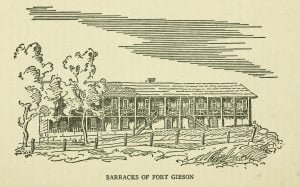
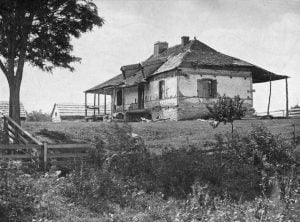
Barracks of Fort Gibson

In 1836, Major Chouteau explored the region between the Red River and the Colorado River, encountering numerous Comanche, Kiowa, and Kiowa Apache camps during their buffalo migration. Despite initial suspicion, he engaged in discussions with tribal leaders, ultimately facilitating a treaty in May 1837, aimed at peace among the tribes and protection for traders. However, amidst rising tensions due to Mexican influence and Indian warfare, further conflicts loomed, highlighting the precarious nature of relations between the tribes and the encroaching settlers in Texas.

Governor Stokes’s Uncompleted Plans

In March 1836, Governor Stokes became the sub-agent for the Cherokee, Seneca, and Shawnee tribes at Fort Gibson, receiving a modest salary of $750 annually. He faced numerous challenges, including a cramped office space and subordination to a disbursing officer, complicating his relations with the tribes. Stokes advocated for the rights of the Half-Breed reserves of the Osage Nation but struggled to secure assistance for them. Despite his dedication, his term ended without reappointment, and he passed away in November 1842, leaving a significant legacy.

Bossu’s Visit To The French Forts Upon The Alabama And Tombigby Rivers

History of Alabama and incidentally of Georgia and Mississippi, from the earliest period

Captain Bossu, dispatched by Governor Kerlerec from New Orleans, reached Fort Toulouse after a lengthy journey up the Alabama River. He encountered Creek and Alabama tribes, noting their prosperity and peaceful relations. The fort’s command saw tensions with Jesuit missionaries, highlighted by a scandal involving a complaint against the fort’s commander, Montberaut. Bossu’s detailed account also described interactions with local leaders, the hospitality of the tribes, and the changing landscape due to colonial expansion, foreshadowing the eventual transfer of Louisiana to British control.

A Fresh Look at Ocmulgee Bottoms

Ocmulgee in 1000AD

Many of the most fundamental assumptions by the Anthropology profession concerning the Pre-European history of the Lower Southeast were developed during the mid-20th century as a result of a massive, federally-funded excavation of archaeological sites near Macon, GA. While today, anthropologists, museums and the National Park Service present a united front stating that the body of knowledge, which resulted from the Ocmulgee Bottoms studies, was the result of comprehensive analysis, plus well-thought out consensus by some of the most brilliant men of their time, the truth is quite a bit different.

The Stokes Treaty Commission

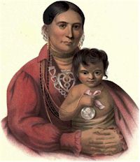
Mohongo

The Arkansas Osage, relocated from their old home to the Verdigris, faced significant challenges in their adjustment and governance. Initially lacking an agent until 1822, they experienced several leadership changes due to tragic events, such as Nathaniel Philbrook’s drowning. Frequent conflicts necessitated annual conferences, culminating in treaties with the Creeks and Cherokees in 1831. The 1833 commission, led by Governor Stokes, sought to establish peace and reassign boundaries between tribes, but faced persistent opposition from influential Osage leaders like Clermont, complicating negotiations amid severe hardship within the tribe.

Governor Houston’s Life Among the Indians

Detail from Houston at the Battle of San Jacinto

Following his failure to secure a contract for Indian rations, Sam Houston engaged in a series of contentious correspondences, criticizing officials and accusing Colonel Hugh Love of collusion. His passion led to public outbursts, including an intemperate proclamation against opponents. Despite his controversies, he was seen as an advocate for Indian rights, notably the Cherokee and Creek tribes. Houston’s deeper ambitions in Texas and his relationships with these tribes were marked by significant developments, including allegations of attempts to manipulate land settlements in their favor.

Governor Houston at His Trading Post on the Verdigris

Surrender of Santa Anna

In February 1828, Colonel Brearley led the Creek immigrants to the Verdigris, following governmental commitments from the 1826 treaty. During this time, Samuel Houston, a former U.S. Army officer and politician, was redefining his life among the Cherokee. After abandoning his political career and personal troubles, he became deeply involved with the Cherokee, adopting their customs and language. Houston’s influence grew as he criticized corrupt Indian agents and sought to improve conditions for Native Americans, eventually being adopted into the Cherokee tribe in 1829.

Western Garrison Life

Clermont, Osage Chief

Holland Coffee, a trader at Fort Smith, led a trading expedition into western Indian territories alongside Robert M. French. They set up a trading post near the Red River, at the old Pawnee village, aiming to capitalize on friendly relations established by Colonel Dodge with western tribes. Despite challenges, including unrest among the tribes regarding treaty assurances, a significant conference was held at Fort Gibson in 1835, resulting in the first treaty with western prairie tribes, crucial for U.S. plans to relocate eastern Indians.

Fort Gibson Conference with the Indians, 1834

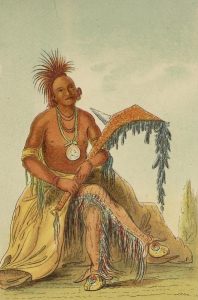
Catlin Painting a Chief at the Base of the Rocky Mountains

In September 1834, Colonel Dodge convened a significant council at Fort Gibson with chiefs from various tribes, including the Osage, Cherokee, and Kiowa, following earlier negotiations with the Comanche and others. More than 150 representatives attended amidst an atmosphere of curiosity and caution. The conference aimed to solidify peace and arrange future treaties, which were essential for the U.S. expansion into the Southwest. Despite the potential for violence, Dodge successfully navigated tensions, ensuring safe resolutions and presenting gifts to symbolize friendship.

Peace Attempts with Western Prairie Indians, 1833

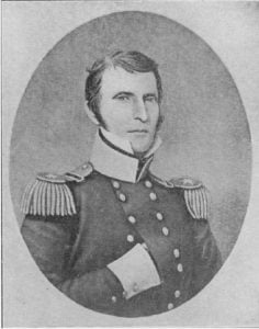
General Henry Leavenworth

In 1830, the Treaty of Dancing Rabbit Creek initiated the relocation of the Choctaw Indians to territories between the Canadian and Red rivers. However, the Choctaw faced threats from Comanche, Kiowa, and Wichita tribes, who attacked traders and settlers. In May 1833, Colonel Arbuckle sent a military expedition to protect the traveling Choctaw and assert U.S. power. Despite efforts, the expedition suffered losses, including ranger George B. Abbay, who was captured, and ultimately failed to achieve its objectives, highlighting the challenges of westward expansion.

Washington Irving at Fort Gibson, 1832

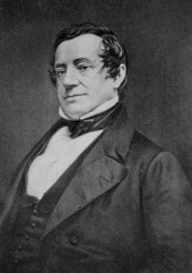
Irving Washington

The McIntosh Creeks established productive farms along the Arkansas River, but their land was mistakenly included in the 1828 treaty with the Cherokee, leading to tensions and grievances. The Creeks petitioned the government for aid against attacks from other Indian bands. In response, Congress set up a commission to address these issues, appointing three commissioners, including Montford Stokes. Eventually, Washington Irving joined the commission’s journey from St. Louis to Fort Gibson, experiencing the rich tapestry of frontier life and the challenges faced by the tribes.

Earliest Known Traders on Arkansas River

Country Home of Augustus Pierre Chauteau

Before the Louisiana Purchase, early French traders, notably Joseph Bogy, ventured along the Arkansas River, engaging in commerce with local Indian tribes, such as the Osage. Bogy’s expeditions included confronting Choctaw opposition in 1807, leading to government claims for losses. Prominent figures included Nathaniel Pryor and A. P. Chouteau, who established trading posts at the mouth of the Verdigris. These traders influenced the region’s economy, exchanging goods like furs and providing items such as tobacco and tools to Native Americans, fostering significant cultural exchanges.

The Natural Environment of Ocmulgee Bottoms

Tama-ulamako

Beginning in the late 1500s and continuing through the late 1600s, European maps showed a large lake in central Georgia that received both the Ocmulgee and Oconee River. Its outlet was the Altamaha River, which the French called the May River. The memoirs of the commander of Fort Caroline, René de Laudonnière, wrote in his memoir that several expeditions which he dispatched in a northwestward direction from the fort, encountered a large shallow lake at the headwaters of the May. These expeditions continued northward across the lake in their canoes and then traveled up the Oconee River to the Kingdom of Apalache and then the Appalachian Mountains. No mention is made of the Ocmulgee River by Laudonnière, but it also appeared on later maps of the region, flowing into Lake Tama. Apparently someone, either French or Spanish did canoe northwestward across the shallow lake and travel up the Ocmulgee.

Establishment of Fort Gibson in 1824

Fort Gibson in 1875

The Arkansas Territory was established by Congress in 1819, encompassing parts of present-day Arkansas and Oklahoma, with governance limited to the eastern section. James Miller became its first governor in 1819, tasked with overseeing relations with Native tribes. Efforts to broker peace between the Osage and Cherokee tribes were largely unsuccessful, leading to military reinforcements at Fort Smith. In 1824, troops were moved to a new post, Cantonment Gibson, established to enhance security and regulate tensions, which would eventually evolve into Fort Gibson, founded in 1824.

1860 Census West of Arkansas – Creek Nation

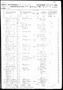
1860 Free Inhabitants Creek Nation Page 1

The 1860 census for the Creek Nation, located west of Arkansas, reveals a diverse array of free inhabitants, including Native Americans from Creek and Seminole tribes. This listing indicates that many individuals either renounced their tribal affiliations or were never granted citizenship. Several entries mark those who married Native individuals but were still denied citizenship, suggesting a complex social structure within the community. The presence of individuals identified by racial categories reflects the intricate interplay of identities during this period.

Maya Cultural Traditions at the Ortona Archaeological Zone

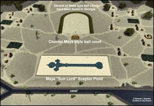
Ortona Sceptor Pond

Archaeological investigations at the Ortona site reveal complexities in architectural similarities between the Southeastern United States and Mesoamerica, particularly in mound construction and ceremonial practices. Both regions feature oval mounds and structures influenced by earlier residential designs. The use of lime stucco, previously thought absent in the Southeast, is also noted. The presence of crescent-shaped mounds suggests potential connections to Chontal Maya traditions. Notably, Ortona differs from typical indigenous constructions in the U.S., highlighting a unique blend of cultural influences and ceremonial functions.

A Description of the Towns on Coosau and Tallapoosa Rivers

Tal-e-see, positioned at the Tal-la-poo-sa’s junction with Eu-fau-le, reflects a decline in its native population and agricultural vigor. Although the land yields rich spots, the inhabitants, mostly Indians, are increasingly farming out in more favorable locations close to the creek, where cattle are beginning to thrive. The town’s leadership faces internal dissent and struggles with maintaining traditional customs amid pressures from white settlers. Nearby, Took-au-bat-che showcases a more active trading center, rich in resources and potential for agricultural development.

Jeanne Pappas DNA Results

MDLP K12

Jeanne Pappas’s DNA results revealed a surprising heritage, contrasting her family’s beliefs of Anglo-Saxon, Scottish, and Creek Indian ancestry. Instead, her analysis indicated significant connections to the Iberian Peninsula and Mediterranean, suggesting a strong Sephardic Jewish lineage. Despite no apparent Spanish or Sephardic surnames in her family tree, she theorizes that this Jewish ancestry may have been integrated through her Creek Indian roots, illustrating the complexity of her diverse background.

North America Indian Names of Places in Mississippi, Alabama, Georgia, Florida, and Louisiana

The post examines the significance and origins of North American Indian place names in Mississippi, Alabama, Georgia, Florida, and Louisiana, particularly those derived from the Choctaw and Chickasaw languages. It highlights how these names reflect the rich cultural and linguistic heritage of the Native American tribes, while noting that many translations have become corrupted over time. The text provides numerous examples of place names alongside their original meanings, illustrating the deep historical connections embedded in the geography of the region.

Mayhew, Brainard, Elliot, and Monroe Missions

From 1822 until their forcible removal, the North American Indians saw a rise in schools and religious practices, despite being unjustly labeled as infidels and savages. Missionaries, upon their arrival, found the Native peoples to possess moral integrity, respect for property, and a sincere belief in a Supreme Being. They discovered a society rich in virtues, countering misconceptions of savagery. However, the intrusion of white settlers led to the tragic displacement of these tribes from their ancestral lands, marking a devastating shift in their existence.