Cherokee Westward Migration

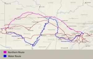
Map of the principal routes taken by Cherokee removal parties in the late 1830s.

From the late 18th to early 19th centuries, the Cherokee faced pressure from American expansion, prompting voluntary migrations westward before the Trail of Tears. Early attempts included a 1782 petition to Spanish authorities, leading to settlements in Missouri and Arkansas. Multiple treaties, particularly those in 1817 and 1819, formalized land exchanges and recognized divisions within the Cherokee Nation. The Emigration Rolls from 1817 to 1835 document these movements, revealing the complex responses of families as they sought refuge from encroaching settlers, leading to significant cultural and geographical shifts.

Cherokee Muster Rolls, 1835 – 1838

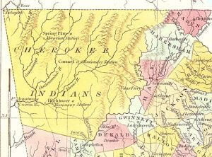
1830 Map of Cherokee Territory in Georgia

The Cherokee Muster Rolls of 1835-1838 document the forced relocation of the Cherokee people during the Trail of Tears. These rolls list families who were moved west, including those who left voluntarily, were rounded up by military forces, or migrated under Cherokee leadership. They offer crucial genealogical information for descendants of Cherokee individuals from the southeastern U.S., particularly those connected to the Cherokee Nation and the Eastern Band. These records, like the 1835 Henderson Roll and various muster rolls, are important for researchers tracking Cherokee ancestry during this difficult chapter in American history.

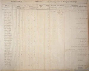
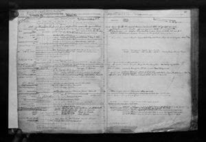
1834 Cherokee Muster Roll

1834 Cherokee Muster Roll - page 1

The 1834 Cherokee Muster Roll documents Cherokee Indians who emigrated westward under J. A. Harris before the 1835 Henderson Roll. It includes 216 Heads of Families among the 903 individuals who traveled, noting that some returned east due to conditions. Births and deaths occurred along the journey, and family members were not always together. Each family was provided with supplies. If your ancestor is missing from the Henderson Roll, this muster roll may hold their name.

Names of Cherokee Soldiers in the Civil War

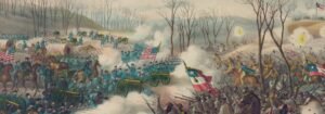
Pea Ridge Battle

In 1861, Stand Watie led the formation of the Cherokee Mounted Rifle Regiment in support of the Confederacy, becoming its Colonel. Other officers included Thomas Fox Taylor and Elias Cornelius Boudinot. Companies were organized with various captains and lieutenants, including notable figures like Joseph Franklin Thompson and James Madison Bell. Despite initial neutrality, pressures led to alliances with Confederate forces as the Cherokee sought to protect their interests. The regiment, reflecting their commitment, faced numerous challenges and engaged in battles throughout the Civil War.

Unraveling Catherine Whittle’s Choctaw Citizenship Claim

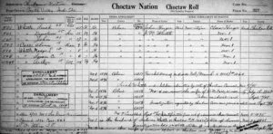
Choctaw By Blood - Card 237

Catherine Whittle applied for enrollment as a Choctaw citizen in 1899, alongside her children, due to her sister Sarah Whittle’s recognized status. Their application was denied in 1900 despite their long-term residence in the Choctaw Nation. Legal efforts in 1910 highlighted familial connections and supportive testimonies, but a final decision remains unrecorded. Other related claims were made by Eliza Jane Pearce, Catherine’s cousin. Evidence of lineage was provided but met with administrative resistance throughout the enrollment process.

OKGenWeb – Oklahoma GenWeb

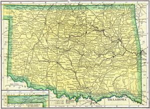
1910 Oklahoma Census Map

OKGenWeb is created by a group of volunteers as part of the USGenWeb Project working together to provide free genealogy websites for genealogical research in every county in Oklahoma. This Project is non-commercial and fully committed to free genealogy access for everyone.

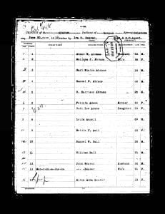
1910 Quapaw Census

1910 Quapaw Census (1)

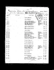
Pages of the 1910 Quapaw Census. Contains table showing the previous roll number, current roll number, Indian name if given, English name if given, Relationship, Age, and Sex. Also contains the original images of the census.

A history of Covington Oklahoma

A History of Covington, Garfield County, Oklahoma

Fannie L. Eisele’s book, “A History of Covington, Garfield County, Oklahoma, and Surrounding Territory,” is a folksy chronicle of the pioneering era in southeastern Garfield County following the opening of the Cherokee Strip. Published in 1952 by Newel A. Ellis, this 214-page volume documents the transformation of untamed prairie claims into flourishing farms and the lives of the settlers who cultivated the land. Growing up just west of what is now the town of Covington, Eisele’s personal history and connection to the land add depth to her account. Her work not only chronicles the development of Covington but also aims to include the surrounding townships of Wood, Otter, Reed, and Marshall, each contributing to the broader history of the Cherokee Strip and Oklahoma.

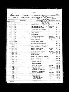
1910 Peoria Census

1910 Peoria Census - (1)

Pages of the 1910 Peoria Census. Contains table showing the previous roll number, current roll number, Indian name if given, English name if given, Relationship, Age, and Sex. Also contains the original images of the census.

1910 Ottawa Census

1910 Ottawa Census - Page 1

Pages of the 1910 Ottawa Census. Contains table showing the previous roll number, current roll number, Indian name if given, English name if given, Relationship, Age, and Sex. Also contains the original images of the census.

1910 Modoc Census

1910 Modoc Census - Page 1

Pages of the 1910 Modoc Census. Contains table showing the previous roll number, current roll number, Indian name if given, English name if given, Relationship, Age, and Sex. Also contains the original images of the census.

1910 Western Miami Census

1910 Western Miami Census - Page 1

Pages of the 1910 Western Miami Census. Contains table showing the previous roll number, current roll number, Indian name if given, English name if given, Relationship, Age, and Sex. Also contains the original images of the census.

1910 Eastern Shawnee Census

1910 Eastern Shawnee Census – page 1

Pages of the 1910 Eastern Shawnee Census. Contains table showing the previous roll number, current roll number, Indian name if given, English name if given, Relationship, Age, and Sex. Also contains the original images of the census.

1914 Eastern Shawnee Census

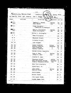
The 1914 census record of the Eastern Shawnee Tribe from the Quapaw Agency was taken on June 30, 1914, in Indian Territory, which is now Oklahoma. The Eastern Shawnee Tribe primarily resides in northeastern Oklahoma, having separated from other Shawnee groups in the 19th century to establish their community in this region. Recognized as a federally recognized tribe, the Eastern Shawnee have their own government and tribal structure. The purpose of the 1914 census was to maintain an official record of the Eastern Shawnee Tribe members as part of the U.S. government’s broader efforts to document Native American populations. This census provides detailed information about individual tribe members, including their names, ages, sex, family relationships, allotment numbers, and roll numbers.

History of Jefferson County Oklahoma

History of Jefferson County, Oklahoma

In “History of Jefferson County, Oklahoma,” Jim M. Dyer provides a comprehensive account of the development and heritage of Jefferson County within the broader context of Oklahoma’s growth since its inception as a state in the Union. This work is particularly significant as it commemorates Oklahoma’s Semi-Centennial, marking fifty years of statehood filled with rich productivity and development. Dyer’s exploration is driven by a multifaceted purpose: to celebrate the state’s achievements, to preserve the memory of Jefferson County’s “birth and growth” for future generations, and to honor the pioneers whose resilience and dedication laid the foundations for the county’s prosperity.

The History of Carter County Oklahoma

The history of Carter County

Published in 1957, ‘The History of Carter County’ provides a comprehensive visual and textual history of Carter County Oklahoma. Covering the period from its Native American origins to the mid-20th century, the book focuses on the themes of Native American presence, settlement, churches, utilities, transportation, and industry. In doing so, it serves as a tribute to the people who shaped Carter County.

The Ottawa Tribe of Oklahoma

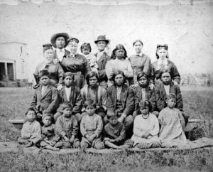
Ottawas in Kansas, ancestors of the Ottawa Tribe of Oklahoma

The Ottawa Tribe of Oklahoma, hailing from the term “adawe” or ‘trade’, played an instrumental role in North America’s fur trade. This article chronicles their history, from early interactions with the French to contemporary times, highlighting significant milestones such as their involvement in the French and Indian War, their migrations, and their efforts towards educating their children. It also details their temporary termination by the U.S. Government in 1956 and subsequent reinstatement in 1978, emphasizing the resilience of the tribe throughout their enduring history.

United States Bureau of Land Management Tract Books, 1800-c. 1955

record-image_3QS7-89W3-39QL-W

3,907 land management tract books containing official records of the land status and transactions involving surveyed public lands arranged by state and then by township and range. These books indicate who obtained the land, and include a physical description of the tract and where the land is located. The type of transaction is also recorded such as cash entry, credit entry, homesteads, patents (deeds) granted by the Federal Government, and other conveyances of title such as Indian allotments, internal improvement grants (to states), military bounty land warrants, private land claims, railroad grants, school grants, and swamp grants. Additional items of information included in the tract books are as follows: number of acres, date of sale, purchase price, land office, entry number, final Certificate of Purchase number, and notes on relinquishments and conversions.

Mayes County Oklahoma Cemeteries

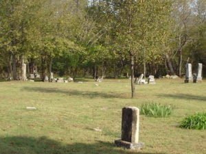
Alberty Cemetery, Sportsmen Acres, Mayes County, OK

A complete listing of all available online Mayes County Oklahoma cemeteries, with links to multiple cemetery transcriptions, gravestone photos, tombstone photos, official records, etc.

Washita County Oklahoma Cemeteries

Confederate State Cemetery, Fort Washita

A complete listing of all available online Washita County Oklahoma cemeteries, with links to multiple cemetery transcriptions, gravestone photos, tombstone photos, official records, etc.