Harrisville, Cheshire County, New Hampshire History

Harrisville lies in the extreme eastern part of the county, in lat. 42º 57′ and long. 4º 59′, bounded north by Nelson and Hancock, the latter in Hillsborough county, east by Hancock and Peterboro, south by Dublin and west by Roxbury and a portion of Marlboro. This is the youngest township in the county, having been incorporated as late as July 2, 1870, its area being made up of territory taken from the southern part of Nelson and northern part of Dublin. The extreme length of the town, east and west, is nearly eight miles, and its greatest width, north … Read more

Alstead, Cheshire County, New Hampshire History

Alstead, Cheshire county, New Hampshire, with an area of 24,756 acres, lies in the extreme northern part of Cheshire county, in 43º 6′ of north latitude, and longitude 4º 48′ east from Washington, bounded north by Sullivan county, east by Marlow, south by Gilsum and Surry, and west by Walpole and a part of Sullivan county. The territory now lying within its limits was originally granted by Gov. Benning Wentworth, probably in 1761. This history entails sketches of early industry, churches, military, and benevolent societies, as well as biographies and sketches of the early settlers. History of Alstead, New Hampshire … Read more

Chesterfield, Cheshire County, New Hampshire History

Chesterfield lies in the western part of the county, in lat. 42º 54′ and long. 4º 40′, bounded north by Westmoreland and Keene, east by Keene and Swanzey, south by Winchester and Hinsdale, and west by the west bank of Connecticut river, and has an area, exclusive of the Connecticut, of about forty-four square miles, or 28,160 acres. This history entails sketches of early industry, churches, military, and benevolent societies, as well as biographies, genealogies and sketches of the early settlers. History of Chesterfield, New Hampshire General History of Chesterfield, NH Early Settlers of Chesterfield, NH Early Manufacturing of Chesterfield, … Read more

Dublin, Cheshire County, New Hampshire History

Dublin lies in the extreme eastern part of the county, in lat. 45° 54′ and long. 4° 59′, bounded north by Harrisville, east by Peterboro, in Hillsborough county, south by Jaffrey, and west by Marlboro. It was originally granted by the proprietors of land purchased of John Tufton Mason, to Matthew Thornton and thirty-nine others, November 3, 1749, the charter being given by Col. Joseph Blanchard, of Dunstable, and was called Monadnock No. 3, or North Monadnock. The grant comprised an area of thirty-six square miles, or a territory seven miles long and five wide, and was given under the … Read more

History of Cornish New Hampshire

History of Cornish New Hampshire

Volume 1 of “History of the Town of Cornish, New Hampshire, with Genealogical Record, 1763-1910,” authored by William Henry Child, presents a comprehensive account of Cornish from its origins to the early 20th century. Published in 1911, the book documents the town’s history, geography, and prominent families, while honoring the early settlers’ contributions to its development. Child’s meticulous research serves as both a historical narrative and genealogical reference, making it a vital resource for understanding the local heritage of Cornish, New Hampshire.

Early History of Brown County Nebraska

Early Ainsworth Nebraska

This historical sketch of Brown County, Nebraska, primarily sourced from the early settlers’ recollections, aims to capture the essence of the region’s past, strongly tied to its pioneer spirit. Before the arrival of white settlers, the vast prairies, known for their “sea of grass,” served as hunting grounds for local Native American tribes and provided pastures for buffalo herds. The text not only charts significant events like harsh winters and droughts from 1880-1895 but also notes aspects of local life such as the establishment of schools, churches, and law enforcement. The compendium underscores the interplay between the environment, the indigenous people, the wildlife, and the settlers, all converging to shape the civilization that emerged in this part of Nebraska. Through these narratives, the author wishes to honor the fortitude of those early pioneers and provide insight into their lives and challenges.

Montana Politics, Legislation and Reform

Having discharged the onerous duties of his office for a few months, Governor Smith returned to the states, and Meagher again came to the front. Once more he proclaimed a special session of the legislature, the motive of which was that a law had just been passed by congress and approved by the president convening the 40th congress on the 4th of March, whereas the election law of Montana, which fixed the day of general election on the first Monday of September, would leave the territory without a delegate from March until September. Not that a delegate had ever been … Read more

Montana Towns and Pioneer Sketches, 1862-1864

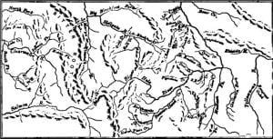
Gulches and Lodes Map - 1865

Among these detained in Beaverhead Valley because wagons could not go through from Lemhi to Salmon River was a party of which John White and John McGavin were members. This company, about the 1st of August, 1862, discovered placers on Willard or Grasshopper Creek, where Bannack City was built in consequence, which yielded from five to fifteen dollars a day to the hand. White, who is usually accredited with the discovery, having done so much for his fame, has left us no other knowledge of him or his antecedents, save that he was murdered in December 1863. Almost at the … Read more

Montana Settlement, Geology, Exploration, 1728-1862

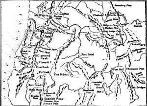
General View of Mountain Passes

Montana, mountainous or full of mountains is a name, as herein used, no less beautiful than significant. From the summit of its loftiest peak – Mount Hayden – may be seen within a day’s ride of each other the sources of the three great arteries of the territory owned by the United States – the Missouri, the Colorado, and the Columbia. From the springs on either side of the range on whose flanks Montana lies flow the floods that mingle with the North Pacific Ocean, the Gulf of California, and the Gulf of Mexico. The Missouri is 4,600 miles in … Read more

The Organization of Montana, 1864-1866

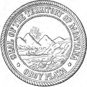
Montana Seal

Up to this time the territory later called Montana was still within the limits of Idaho, which embraced the mining country east of the Rocky Mountains. On the 26th of May, 1864, congress passed an act providing a temporary government for a new territory to be called Montana, the boundaries of which embraced 143,776 square miles, or 92,016,640 acres; commencing at a point formed by the intersection of the 27th degree of longitude west from Washington with latitude 45°, thence due west to longitude 34°, thence to latitude 44° 30′, thence west along that line to the summit of the … Read more

Montana Expansion, Labor, Transportation and Citizens

The progress of Montana in mining, as indicated in the previous chapter, had received a partial check from about 1870 to 1880. The reason of this was that surface mining had declined, the placers being exhausted, and deep mining had not yet been sufficiently developed to give equal returns. There were other causes operating at the same time, such as the great cost of transportation of machinery, and the financial crisis resultant upon the suspension of Jay Cooke & Co., with the consequent embarrassments of the Northern Pacific railroad company, to whose advent in the territory all eyes had been … Read more

Formation of Montana State Government

As this chapter is to deal with the formation of the state government of Montana, let us go back to 1884, in January of which year a constitutional convention was held at Helena, an act having been passed by the thirteenth session of the Montana legislature authorizing an election for delegates to be held in November 1883. The election took place, and the convention met, forming a constitution subject to acceptance or rejection by the qualified electors at the biennial election of 1884. The voting on adoption was light, the total vote being 7,197 less than the total for delegate … Read more

Town History of Fryeburg, Maine

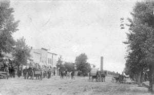
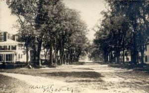
1910 Main Street Fryeburg Maine

Nestled close to the New Hampshire border is the small community of Fryeburg, Maine. Our newest online free manuscript provides you a look into the history of this community. Included with this manuscript is information on the Sokokis Indians, and a brief military history of Fryeburg.

History and Biographies of Todd and Christian Counties, Kentucky

Log House

Be it Enacted by the General Assembly of the Commonwealth of Kentucky, That from and after the first day of April next, all that part of said counties of Logan and Christian, contained in the following boundary, to wit: Beginning on the Tennessee State line, at the present corner of the counties of Logan and Christian, on said State line; thence on a straight line to the Muhlenberg County line, two miles east of the present corner of said counties of Logan and Christian, on said Muhlenberg County line; then westwardly with said Muhlenberg County line, until a due south … Read more

Reminiscences of the Early Settlement of Dragoon Creek, Wabaunsee County

When the Kansas-Nebraska Act opened up the Kansas Territory to settlement, a tide of immigration began as citizens from across the United States, and foreigners, recently arrived in the US, rushed to receive some of the prime property. Stephen J. Spear was one such settler, and this manuscript depicts his life along Dragoon Creek in Wabaunsee County, Kansas.

History of Douglas County Illinois

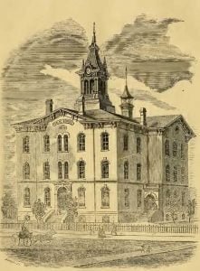
Tuscola Public School Building

This collection on the History of Douglas County Illinois currently contains 114 biographies on important people in the history of Douglas County.

Illustrated History of the State of Idaho

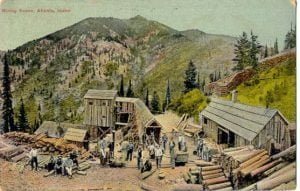
Mining Scene Atlanta Idaho

Illustrated History of the State of Idaho was written in 1899 by the Lewis Publishing Company and comprised one of many large collections of state biography and history books published by the Lewis company. Our collection provides the entire manuscript including the histories and all 480 published biographies.

Idaho Political Affairs, 1862 – 1866

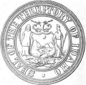
Idaho Seal

On the 22d of September, 1863, more than four months after the passage of the Organic Act of the territory, William H. Wallace, late delegate to congress from Washington, appointed governor of Idaho by President Lincoln July 10th, issued his proclamation organizing the Territory of Idaho, with the capital at Lewiston. Owing to the shifting nature of the population and the absence of mail facilities, the fact of this organization was not known in the mines till late in the spring. Meanwhile the laws of Washington were held to be in force. Much irregularity had prevailed in municipal affairs since … Read more

Nez Percé and Shoshone Indian Lands in Idaho

The Native Races of Idaho were divided by the Salmon River Range of mountains, the Nez Percé being the representative nation of the northern division, and the Shoshones of the southern. The condition and character of the former were relatively higher than those of the latter. During the five years’ war from 1863 to 1868, the history of which I have given, the Nez Percé remained quiescent, taking no part in the hostilities, although they were not without their grievances, which might have tempted other savages to revolt. The troubles to which I here refer began in 1855, with the treaties … Read more