The Stokes Treaty Commission

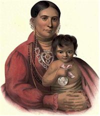
Mohongo

The Osage who left their old home and removed to the Verdigris, were known as the Arkansas Osage. They had no agent until 1822 when Nathaniel Philbrook was appointed sub-agent for them. He was drowned at the mouth of Grand River the latter part of March, 1824 as related by Colonel Chouteau. David Barbour was then appointed in his place at a salary of five hundred dollars yearly. Governor Alexander McNair of Missouri had been appointed agent for the Great and Little Osage on the Missouri and Upper Grand rivers. The difficulties caused by the Arkansas Osage were so frequent … Read more

Governor Houston’s Life Among the Indians

Detail from Houston at the Battle of San Jacinto

The year following his failure to secure the contract, Houston spent writing letters defending his acts and denouncing the officials who had been discharged. In addition to the Indian officials, he poured his wrath and denunciation on Colonel Hugh Love, a trader on the Verdigris whom Houston accused of being in league with the Indian Agent to rob the Creeks; Love replied to Houston with some spirited charges against the latter. Stung by the contents of an article appearing in a Nashville paper, in a burst of passion Houston gave to the press of Nashville a most intemperate letter, July 13, 1831, beginning:

Governor Houston at His Trading Post on the Verdigris

Surrender of Santa Anna

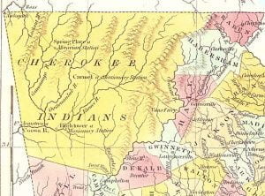
In February, 1828, the vanguard of Creek immigrants arrived at the Creek Agency on the Verdigris, in charge of Colonel Brearley, and they and the following members of the McIntosh party were located on a section of land that the Government promised in the treaty of 1826 to purchase for them. By the treaty of May 6, 1828, the Government assigned the Cherokee a great tract of land, to which they at once began to remove from their homes in Arkansas. The movement had been under way for some months when there appeared among the Indians the remarkable figure of Samuel Houston. The biographers of Houston have told the world next to nothing of his sojourn of three or four years in the Indian country, an interesting period when he was changing the entire course of his life and preparing for the part he was to play in the drama of Texas.

Western Garrison Life

Clermont, Osage Chief

Grant Foreman describes the early life in a Western Garrison; providing insights on some of the traders in the region, the deaths of Seaton, Armstrong, Wheelock and Izard, all soldiers obviously familiar to him. But he also shares the story of the elopement of Miss Sarah Knox Taylor, daughter of General Taylor, to Lieutenant Jefferson Davis… yes, THAT Jefferson Davis.

An interesting section of the chapter are the references to the punishments inflicted upon the soldiers in the event of their disobedience.

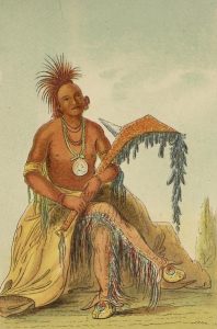
Painted by Catlin in 1834, the picture attached is of Clermont, chief of the Osage Tribe. Clermont is painted in full length, wearing a fanciful dress, his leggings fringed with scalp-locks, and in his hand his favorite and valued war-club.

Fort Gibson Conference with the Indians, 1834

Catlin Painting a Chief at the Base of the Rocky Mountains

One of the most important Indian conferences ever held in the Southwest, occurred at Fort Gibson in 1834 for it paved the way for agreements and treaties essential to the occupation of a vast country by one hundred thousand members of the Five Civilized Tribes emigrating from east of the Mississippi; to the security of settlers and travelers in a new country; to development of our Southwest to the limits of the United States and beyond and contributed to the subsequent acquisition of the country to the coast, made known to us by the pioneers to Santa Fe and California traveling through the region occupied by the “wild” Indians who, at Fort Gibson, gave assurances of their friendship. It is true, these assurances were not always regarded, and many outrages were afterwards committed on the whites and by the whites, but the Fort Gibson conference was the beginning and basis upon which ultimately these things were accomplished.

The Osage Massacre

Kiowa Calender

When the treaty council with the Osage at Fort Gibson broke up in disagreement on April 2, 1833, three hundred Osage warriors under the leadership of Clermont departed for the west to attack the Kiowa. It was Clermont’s boast that he never made war on the whites and never made peace with his Indian enemies. At the Salt Plains where the Indians obtained their salt, within what is now Woodward County, Oklahoma, they fell upon the trail of a large party of Kiowa warriors going northeast toward the Osage towns above Clermont’s. The Osage immediately adapted their course to that pursued by their enemies following it back to what they knew would be the defenseless village of women, children, and old men left behind by the warriors. The objects of their cruel vengeance were camped at the mouth of Rainy-Mountain Creek, a southern tributary of the Washita, within the present limits of the reservation at Fort Sill.

Colonel Dodge Reaches Villages of Western Indians

Trailing through broad and verdant valleys, they went, their progress often arrested by hundreds of acres of plum trees bending to the ground with tempting fruit; crossing oak ridges where the ground was covered with loaded grapevines, through suffocating creek-bottom thickets, undergrowth of vines and briars, laboring up rocky hillsides and laboring down again, the horses picking their way through impeding rocks and boulders, until on the twenty-ninth of the month, two hundred miles from Fort Gibson, General Leavenworth and his staff reached Captain Dean’s camp, a mile or two from the Washita, where there were quartered two companies of … Read more

Peace Attempts with Western Prairie Indians, 1833

General Henry Leavenworth

What was known as the Treaty of Dancing Rabbit Creek was entered into in Mississippi with the Choctaw Indians September 27, 1830; pursuant to the terms of the treaty, in 1832 the movement of the Choctaw to their new home between the Canadian and Red rivers was under way but they were in danger from incursions of the Comanche and Pani Picts or Wichita, and the Kiowa tribe, who came east as far as the Washita and Blue rivers; these Indians had also evinced a hostile attitude toward white citizens and had attacked and plundered Santa Fe traders, trappers, and … Read more

Washington Irving at Fort Gibson, 1832

Irving Washington

The McIntosh Creeks had been located along Arkansas River near the Verdigris on fertile timbered land which they began at once to clear, cultivate, and transform into productive farms. The treaty of 1828 with the Cherokee gave the latter a great tract of land on both sides of Arkansas River embracing that on which the Creeks were located. This was accomplished by a blunder of the Government officials, in the language of the Secretary of War, “when we had not a correct knowledge of the location of the Creek Indians nor of the features of the country.” This situation produced … Read more

Earliest Known Traders on Arkansas River

Country Home of Augustus Pierre Chauteau

With the help of contemporary records it is possible to identify some of the early traders at the Mouth of the Verdigris. Even before the Louisiana Purchase, hardy French adventurers ascended the Arkansas in their little boats, hunting, trapping, and trading with the Indians, and recorded their presence if not their identity in the nomenclature of the adjacent country and streams, now sadly corrupted by their English-speaking successors. French Influence in Arkansas One of the first of the French traders up the Arkansas whose name has been recorded was Joseph Bogy, an early resident of the old French town, Arkansas … Read more

Establishment of Fort Gibson in 1824

Fort Gibson in 1875

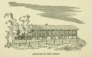
By Act of Congress of March 2, 1819, Arkansas Territory was established July 4, embracing substantially all of what are now the states of Arkansas and Oklahoma; though the civil government of Arkansas Territory was limited to that section lying east of the Osage line, divided into counties, and embracing approximately the present state of Arkansas. That west of the Osage line was the Indian country, and in later years became known as Indian Territory. James Miller of New Hampshire was appointed the first Governor of Arkansas Territory, and among the duties of his office was that of supervision of … Read more

Establishment of Fort Smith in 1817

Quapaw Cession Map

The white population in Arkansas in 1817 had increased to several thousand, whose protection, as well as that of the Cherokee people living in that territory, from the continued hostilities of the Osage, required the establishment of a military post at the western border dividing the white settlements from the Osage. From Saint Louis came further news of threatened hostilities by the Osage near Clermont’s Town, and a report that Major William Bradford with a detachment of United States riflemen, and accompanied by Major Long, topographical engineer, had left that city for the purpose of establishing a military post on … Read more

1860 Census West of Arkansas – Creek Nation

1860 Free Inhabitants Creek Nation Page 1

Free Inhabitants in “The Creek Nation” in the County “West of the” State of “Akansas” enumerated on the “16th” day of “August” 1860. While the census lists “free inhabitants” it is obvious that the list contains names of Native Americans, both of the Creek and Seminole tribes, and probably others. The “free inhabitants” is likely indicative that the family had given up their rights as Indians in treaties previous to 1860, drifted away from the tribe, or were never fully integrated. The black (B) and mulatto (M) status may indicate only the fact of the color of their skin, or whether one had a white ancestors, they may still be Native American.

Disbursements to Cherokees under the Treaty of May 6, 1828

Treaty of May 6, 1828, page 9

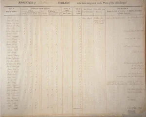
Abstract of disbursements and expenditures made by George Vashon, Indian Agent for the Cherokees west of the Mississippi, under the stipulations of the Treaty with said tribe of 6th May, 1828, between the 16th September, 1830, and the 31st December, 1833. In total this list represents 390 Cherokee families and 1835 individuals who each received 25.75 as part of their payment under the 5th article of the treaty of 6th May, 1828.

Andrew Ayers Martin’s DNA Results

GedMatch Ethnicity Martha Payne Albertson

Andrew Ayers Martin (Cherokee) I would be happy to share these profiles with Dennis. I am attaching the initial analysis on my DNA done at Ancestry as well as the breakdowns done on the FTDNA results by analysis at GedMatch. The proportions of Middle Eastern and Mediterranean DNA are relatively stable. Some others not related to me whose families have traditions of being part Cherokee show similar percentages. The stable proportions are consistent with the Hardy Weinburg principle of biology. Only my uncle [kit 185473] shows detectable Amerindian DNA at 1.83%. My uncle and daughter show Red Sea [Jewish] DNA. … Read more

Charlie Whitener’s DNA Results

Charlie Whitener (Eastern Band of Cherokees) I appreciate all your writings on southern Native Americans. My family reflects all your writings. We believed we were all northern European with a strong Cherokee heritage. My dad once lived on the reservation land in Murphy, NC But between my dad and mom and myself we reflect southern European and SE European and North Africa and Sudan and Arabia and SA and Tuscan and Italian etc. My dad has since past.   He did the National Geographic DNA test. My mom and my identical twin used the Family Tree DNA lab. However, the results … Read more

Richard Stewart’s DNA Results

Map of Known Human Migrations

Richard Stewart (Shawnee or Cherokee Descendant) My name is Richard Stewart.  I have had several ethnicity DNA tests done, but I find myself less than satisfied with the results.  I will attempt to find other test results in my archived mail.  My first DNA test showed 8% NA but came out East Asian as is often the case. Another test showed three NA matches out of a total of 20.  Below is the last test I’ve taken.  This was done in part to determine a baseline for Melungeons.  I do not strongly identify as a Melungeon.  I was born and raised … Read more

What Happened to the Sephardic Jewish Colonists?

Map of the Watauga Settlements

There has never been a scientific study to determine the post-colonial history of the Sephardic communities in the Southern Piedmont and Appalachians. Anything that can be said must be in the realm of speculation, based on the known cultural history of the Southeast during the Colonial and Antebellum Eras. The only significant religious-based persecution in the Lower Southeast was between the Sephardic Jews and the Ashkenazi Jews from Eastern Europe. A Protestant minister in Savannah wrote, “Some Jews in Savannah complain that the Spanish and Portuguese Jews should persecute the German Jews in a way no Christian would persecute another … Read more

Who Really are the Cherokees?

1718 French Map of North America - Detail

In 1976, while writing his dissertation for a Ph.D. in Anthropology, Archaeologist Bennie Keel was under heavy pressure to state that the Cherokees had lived in western North Carolina for at least 1000 years. That was a new policy adopted by the State of North Carolina. What Keel did say was that only three probable Cherokee structures in North Carolina had produced radiocarbon dates before the 1720. Keel noted that there was a century long gap between the archaeological record of large towns with multi-roomed rectangular houses, large plazas and pyramidal platform mounds, and the small villages typical of the … Read more

Cherokee Intermarriage and Enrollment

Nimrod J. Smith

The Records of this office show: That prior to October 31, 1902, applications were received by the Commission to the Five Civilized Tribes for the enrollment as citizens by intermarriage of the Cherokee Nation of the following named persons whose names appear upon the partial roll of Cherokee citizens, approved by the Secretary of the Interior, opposite the numbers following their respective name.