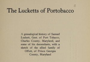
A genealogical history of Samuel Luckett, Gent, of Port Tobacco, Charles County, Maryland, and some of his descendants, with a sketch of the allied family of Ofifutt, of Prince Georges County, Maryland.
Adams, Adderton, Addison, Alexander, Applebaugh, Ashby, Atkisson, Baggett, Bainbridge, Baldwin, Barnes, Barney, Bartlett, Battle, Beale, Beall, Beatty, Beaven, Belt, Benson, Bethel, Blair, Borden, Bottrell, Bowie, Bradford, Brazier, Brengle, Briscoe, Brocke, Brogdon, Brown, Bryan, Burgess, Campbell, Cantwell, Carr, Carroll, Cave, Chiswell, Clapman, Clements, Clephane, Contee, Cooke, Cooper, Cope, Cox, Creek, Cumming, Dade, Davis, Delahay, Dent, Doling, Dorry, Dorsey, Douglas, Drone, Duval, Eagler, Earle, Edelen, Edmonston, Elms, Evans, Fendall, Ferguson, Field, Fink, Floyd, Fouch, Franklin, Galford, Gladden, Glahn, Glenn, Godfrey, Goodrick, Gracey, Graham, Gray, Green, Griffin, Gulick, Haddox, Hall, Hamill, Hamilton, Hanson, Harding, Harris, Harrison, Harrold, Hawkins, Haynie, Hobbs, Hobson, Holton, Hussey, Jamieson, Jenifer, Jenkins, Jett, Johnson, Jones, Jordan, Kalbfleisch, Keith, Kennedy, Kenner, Kerrick, Kybert, Langworth, Lawson, Lennarts, Lewis, Lilley, Lowe, Luckett, Lynn, Maddox, Magruder, Mantz, Manzy, Markham, Marlow, Martin, Marye, Mastin, Matthews, McCane, McCauley, Metcalf, Middleton, Miller, Minor, Mooney, Moore, Morehead, Morris, Mudd, Muir, Murray, Neale, Nelson, Nesbit, Nichnow, Nichollas, Odom, Offord, Offutt, Oldham, ORea, Orrell, Parker, Parnell, Patton, Payne, Perry, Peters, Peyton, Posey, Price, Ramsey, Rankin, Rasbury, Ratliff, Reed, Robey, Robinson, Roxborough, Sage, Sargeant, Sayles, Scott, Sewell, Seydel, Shaw, Shrive, Sidener, Skinner, Smith, Smoot, Sprigg, Spriplin, Steel, Stone, Sugar, Swansted, Swearingen, Taylor, Theobald, Thickpenny, Thompson, Tolson, Tongue, Trundle, Tyler, Venom, Wall, Wallace, Ware, Watkins, West, Westman, Wheadon, Wheeler, White, Whiting, Wickliff, Willcoxen, Williams, Withers, Witt, Wood, Woods, Woodward, Yates, Yost.

