Cattaraugus Indian Reservation Map and Occupants, 1890

Theodore F. Jimerson (De-hah-teh), Cattaraugus Seneca

The Cattaraugus Reservation, in Cattaraugus, Chautauqua, and Erie Counties, New York, as delineated on the map, occupies both sides of Cattaraugus creek. It is 9.5 miles long on a direct east and west line, averages 3 miles in width at the center, dropping at is eastern line an additional rectangle of 2 by 3 miles. A 6-mile strip on the north and 2 “mile blocks” at diagonal corners are occupied by white people, and litigation is pending as to their rights and responsibilities. The Seneca Nation claims that the permit or grant under which said lands were occupied and improved … Read more

G. M. Beaver

2nd Lt. 26th Co., 156th Depot Brig.; born in Cabarrus County. Entered the service Dec. 15, 1917, at Concord, N.C. Was sent to Camp Jackson, S. C. Later transferred to Non Com’n Officers Training School. Later organized to 25th Co., 156th Depot. Promoted from 1st Sergt. to 2nd Lt. Oct. 15, 1918. Was at Camp Sevier, S. C., then went to Camp Stanley, Texas. Transferred to Camp Travis, Texas. Discharged from there Dec. 12, 1918.

The Osage Massacre

Kiowa Calender

When the treaty council with the Osage at Fort Gibson broke up in disagreement on April 2, 1833, three hundred Osage warriors under the leadership of Clermont departed for the west to attack the Kiowa. It was Clermont’s boast that he never made war on the whites and never made peace with his Indian enemies. At the Salt Plains where the Indians obtained their salt, within what is now Woodward County, Oklahoma, they fell upon the trail of a large party of Kiowa warriors going northeast toward the Osage towns above Clermont’s. The Osage immediately adapted their course to that pursued by their enemies following it back to what they knew would be the defenseless village of women, children, and old men left behind by the warriors. The objects of their cruel vengeance were camped at the mouth of Rainy-Mountain Creek, a southern tributary of the Washita, within the present limits of the reservation at Fort Sill.

Biographical and Portrait Cyclopedia of Chester County, PA

Title Page for Biographical and Portrait Cyclopedia of Chester County Pennsylvania

Biographical and Portrait Cyclopedia of Chester County, Pennsylvania – comprising a historical sketch of the county, by Samuel T. Wiley, together with more than five hundred biographical sketches of the prominent men and leading citizens of the county.

1923 Historical and Pictorial Directory of Angola Indiana

1923 Angola Indiana Directory Book Cover

Luedders’ historical and pictorial city directory of Angola, Indiana for the year 1923, containing an historical compilation of items of local interest, a complete canvass of names in the city, which includes every member of the family, college students, families on rural lines, directory of officers of county, city, lodges, churches, societies, a directory of streets, and a classified business directory.

Records of Pleasant Hill Methodist Church, 1829-1894

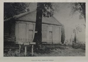
Pleasant Hill Methodist Church, 1953

This is a copy of a record book of the Pleasant Hill Methodist Church in Washington Township, Guernsey County, Ohio. The front portion of this manuscript contains the history of Pleasant Hill Methodist Church, which we provide here, and biographies of their pastors up to 1953. Starting on page 18 you will find the Membership Record for the church beginning in 1829 and through January of 1894.

History of Adair County Iowa and its People – vol 2

History of Adair County, Iowa, and its people vol 2 title page

Back in 1915, Lucian Moody Kilburn, was engaged to write a history of Adair County Iowa by the Pioneer Publishing Company of Chicago Illinois, he then being at that time a resident of the county for 50 years. The manuscript was divided into two volumes. This volume, numbered 2, provides biographical sketches of 348 leading men and women of the County of Adair including many of its founding families. You can read or download the free eBook from this website.

1914 Eastern Shawnee Census

The 1914 census record of the Eastern Shawnee Tribe from the Quapaw Agency was taken on June 30, 1914, in Indian Territory, which is now Oklahoma. The Eastern Shawnee Tribe primarily resides in northeastern Oklahoma, having separated from other Shawnee groups in the 19th century to establish their community in this region. Recognized as a federally recognized tribe, the Eastern Shawnee have their own government and tribal structure. The purpose of the 1914 census was to maintain an official record of the Eastern Shawnee Tribe members as part of the U.S. government’s broader efforts to document Native American populations. This census provides detailed information about individual tribe members, including their names, ages, sex, family relationships, allotment numbers, and roll numbers.

1910 Western Miami Census

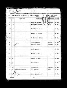
1910 Western Miami Census - Page 1

Pages of the 1910 Western Miami Census. Contains table showing the previous roll number, current roll number, Indian name if given, English name if given, Relationship, Age, and Sex. Also contains the original images of the census.

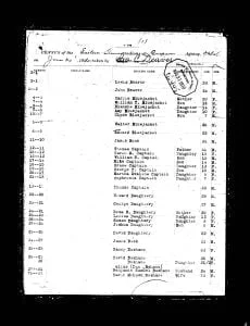
1910 Eastern Shawnee Census

1910 Eastern Shawnee Census – page 1

Pages of the 1910 Eastern Shawnee Census. Contains table showing the previous roll number, current roll number, Indian name if given, English name if given, Relationship, Age, and Sex. Also contains the original images of the census.

1910 Quapaw Census

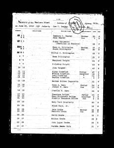
1910 Quapaw Census (1)

Pages of the 1910 Quapaw Census. Contains table showing the previous roll number, current roll number, Indian name if given, English name if given, Relationship, Age, and Sex. Also contains the original images of the census.

History of Jefferson County Oklahoma

History of Jefferson County, Oklahoma

In “History of Jefferson County, Oklahoma,” Jim M. Dyer provides a comprehensive account of the development and heritage of Jefferson County within the broader context of Oklahoma’s growth since its inception as a state in the Union. This work is particularly significant as it commemorates Oklahoma’s Semi-Centennial, marking fifty years of statehood filled with rich productivity and development. Dyer’s exploration is driven by a multifaceted purpose: to celebrate the state’s achievements, to preserve the memory of Jefferson County’s “birth and growth” for future generations, and to honor the pioneers whose resilience and dedication laid the foundations for the county’s prosperity.

1910 Peoria Census

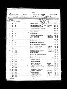
1910 Peoria Census - (1)

Pages of the 1910 Peoria Census. Contains table showing the previous roll number, current roll number, Indian name if given, English name if given, Relationship, Age, and Sex. Also contains the original images of the census.