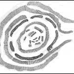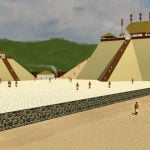
Inexplicably, Loubser did not mention a major field stone structure complex in Union County that can be seen from the acropolis of the Track Rock terraces in his Appraisal of a Piled Stone Feature Complex report.. This archaeological zone is known as Fort Mountain. It is not the same site as Fort Mountain State Park in Murray County, GA. It is located at the edge of the Nottely River Valley in the Choestoe Community. The two sites align on the azimuth of the Winter Solstice sunset. The plaza of the acropolis is also aligned to this azimuth. Draw a line from the stone altar on this plaza. Iit will pass through the center of Fort Mountain in Union County, then end up at the center of the Ladds Mountain stone enclosure in Cartersville, GA.
Aligned to Track Rock Gap on the azimuth of the sunrise of the Winter Solstice is the Aleck Mountain stone enclosure in the Nacoochee Valley. “Alek” is the Creek word for a medical doctor. This stone circle was not mentioned in the Loubser Report even though it has been studied by University of Georgia archaeologists. A report about this site was published.

Native American occupation of the Track Rock terraces was almost exactly the same as that at Etowah Mounds National Landmark in Cartersville, GA. Etowah is slightly older. Both sites contain fieldstone retaining walls. There was also a complex of circular stone walls and straight walls on Ladds Mountain, overlooking the Etowah town site. This important coincidence was missing from the archaeologist’s report.
Etowah Mounds National Landmark is considered the mother town of the Creek Indians. The official title of the Principal Chief of the Muscogee-Creek Nation is Etalwamikko – King of Etowah.
The final discussion of archaeological sites in the report focused on those 45 to 105 miles away in North Carolina. Much of the text was devoted to the, now destroyed, Garden Creek Mounds Site in Canton, NC. Canton, NC is 75 miles northeast of Blairsville, GA (Union County.) The Garden Creek site was primarily occupied during the Middle Woodland, Late Woodland and earliest portion of the Mississippian Period (roughly 600 AD through 1200 AD.) Archaeologists did not find any stone structures when it was excavated. They did not assign any ethnic identity to the town, but noted that the artifacts were very similar to those found in contemporary Muskogean town sites in eastern Tennessee and northern Georgia. However, in current Cherokee tourist literature, Garden Creek is described as the first Cherokee town, because it is on the eastern edge of territory occupied by the Cherokees in the mid-1700s.

In 1991, archaeologist Jack T. Wynn, of the U.S. Forest Service Office in Gainesville, GA, published a book on the Mississippian Culture archaeological sites in northern Georgia. It is now a field manual published by the University of Georgia’s Department of Anthropology. The book lists 74 Georgia archaeological sites, many with mounds, within 35 miles of Track Rock Gap that were contemporary with the occupation of the terraces. The artifacts found in these communities are universally considered ancestral to the Creek Indians. One contemporary town site with mounds in the Nottely River Valley is about a 30 minute walk from Track Rock Gap. It was occupied for many centuries before the Track Rock terraces. It produced artifacts typical of Etowah Mounds until the 1700s, when it was captured by the Cherokees.
The Loubser Report does not discuss any of the Georgia Mississippian Culture town sites mentioned by Jack Wynn, even those in Union and Towns Counties. The entire text of the report appeared to be trying to build a case for the Cherokees being the builders of the terraces of Track Rock Gap. However, in its conclusion it does not give a definitive statement which stated who built the terraces. The report, in essence, said that the archaeologists would have liked to name the Cherokees as the builders of the Track Rock Gap terraces, but no proof could be found.
