The Chontal Maya or Putun Maya

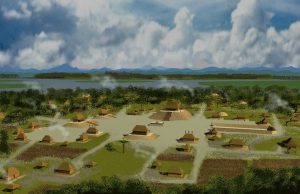
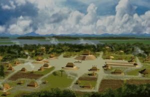
A vector image of Chontalpa Town

The Chontal Maya, also known as Putun Maya, originated in the coastal marshes of Tabasco, Mexico, and were skilled navigators and traders. They played a vital role in inter-regional trade across Mesoamerica, establishing ports and trade routes between the Yucatán Peninsula and other areas. As they absorbed various cultural influences, their hybrid language evolved. Despite previous neglect in archaeological literature, renewed interest has emerged regarding their connections to indigenous peoples in Florida and the broader implications of their trade and maritime activities from ancient times to the Spanish colonial period.
Maya Cultural Traditions at the Ortona Archaeological Zone

Ortona Sceptor Pond

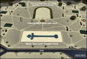
Archaeological investigations at the Ortona site reveal complexities in architectural similarities between the Southeastern United States and Mesoamerica, particularly in mound construction and ceremonial practices. Both regions feature oval mounds and structures influenced by earlier residential designs. The use of lime stucco, previously thought absent in the Southeast, is also noted. The presence of crescent-shaped mounds suggests potential connections to Chontal Maya traditions. Notably, Ortona differs from typical indigenous constructions in the U.S., highlighting a unique blend of cultural influences and ceremonial functions.

Opechancanough and Don Luis

Opechancanough

Jamestown, established in 1607, was on land of the Powhatan Confederacy, whose true center was Werowocomoco, not near Jamestown. Wahunsenacawh, or Powhatan, and his brother Opechancanough were significant leaders, with Opechancanough being well-educated and multilingual due to his time in Spain. Opechancanough, identified with “Don Luis,” returned disillusioned after witnessing Spanish oppression of Native peoples. His experiences fueled a deep resentment toward Europeans, influencing the dynamics of colonial confrontations in the early 1600s.

Mexican Native Americans

By around 900 AD, three prominent cultural centers—the Toltec capital of Tula, a trade city in Georgia, and a canal-based settlement in Florida—had emerged, yet all declined by 1150 AD. The Itza Maya, ruling from Chichen Itza during their Golden Era, may have been of non-Maya descent, evidenced by their distinct language. Concurrently, the Kusa tribe in the Southeastern U.S. grew powerful, echoing the Mexica’s expansion in central Mexico. Both societies exhibited advanced agriculture, reinforcing their dominance until the arrival of Europeans disrupted their trajectories.

Toltecs

Tula, founded around 900 AD, served as the Toltec capital and is located north of Mexico City. Its architecture, reminiscent of Cahokia, differs from neighboring civilizations like the Totonac and Huastec. The Toltecs’ cultural influence extended into Maya regions, where legends speak of their leader, Topiltzin, who promoted a monotheistic worship of Quetzalcoatl before a coup returned the city to martial beliefs. The rich tapestry of Mesoamerican legends intertwines with the histories of the Creek and Cherokee, highlighting shared motifs and symbols.

Totonac Civilization

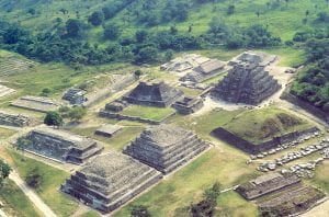
Aerial View of El Tajin

El Tajin, founded around 750 AD, emerged as the largest city of the Totonac civilization in northern Veracruz after the decline of Teotihuacan. The Totonacs, claiming descent from Teotihuacan’s elite, developed distinct architectural styles and advanced building techniques, including pozzolanic concrete. Their cities, such as Cempoala, exhibited asymmetrical layouts unlike Teotihuacan’s rigid designs. The Totonacs engaged in maritime trade with Chontal Maya, which influenced their language and culture, while establishing a trading network that spread northward along the Gulf Coast.

Late Classic Maya Heartland

After a hiatus in the mid-Sixth century, the population of the Maya cities surged, reaching potentially 22 million by 800 AD, significantly higher than previous estimates. This population growth coincided with increased affluence, leading to a reliance on slavery for manual labor, with estimates suggesting that up to 40% of the population were enslaved. While many southern Maya cities collapsed during the 800s, others, like Chichen Itza, persisted until Spanish contact, and new groups like the Putun Maya emerged, replacing the old aristocracy and continuing regional trade.

Tabasco and Chiapas

Chontalpa

The Chontal Mayas of Tabasco emerged from coastal marshes, evolving into significant trade leaders in Mesoamerica. Their landscape resembled southeastern Georgia, marked by humid terrain and tidal marshes. Initially illiterate, the Marsh People thrived through agriculture and fishing, constructing mounds similar to those in southeastern U.S. cultures. As trade flourished, particularly with the rise of Teotihuacan, they developed advanced navigational skills and trading jargon. Following a devastating volcanic eruption in 800 AD, the Chiapas Highlands saw a decline in population, impacting agricultural networks vital to the Maya civilization.

Apocalypto

The author reflects on their limited understanding of Creek Indian heritage and the early struggles of anthropologists to comprehend the complexities of Maya civilization. Their personal encounters with Dr. Piña-Chan enhanced their insights into the cultural significance of artifacts, such as potsherds, and the mystery of Maya urbanization. A scene from the film *Apocalypto* triggers memories of their experiences and the connections between ancient cultures, underscoring the continuity of indigenous craftsmanship and the shared history of the region.

Mayan and Creek Similarities

The author recounts a summer fellowship at Georgia Tech focused on Mesoamerican architecture and town planning, involving visits to archaeological sites in Mexico and Central America. Despite initial language barriers and condescension from some hosts, including renowned archaeologists Dr. Ignacio Bernal and Dr. Roman Piña-Chan, he engaged in meaningful discussions about the similarities in architecture and culture between Mesoamerican and Southeastern indigenous peoples. His experiences broadened his understanding of indigenous civilizations, emphasizing the connections between the Mayans and the Creek.

Discerning Facts and Myths About Track Rock Gap

The Nacoochee Valley hosts a mound and town above ancient stone box graves, with Cherokee legends attributing these stone structures to burials of warriors. However, no known Cherokee burial sites exist in the region. Claims of the Cherokees conquering Georgia are historically inaccurate, as they suffered defeats in the Creek-Cherokee War. Legends, including those relayed by the Swimmer to ethnologist James Mooney, are criticized as embellishments. Additionally, European maps reveal that the territory was predominantly occupied by the Apalachee and Creek Indians, challenging the narrative of Cherokee dominance.

Interpretation of the Track Rock Gap Petroglyphs

The Track Rock petroglyphs, recently preserved by the USFS, feature ancient carvings that have deteriorated due to environmental exposure. Renderings created in 2000 by Stratum Unlimited, LLC document these boulders and their intricate designs. Interpretations suggest multiple ethnic groups contributed to the petroglyphs over time, with some images linked to the Creek Indians and Itza Maya glyphs. The predominant themes in these carvings reflect significant cultural symbols rather than mere graffiti, as argued against prior interpretations attributing them solely to Cherokee hunters.

Track Rock Gap Archaeological Survey

In 2000, the U.S. Forest Service commissioned South African archaeologist Johannes Loubser to survey the Track Rock Petroglyphs, aided by local groups and the Eastern Band of Cherokee Indians. The survey involved two test pits and comprehensive soil analysis, revealing no evidence of Spanish colonial structures. Loubser’s published findings sparked further investigation, leading to a more accurate site plan created by a local historian, which uncovered additional features not included in Loubser’s report. The survey highlighted the complexity of the Track Rock Gap archaeological zone.

The Track Rock Terrace Complex

Recent communication with a local historian revealed significant archaeological findings near Track Rock Gap. The area features stone walls and piles, with recent studies indicating a complex dating back over a thousand years. Analysis by archaeologist Johannes Loubser suggests the presence of a terrace complex, with pottery evidence suggesting origins as early as 750 AD. This challenges previous assumptions regarding the site’s history, particularly the notion of it being a Sephardic mining village established in the 1600s. The impact of acid rain has diminished the visibility of nearby petroglyphs.

Pre Darmos Casada

The author’s initial interest in an archaeological zone in Union County, Georgia, arose from discovering features they believed were linked to gold mining. This investigation led to findings of old fieldstone foundations, which they hoped could be remnants of 17th-century Spanish Sephardic colonists. A significant discovery was an inscription on a boulder, later identified as a memorial to a Sephardic marriage in 1615. The author posits that the ruins signify an early Jewish village, supported by additional inscriptions suggesting a Jewish presence in the area.

The Trail to Yupaha

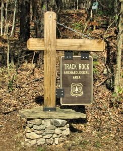
Track Rock Archaeological Site

On June 21, 2011, the author celebrated the Summer Solstice with a hike in the Georgia Mountains, near the Nantahala River, alongside three dogs. He revisited the Track Rock petroglyphs, noticing their deterioration since his last visit. His exploration revealed ancient fieldstone walls and historical alterations to the landscape, prompting inquiries into the area’s archaeological significance. This led to a deeper investigation into the cultural history of Georgia’s Indigenous Peoples, particularly regarding the enigmatic Track Rock Terrace Complex and its connection to Cherokee and Creek legends.