Sevier County 1830 Tennessee Census

1830 Sevier County Census transcription

Published in Knoxville, Tennessee in 1956 and distributed by the Genealogical Publishing Company of Baltimore, Maryland, Sevier County, Tennessee: Population Schedule of the United States Census of 1830 (Fifth Census) provides a transcription of the often difficult to read, 1830 Sevier County Tennessee census. Authored by Blanche C. McMahon and Pollyanna Creekmore, this meticulous reproduction of the original census record sheds light on the people of Sevier County in 1830.

Alleged 1818 Chickasaw Roll – Surname Index

This is an English surname transcription of the alleged 1818 Chickasaw roll said to have been lost in the beginning of the 19th century. I expect, if this is a true roll, that it is the result of the Treaty of October 19, 1818 between the Chickasaw Nation and the United States. I have some doubts, however, as the treaty stipulates payments and land to the tribe, not to individual tribal members as later treaties would. It would be at the discretion of the tribe on how to settle the reservation and distribute the payments.

Winnebago and Boone Counties Genealogy Society

1875 winnebago and boone

The Winnebago and Boone Counties Genealogical Society has placed online at the Cherry Valley Public Library District website, numerous genealogical indices which cover the counties of Boone, Cook, McHenry, and Winnebago. These free genealogy records are PDF’s downloadable to your computer.

Alabama Mortality Census Records

1850 Madison County Alabama Mortality Schedule optimized

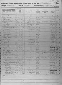
The 1850, 1860, 1870, 1880, and 1885 censuses included inquiries about persons who had died in the twelve months immediately preceding the enumeration. The 1850, 1960, 1870, and 1880 mortality census for Alabama all survived. Mortality schedules list deaths from 1 June through 31 May of 1849–50, 1859–60, 1869–70, 1879–80, and 1884–85. They provide nationwide, state-by-state death registers that predate the recording of vital statistics in most states. While deaths are under-reported, the mortality schedules remain an invaluable source of information.

Indians in Mason County Michigan 1850 Census

The following 75 people were identified as Indians (I) in column 6 (color) of the 1850 census for Mason County Michigan. One will note, that this does not follow the federal instructions for the census, as it was not intended that Native Americans be included in this census, but the enumerator did it anyway, and identified them with an I. Some census takers, enumerated their Native American residents with an M or B.

Indians in Mason County Michigan 1880 Census

Mason County 1880 Census Reel 0594, page 475

These 355 people were identified as Indians (I) in column 4 (color) of the 1880 census for Mason County Michigan. In order to have been enumerated they are believed to either have renounced tribal rule, and under state law, exercised their rights as citizens; or because they “mingled” with the white population of these Michigan towns were enumerated under the expanded definitions.

Indians in Mason County Michigan 1870 Census

Mason County 1870 Census Reel 0689 page 492

These 229 people were identified as Indians (I) in column 6 (color) of the 1870 census for Mason County Michigan. In order to have been enumerated they are believed to have renounced tribal rule, and under state law, exercised their rights as citizens.

Indians in Mason County Michigan 1860 Census

Mason County 1860 Census Reel 554 page 81

These 409 people were identified as Indians (I) in column 6 (color) of the 1860 census for Mason County Michigan. In order to have been enumerated they are believed to have renounced tribal rule, and under state law, exercised their rights as citizens.

Lowell Massachusetts Genealogy

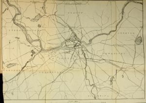
1894 Map of Lowell

Tracing ancestors in Lowell, Massachusetts online and for free has been greatly enhanced by the University of Massachusetts in Lowell which provided digitized version of a large quantity of the Lowell public records. Combined with the cemetery and census records available freely online, you should be able to easily trace your ancestors from the founding of Lowell in 1826 through 1940, the last year of available census records. To add color to the otherwise basic facts of your ancestors existence we provide free access to a wide range of manuscripts on the history of Lowell, it’s manufactures and residents.

1860 Census West of Arkansas – Creek Nation

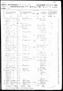
1860 Free Inhabitants Creek Nation Page 1

Free Inhabitants in “The Creek Nation” in the County “West of the” State of “Akansas” enumerated on the “16th” day of “August” 1860. While the census lists “free inhabitants” it is obvious that the list contains names of Native Americans, both of the Creek and Seminole tribes, and probably others. The “free inhabitants” is likely indicative that the family had given up their rights as Indians in treaties previous to 1860, drifted away from the tribe, or were never fully integrated. The black (B) and mulatto (M) status may indicate only the fact of the color of their skin, or whether one had a white ancestors, they may still be Native American.

Cayuga County New York Census Records

1910 New York Census Map

Cayuga County New York Census Records – Search and view the US Federal Census Images from 1790-1940 for Cayuga County, New York for free. Also provided are lists of any state census available online for Cayuga County NY.

1860 Cayuga County New York Census

1860 Cayuga County New York Census Image - Page 1

The following are part of GenWeb’s Census Project website and provide a complete index and transcription for the 1860 Cayuga County New York Census. Since there is no intro page created by the project which reflects this specific census we have created this page so that our users understand the files they need to view, and how to view them. This 1860 census was transcribed and proofread in 2002 and 2003 by Linda Talbott and L. Medlin. (See transcriber’s notes) It took about a year for them to transcribe and index the approximately 42,000 people enumerated within Cayuga County, New York in 1860.

Seneca County New York Census Records

1910 New York Census Map

Seneca County New York Census Records – Search and view the US Federal Census Images from 1790-1940 for Seneca County, New York for free. Also provided are lists of any state census available online for Seneca County NY.

1894 Michigan State Census – Eaton County

United States Soldiers of the Civil War Residing in Michigan, June 1, 1894 [ Names within brackets are reported in letters. ] Eaton County Bellevue Township. – Elias Stewart, Frank F. Hughes, Edwin J. Wood, Samuel Van Orman, John D. Conklin, Martin V. Moon. Mitchell Drollett, Levi Evans, William Fisher, William E. Pixley, William Henry Luscomb, George Carroll, Collins S. Lewis, David Crowell, Aaron Skeggs, Thomas Bailey, Andrew Day, L. G. Showerman, Hulbert Parmer, Fletcher Campbell, Lorenzo D. Fall, William Farlin, Francis Beecraft, William Caton, Servitus Tucker, William Shipp, Theodore Davis. Village of Bellevue. – William H. Latta, Thomas B. … Read more

Parsons and Abbott Roll

Alabama Land Cession Map

The Parsons and Abbott Roll, created in 1833, is a crucial document for genealogical research on the Creek Tribe. Following the 1832 treaty where the Creek Tribe ceded their land east of the Mississippi River to the United States, Benjamin S. Parsons and Thomas J. Abbott conducted a detailed census of Creek Indian heads of families. This census, organized by town and including the number of males, females, and slaves in each family, serves as the most comprehensive pre-removal record. It is a vital resource for identifying Creek ancestors and is foundational for numerous subsequent documents related to Creek claims through the 1960s. The roll also includes entries for some free blacks who gained freedom and citizenship within the Creek Tribe, making it an essential reference for diverse genealogical inquiries.

1832 Creek Census – Wewoakkar Town

By a treaty of March 24, 1832, the Creek Indians ceded to the United States all of their land east of the Mississippi River. Heads of families were entitled to tracts of land, which, if possible, were to include their improvements. In 1833 Benjamin S. Parsons and Thomas J. Abbott prepared a census of Creek Indian heads of families, which gave their names and the number of males, females, and slaves in each family. The entries were arranged by town and numbered; these numbers were used for identification in later records. This is the census for the town of Wewoakkar.

1832 Creek Census – Weogufka Town

By a treaty of March 24, 1832, the Creek Indians ceded to the United States all of their land east of the Mississippi River. Heads of families were entitled to tracts of land, which, if possible, were to include their improvements. In 1833 Benjamin S. Parsons and Thomas J. Abbott prepared a census of Creek Indian heads of families, which gave their names and the number of males, females, and slaves in each family. The entries were arranged by town and numbered; these numbers were used for identification in later records. This is the census for the town of Weogufka.

1832 Creek Census – Ufaula Town

By a treaty of March 24, 1832, the Creek Indians ceded to the United States all of their land east of the Mississippi River. Heads of families were entitled to tracts of land, which, if possible, were to include their improvements. In 1833 Benjamin S. Parsons and Thomas J. Abbott prepared a census of Creek Indian heads of families, which gave their names and the number of males, females, and slaves in each family. The entries were arranged by town and numbered; these numbers were used for identification in later records. This is the census for the town of Ufaula.

1832 Creek Census – Tuskeega Town

By a treaty of March 24, 1832, the Creek Indians ceded to the United States all of their land east of the Mississippi River. Heads of families were entitled to tracts of land, which, if possible, were to include their improvements. In 1833 Benjamin S. Parsons and Thomas J. Abbott prepared a census of Creek Indian heads of families, which gave their names and the number of males, females, and slaves in each family. The entries were arranged by town and numbered; these numbers were used for identification in later records. This is the census for the town of Tuskeega.