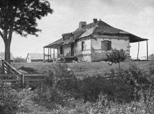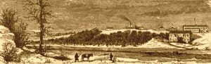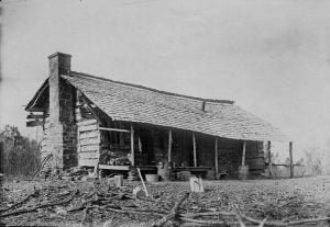
Governor Stokes’s Uncompleted Plans

In March 1836, Governor Stokes became the sub-agent for the Cherokee, Seneca, and Shawnee tribes at Fort Gibson, receiving a modest salary of $750 annually. He faced numerous challenges, including a cramped office space and subordination to a disbursing officer, complicating his relations with the tribes. Stokes advocated for the rights of the Half-Breed reserves of the Osage Nation but struggled to secure assistance for them. Despite his dedication, his term ended without reappointment, and he passed away in November 1842, leaving a significant legacy.
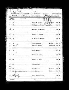
1910 Quapaw Census

1910 Quapaw Census (1)

Pages of the 1910 Quapaw Census. Contains table showing the previous roll number, current roll number, Indian name if given, English name if given, Relationship, Age, and Sex. Also contains the original images of the census.

Treaty of 10 December 1850 – Texas Indians

In a historic meeting on December 10, 1850, near the headwaters of Wallace Creek, Special Agent John H. Rollins forged a pivotal peace treaty with the chiefs of numerous Texas Indian tribes. This landmark agreement, aimed at establishing peace and defining relations between the U.S. government and these tribes, covers a wide array of commitments from acknowledging U.S. jurisdiction to regulating trade, ensuring mutual peace, and setting forth guidelines for the return of prisoners and stolen property. With the original treaty held in Washington and a copy in the Texas State Library, this document remains a crucial piece of history in understanding the complex relationships and negotiations between Native American tribes and the expanding United States.

Western Garrison Life

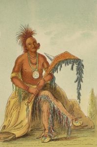
Clermont, Osage Chief

Holland Coffee, a trader at Fort Smith, led a trading expedition into western Indian territories alongside Robert M. French. They set up a trading post near the Red River, at the old Pawnee village, aiming to capitalize on friendly relations established by Colonel Dodge with western tribes. Despite challenges, including unrest among the tribes regarding treaty assurances, a significant conference was held at Fort Gibson in 1835, resulting in the first treaty with western prairie tribes, crucial for U.S. plans to relocate eastern Indians.

Earliest Known Traders on Arkansas River

Country Home of Augustus Pierre Chauteau

Before the Louisiana Purchase, early French traders, notably Joseph Bogy, ventured along the Arkansas River, engaging in commerce with local Indian tribes, such as the Osage. Bogy’s expeditions included confronting Choctaw opposition in 1807, leading to government claims for losses. Prominent figures included Nathaniel Pryor and A. P. Chouteau, who established trading posts at the mouth of the Verdigris. These traders influenced the region’s economy, exchanging goods like furs and providing items such as tobacco and tools to Native Americans, fostering significant cultural exchanges.

Establishment of Fort Gibson in 1824

Fort Gibson in 1875

The Arkansas Territory was established by Congress in 1819, encompassing parts of present-day Arkansas and Oklahoma, with governance limited to the eastern section. James Miller became its first governor in 1819, tasked with overseeing relations with Native tribes. Efforts to broker peace between the Osage and Cherokee tribes were largely unsuccessful, leading to military reinforcements at Fort Smith. In 1824, troops were moved to a new post, Cantonment Gibson, established to enhance security and regulate tensions, which would eventually evolve into Fort Gibson, founded in 1824.

Establishment of Fort Smith in 1817

Quapaw Cession Map

In 1817, a military post was established at Belle Point, now Fort Smith, Arkansas, to protect white settlers and the Cherokee from Osage hostilities. Major William Bradford led the detachment tasked with this, supported by Major Stephen H. Long, who surveyed the area. The post was strategically located at the junction of the Poteau and Arkansas rivers, facilitating navigation and trade. Subsequent treaties with the Osage and other tribes led to significant land cessions, shaping early relations and territorial boundaries in the region.

Treaty of November 15, 1824

On November 15, 1824, the United States and the Quapaw Nation formalized a treaty in which the Quapaw ceded their lands in Arkansas to the U.S. In exchange, the U.S. offered financial compensation and assistance for the tribe’s relocation to the Caddo territory, along with guaranteed hunting rights. The treaty also ensured specific land grants to certain individuals of Indian descent. The agreement emphasized the U.S. commitment to uphold the rights and needs of the Quapaw during their transition.

Treaty of August 24, 1818

On August 24, 1818, the United States, represented by William Clark and Auguste Chouteau, entered into a treaty with the Quapaw tribe. The treaty acknowledged the Quapaw’s protection under the U.S. and involved the cession of significant land while reserving certain territories for their use. It stipulated that the Quapaw could hunt on ceded lands peacefully and that the U.S. would provide goods worth $4,000 initially and $1,000 annually. The agreement aimed to preserve amicable relations and outlined procedures for handling disputes between individuals from both parties.

Illinois Burial Customs

The term “Illinois Indians” encompassed various Algonquian tribes, including the Illinois Confederacy. Early accounts describe their burial customs, highlighting a respect for the dead through careful burial practices. Joutel detailed how they utilized lofty coffins, sometimes hanging bodies in trees. Celebratory dances accompanied burials, marking a contrast with other tribes’ mourning rituals. Presents were offered, and food for the deceased’s journey was included in graves. These customs reveal the diverse ways Illinois Indians honored and remembered their dead across generations.

Treaty of May 13, 1833

On May 13, 1833, a treaty was signed between the United States, represented by Commissioner John F. Schermerhorn, and the Quapaw Indians, addressing their dire situation after previous land cessions. The Quapaw, having suffered from flooding and illness in their assigned lands, agreed to relinquish those rights in exchange for new land in Missouri. The treaty stipulated financial assistance, agricultural tools, livestock, and educational support to facilitate their transition and promote their welfare, while acknowledging previous agreements made in 1824.

Treaty of August 24, 1835

The Treaty of August 24, 1835, established peace and friendship between the United States and the Comanche and Witchetaw nations, alongside other tribal nations like the Cherokee and Osage. Key provisions included mutual forgiveness for past grievances, free passage for U.S. citizens through tribal lands, and permission for tribes to hunt in designated areas. The treaty aimed to foster cooperation, ensuring that any disputes would be resolved amicably. Signatories were promised gifts, reinforcing the commitment to maintaining peaceful relations for future generations.

Quapaw Reservation in 1890

In 1890, the Quapaw Reservation, spanning 56,685 acres in the northeast corner of the agency, is home to 154 members who primarily engage in farming and stock raising, although progress is stifled by the influence of older generations. The tribe maintains traditional practices and cultural elements, such as the stomp dance and hereditary leadership, while exhibiting less assimilation than other tribes. A boarding school offers education, with a focus on practical skills, and the community experiences minimal crime, supported by a local police force.

Fort Coffee Quapaws

A Building in or about Fort Coffee

In September, Villiers, a Quapaw man, and his wife sought admission to the Fort Coffee school after being robbed en route, leaving them destitute. Villiers, a Christian aspiring to the ministry, had lost recommendation letters and all their possessions. Despite their plight and willingness to serve for education, school policies prevented their enrollment. After a brief stay, they received provisions and support before returning to their tribe. Observers noted Villiers’ integrity and the admirable qualities of the Quapaw people.

Treaty of February 23, 1867

On February 23, 1867, the United States entered a treaty with various Indigenous tribes, including the Senecas, Shawnees, Quapaws, and others, to facilitate land cessions and relocations. The agreement outlined financial compensation for ceded lands, provisions for rebuilding homes and farms, and terms for dissolving tribal affiliations in favor of U.S. citizenship. It addressed compensation for wartime losses and education funding, and established frameworks for integration or removal of tribes to new reservations. The treaty aimed to reshape tribal governance and land ownership in light of ongoing westward expansion.

Quapaw Indians

The Quapaw Tribe, meaning “downstream people,” is historically linked to various names from neighboring tribes and early explorers. Initially residing near the Ohio River, they moved to the Arkansas River region by the late 17th century, where they became allies of the French. Over time, population decline due to disease and subsequent treaties led to their displacement across states, resulting in their eventual resettlement in Oklahoma. The tribe’s historical significance is reflected in their name’s influence on the Arkansas River and the state of Arkansas.

Agreement of September 13, 1865

On September 13, 1865, representatives of various Indian tribes, including the Cherokees, Creeks, and Seminoles, entered into an agreement with U.S. commissioners, affirming their allegiance to the United States after previously aligning with the Confederate States. This agreement emphasized the tribes’ recognition of U.S. jurisdiction and the cancellation of any prior treaties made with Confederate forces. The U.S. promised to restore peace and protect the tribes, marking the beginning of efforts to re-establish relations and resolve past treaty disputes.

Villages of the Quapaw Tribe

The article discusses the history and settlement patterns of the Quapaw Tribe, a Siouan group that migrated from the Ohio Valley to the Arkansas River’s mouth. Early French explorers noted their four main villages and distinctive lifestyle, including bark-covered cabins and pottery craftsmanship. The tribe faced gradual decline, with archaeological evidence indicating their presence in the Mississippi Valley. By the 19th century, remnants of the Quapaw had moved westward, with their traditions and customs persisting despite their shrinking population.

Native American Town of Imaha

Imaha was a Quapaw village noted by early French explorers La Metairie in 1682 and Iberville in 1699, located along a southwestern branch of the Arkansas River. Throughout the 18th and 19th centuries, some Quapaw fled to the Caddo for refuge, forming the Imaha division within their confederacy while retaining their Siouan language. This division may have connections to the original village, although their exact origins remain uncertain. The name “Imaha” has persisted, even as cultural ties have diminished over time.

Quapaw Tribe

Quapaw Cession Map

The Quapaw Indians, a southwestern Siouan tribe, are part of the Dhegiha group and historically resided near the Arkansas River’s mouth. Their recorded history begins with De Soto’s expedition in the 1540s. They were known for their fortified villages and mound-building culture. Early French explorers documented their villages and customs, noting a significant decline in population due to conflicts and disease. The Quapaw maintained some traditional practices and had various social divisions, with their history showing a complex migration pattern from the Ohio Valley to their current territory.