History of Old Seagrove School District
Mt Olivet Academy

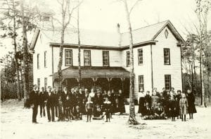
A look at the history and people of the Seagrove area of Randolph County, North Carolina. Using the school district as its focus, it covers the history up to 1976 of several communities: Seagrove, Erect, Pisgah, Ulah, and Why Not. Yes there is an unincorporated area of NC called Whynot. Book is free to read or download.

History of Littleton New Hampshire

1895 Map of Littleton New Hampshire

The History of Littleton New Hampshire is comprised of three volumes, two volumes of history, and a final volume of genealogies. Considered one of the best examples of local history written in the early 20th century, is your ancestors resided in Littleton then you need these books. Read and download for free!

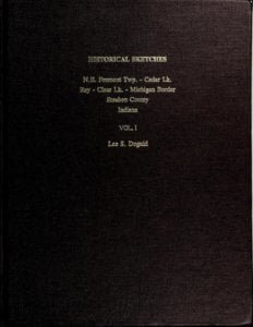
Historical sketches of Fremont, Cedar Lake, Ray, Clear Lake, Indiana

Historical sketches of N.E. Fremont Twp., Cedar Lk., Ray, Clear Lk., Michigan border, Steuben County, Indiana

Historical sketches of N.E. Fremont Twp., Cedar Lk., Ray, Clear Lk., Michigan border, Steuben County, Indiana. Included with these books is a separate manuscript called “William Duguid Descendants and History in America.” This manuscript starts at image 653 of 886 in volume 1. Volume 2 contains the Cedar Lake Congregation Session Records 1841-1892 and Deeds, Documents and Letters concerning the William Duguid descendants. Both volumes contain historical articles and remembrances concerning the area in Steuben County Indiana.

How the Government Surveys Land

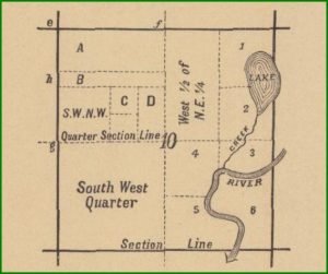
Example of a Quarter Section in a Plat Map

The rectangular surveying system in the United States, established by Congress on May 20, 1785, organized land into six-mile-square townships and thirty-six sections, initially applied in Ohio’s Old Seven Ranges. Subsequent acts in 1796, 1805, and 1812 formalized the roles of surveyors and the General Land Office, overseeing public land surveys. The system, marked by cardinal direction lines, designated land as townships, sections, and quarter sections, and established legal corners through specific methodologies for surveying, marking, and re-establishing boundaries.

Ancient Southeastern Maps

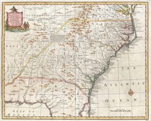
1747 Bowen Map of the Southeast

The America Septentrio map of 1640 reflects early European perceptions of the Appalachian region, emphasizing the gold-bearing nature of the mountains while lacking accurate native representation. Subsequent maps, including those by Johann Lederer (1669) and Jean-Baptiste Louis Franquelin (1684), continued this trend, often omitting significant tribes like the Cherokee and Creek. By 1725, John Herbert’s map marked the first official mention of Cherokee towns and the establishment of a Cherokee identity. Overall, maps served as both geographic and political tools, shaping European narratives of indigenous territories.

Map Making, from Majorca to Appalachia

Following the discovery of the New World, European cartographers, particularly from Majorca, initially produced maps filled with inaccuracies. Majorcan Sephardic Jews were pivotal in advancing cartography and navigational instruments during the Age of Discovery. However, they faced persecution after the Reconquista and subsequent political changes, leading many to migrate to Portugal and later the Netherlands. There, they contributed to significant improvements in navigation and shipbuilding, eventually influencing exploration and colonization efforts in the New World, including Southeastern North America.

Section Map of Captain John Mullan

Capt John Mullan Map 3

This section of maps, created under the direction of Captain John Mullan between 1858 and 1862, showcases the geographical data he meticulously collected during his explorations. The maps are organized systematically, providing a comprehensive visual representation of the terrain as understood by Mullan at the time. Such cartographic efforts significantly contributed to early American surveying and navigation in the region.

Northern Alabama Land Cessions Map

Northern Alabama Land Cessions Map

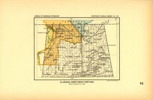
The Northern Alabama Land Cessions map, created in 1896 by A. Hoen Company for the Bureau of American Ethnology, illustrates land cessions by various Native American tribes prior to that year. It documents four specific cessions: treaties with the Cherokees and Chickasaws notably from 1806, 1816, and 1832. These treaties outline the relinquishment of territory and the tribes’ decisions to sell their lands due to oppressive conditions, marking significant historical transactions between Native tribes and the United States government.

Alabama Land Cessions Map

Alabama Land Cessions Map

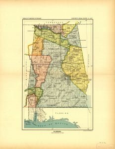
The Alabama Land Cessions map, created by A. Hoen Company in 1896, documents 16 specific land cessions made through treaties and agreements between the United States and various Native American tribes prior to that year. It serves as a reference for Charles C. Royce’s compilation of Indian land cessions across the U.S., providing insights into historical land negotiations involving the Choctaws, Cherokees, and Chickasaws. Each cession is linked to treaties, detailing boundaries and land relinquishments throughout Alabama.

The Indian Tribes of North America

Linguisitic Families of American Indians - Powell

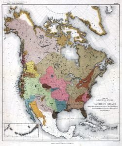
Swanton’s “The Indian Tribes of North America,” published in 1953, is a seminal work in Native American ethnology. It categorizes tribes by state and provides insights into their histories, names, locations, populations, and cultural ties. The resource includes a linguistic mapping of tribes across the United States, showcasing the diversity and complexity of Indigenous peoples. AccessGenealogy offers an online platform for exploring these tribes, making valuable historical and ethnological information accessible to a wider audience.