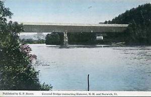
History of the Bridges Between Hanover NH and Norwich VT
The earliest form of transportation across the Connecticut River between Norwich and Hanover of which we have any information was the canoe of Nathan Messenger, who sometime in the summer of the year 1765 established a hunting camp near the bank of the river, a few rods south of where the west end of Hanover bridge now is. In this canoe the family and household goods of John Hutchinson were brought over from the Hanover side in the late fall of the same year, at the completion of their long journey from Ashford, Conn., to their new home. This family … Read more

