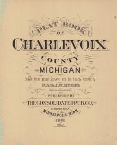
The 1901 Charlevoix County MI Plat Book, a beautiful historical piece, full of interesting tidbits of information about properties, is now available digitally. Digitization was made possible through a generous donation by the Friends of the Charlevoix Public Library. The scanning work was completed locally, by Village Graphics.
The rectangular system of surveying Government lands, termed the Land System of the United States, was adopted by an act of Congress passed May 20, 1785. The ordinance provided for townships six miles square, containing thirty-six sections of one mile square. The region embraced by the surveys under this law forms a part of the present State of Ohio, and is usually styled “Old Seven Ranges.” The town-ships, six miles square, were laid out in ranges, extending northward from the Ohio River, the townships being numbered from south to north, and the ranges from east to west. In these initial surveys only the exterior lines of the townships were surveyed and mile corners were established on the township lines, but the plats were marked by subdivisions into sections of one mile square. The sections were numbered from one to thirty-six, commencing with number one in the southmost corner of the township, and running from south to north in each tier to number thirty-six in the northwest corner of the township. These first public surveys were made under the direction of the Geographer of the United States. 1
Note: The maps from the plat book are labeled and listed below. Each item is a link that will connect you to a scanned image of the map located within the Charlevoix Public Library Flickr account. After opening the desired map you can select a larger or smaller image of the map and also have the option to download the image to your computer.
1901 Charlevoix County MI Plat Book

- 1901 Michigan State Map
- Charlevoix County Map
- Plat Maps
- Bay Shore Plat Map
- Bay Twp Plat Map
- Big Beaver Island Plat Map
- Boyne City Plat Map
- Boyne Falls Plat Map
- Boyne Valley Twp Plat Map
- Chandler Twp Plat Map
- Charlevoix Plat Map
- Charlevoix Twp Plat Map
- Clarion – Melrose Twp Plat Map
- Eveline and Evangeline Twp Plat Map
- Garden Island Twp Plat Map
- Hayes Twp Plat Map
- Hudson Twp Plat Map
- Ironton Twp Plat Map
- Little Beaver Island and Hog Island Twp Plat Map
- Marion Twp Plat Map
- East Jordon and South Arm Plat Map
- Melrose Twp Plat Map
- Norwood Twp Plat Map
- South Arm Twp Plat Map
- Spring Harbor and Norwood Twp Plat Map
- Talcott Walloon Lake Area Plat Map
- Wilson Twp Plat Map
- Patron’s Directory
Citations:
- AccessGenealogy. How the Government Surveys Land. Online publication, 2014.[
]
