ross map e1309573930404

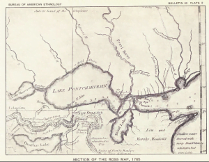
Section of Ross Map, 1765

Last Updated on September 28, 2016 by Dennis

Section of the Ross Map, 1765 which depicts the area settled by the Choctaw of Bayou Lacomb:

Lake Ponchatrain Section of the 1765 Ross Map

Topics:
Choctaw, Map,

Collection:
Bushnell, David I., Jr. The Choctaw of Bayou Lacomb, St Tammay Parish Louisiana. Washington Government Printing Office. 1909.
Leave a Comment

Your email address will not be published. Required fields are marked *

This site uses Akismet to reduce spam. Learn how your comment data is processed.

Discover more from Access Genealogy

Subscribe now to keep reading and get access to the full archive.

Continue reading

Scroll to Top