Cornplanter Reservation and Occupants, 1890

This reservation, in Warren County, Pennsylvania, nominally a tract of 640 acres, owned by Cornplanter‘s heirs, lies on both sides of the Allegheny River, and is about 2 miles long and half a mile wide, including Liberty and Donation Islands, which are formed by the forking of the river. The land surface, including the riverbed and some worthless shoals, contains about 760 acres. It was a donation to the celebrated chief Gy-ant-wa-hia, “The Cornplanter“, March 16, 1796, by the state of Pennsylvania, in consideration, states Judge Sherman, “for his many valuable services to the white people, and especially that most … Read more

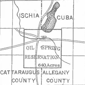
Oil Spring Reservation Map

Oil Spring Reservation Map, 1890

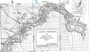
Oil Spring reservation, in Cattaraugus County, New York, as indicated on the Allegany reservation map, contains 640 acres in 2 towns and counties. It was by oversight included in the treaty made at Big Tree, in the sale by the Seneca Nation of 3,500,000 acres to Robert Morris, and passed with his title to the Holland Land Company. A suit for the recovery of this land was brought in 1856, and resulted in favor of the Seneca Nation. On the trial Governor Blacksnake, as he was named by Washington when he visited the capital in company with Cornplanter, testified, at … Read more

Allegany Reservation Map and Occupants, 1890

Allegany Reservation Map, 1890

Allegany Reservation, lying in Cattaraugus County, New York, has remarkable features in very respect, and of great social and political concern. Besides resting under the burden of the Ogden Land Company pre-emption right to purchase whenever the Seneca Nation shall agree to sell its lands, it is already occupied in part by white people, who, in large numbers, hold duly legalized leases, running until May, 1892, and subject by recent act of Congress to renewal upon the consent of the parties thereto for a term not exceeding 99 years. Upon location of the New York, Lake Erie and Western and … Read more

Historical Maps of the United States

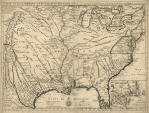
1718 De Lisle Map

Other then adding a splash of color to a web page, maps provide the researcher valuable clues to historic why’s. Here at AccessGenealogy we believe early maps play a valuable role in identifying the location and names of Indian villages and towns. While not always accurate as to the actual placement of villages (especially the early American ones), maps do shed light on the tribal affiliations, the identification of the tribe by various government entities (mainly French, Spanish and British), and approximate locations. Historical Maps of the United States 1640 Virginiae et Floridae Map 1718 de L’Isle Map 1755 Mitchell … Read more

Civil War Battlefield Maps

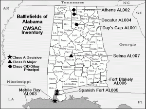
Alabama Civil War Battlefield Map

The following Civil War battlefield maps geographically depict the major battles of the War between the States. While most states, having limited major battles have only one map to show, some like Virginia have as many as five.

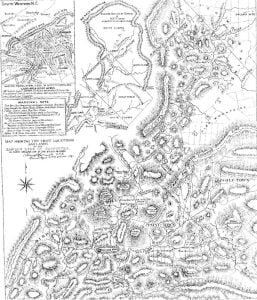
Map of Western North Carolina

Western North Carolina

Map showing the chief location and lands of the Eastern Band of Cherokee in Cherokee, Jackson, Graham and Swain Counties, North Carolina.

Qualla Reservation Map

The following map outlines the “Qualla Boundary” of which became the Qualla Reservation in North Carolina.

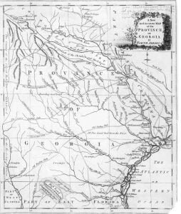
1779 Map of Georgia

1780 Georgia Map

The 1779 map of Georgia remains unattributed to a specific cartographer, but it has considerable similarities to a map published just one year later by Bew, called A new and accurate map of the chief parts of south Carolina and Georgia. Native American Research This map is important for Muskogee and Cherokee research as it details the locations of many Indian towns and Indian Trails. One can determine by looking at the Indian towns on the map that there was little known by this cartographer concerning the interior of Georgia from the Atlantic coast to the Flint River. While he … Read more

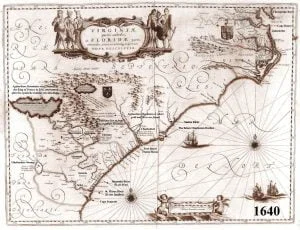
1640 Virginiae et Floridae Map

1640 Official French Royal Map – Virginiae et Floridae

The Kingdom of France continued to claim what is now Georgia and South Carolina even though there is no record of any French settlements in the region after 1568.  By issuing this map, the King of France also recognized the legitimacy of the Virginia Colony.  The coat of arms of Great Britain are placed upon that section of North America.  By this time, France had also established permanent settlements in Quebec and was claiming all of present day Canada, except for Newfoundland. This map is the first one to provide an accurate description of the South Atlantic Coast.  It includes … Read more

1718 de L’Isle Map

1718 De Lisle Map

In 1718 Guillaume de L’Isle published “Carte de la Louisiane” which was based on the 1703 maps “Carte de Mexique et de la Floride” and “Carte du Canada ou de la Nouvelle France,” credited to him, but actually done by his father, Claude. The 1703 maps were based on the explorations of Marquette, Joliet, La Salle, LeSueur, and others. These maps depicted the Missouri River extending as far as the country of the Omaha Indians, the “Rivière Longue” of Lahontan, the full course of the Mississippi River and, for the first time, an accurate representation of the mouth of the … Read more

Historical Maps of Southeast United States

1.  1550 – Dutch map of the Western Hemisphere This map shows the accurate description of the shape of the Florida Peninsula before the late 1600s.  Later maps described its shape as being triangular.  Even though the survivors of the de Soto Expedition returned to Mexico City in 1543, this map does not show any information about the interior.  Note that Japan (Zimpango) is shown off the coast of North America.     2. 1562 – French map of the Western Hemisphere This map contains many of the rivers along the coast of North America and the Gulf Coast, but … Read more

De Bry’s Map of 1561

De Brys Map of 1591

A map of extraordinary rarity and seminal importance, this is one of the earliest and most influential maps of the American southeast ever published. Drawn by the French artist Jacques Le Moyne de Morgues c. 1565 and published by Theodore de Bry in 1591, this magnificent map details the Florida peninsula and Carolina coast from Cuba to the Bahamas, to “Prom Terra flag” or, as it is known today, Cape Lookout near Beaufort, North Carolina. The fascinating story of this map begins with the ambitions of the influential Huguenot Admiral Gaspard de Coligny. De Coligny, desirous of a French foothold … Read more

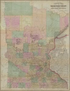
Sewall’s Map of Minnesota, 1857

Sewall's map of Minnesota

Sewall’s Map of Minnesota was entered according to Act of Congress in the year 1857, by J. S. Sewall. The map provides insight into the 19th century topographical history of Minnesota and Wisconsin, along with pinpointing the location of several Native American villages of the Chippewa and Sioux. The map was prepared for the purpose of land sales and the construction of the Lake Superior and Mississippi Railroad which was to be completed by June 1870. The map is extremely detailed for such an early creation, and includes natural and man-made creations such as waterways, roads, railroads, and reservations. A … Read more

Map of Omaha Indian Reservation, Nebraska

Showing portion thereof appraised for sale, and portion retained and allotted the Omaha Indians in severalty for the years 1905-1906. The map of the Omaha Indian Reservation in Thurston Nebraska was split into 9 pages in the original manuscript and is presented as they had it split. The numbers listed on the maps below are only a rough idea.  Find the name of the person you are searching for and then look on the map to find the location. All land is is Thurston County, Nebraska. Map 1 31 45 47 48 104 122 144-150  197 418 485 497 545 547 … Read more

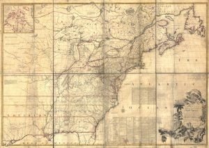
1755 Mitchell Map

1755 Mitchell Map

In 1755 John Mitchell produced a large map of what was known at that time of the Map of the British and French Dominions. Produced in 8 sheets, this map when laid out covered a space roughly equal to 6.5ft by 4.5 ft. John Mitchell created this map by researching and looking at previously published maps and manuscripts. While fraught with obvious bias towards English imperial claims to America, by minimizing the claims of the French and Spanish, this map has still reached notoriety in it’s authenticity and accuracy… The maps greatest reference was when it was used to set … Read more

Virginia Civil War Battlefield Maps

Virginia Civil War Battlefield Map – Maps depicting the battles fought within the state of Virginia during the Civil War. 1861 1862 1863 1864 1865