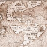
1. 1550 – Dutch map of the Western Hemisphere
This map shows the accurate description of the shape of the Florida Peninsula before the late 1600s. Later maps described its shape as being triangular. Even though the survivors of the de Soto Expedition returned to Mexico City in 1543, this map does not show any information about the interior. Note that Japan (Zimpango) is shown off the coast of North America.
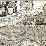
2. 1562 – French map of the Western Hemisphere
This map contains many of the rivers along the coast of North America and the Gulf Coast, but distorts Florida. It labels the Apalachen Mountains and portrays the Chattahoochee and Ashley River System fairly accurately. However, the Suwannee River is shown as originating in the mountains. The Suwannee begins only few miles south of the channel of the Altamaha River in southeastern Georgia. The Altamaha and Savannah Rivers are not shown. There is no information from the de Soto Expedition. This is the year that Charlesfort was settled.
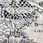
3. 1566 – Spanish map of North America
This is the earliest map to show the new settlement of Santa Elena. No mention is made of Charlesfort. However the location of Fort Caroline or Fort Matheo is located on the south side of the Setto River. The Altamaha River is labeled the Secco River. St. Augustine is also showed. This Spanish map is one of the strongest pieces of evidence that place Fort Caroline on the Altamaha and not on the St. Johns River.
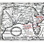
4. 1578 – Spanish map of North America
This map labels the Altamaha River as the May River. Both St. Augustine and Santa Elena are shown in their approximate locations. San Mateo is shown on the St. Johns River. Charlesfort is shown on the May River and Fort Caroline is shown at Port Royal, along with Santa Elena. The mapmaker got Charlesfort and Fort Caroline mixed up. Apparently, Fort San Mateo was relocated southward after the original fort on the May River was burned. On this map, the Spanish clearly considered the May and San Juan Rivers to be separate. The Native American village on the St. Marys River that is called Selloy by the French, is labeled St. Mateo on the Spanish maps. Interestingly, the 1578 map shows San Mateo to be larger and more important than San Augustine. Until Santa Elena was abandoned in the 1780s, San Augustine was a small garrison with no more than 100 men.
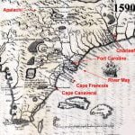
5. 1590 – Theodor de Bry Map of North America
This map credits Jacques Le Moyne as its source. Therefore, legions of references, such as Wikipedia, date it at 1565 or 1574, the year Le Moyne died. In fact, it was published no later than the end of 1589. The map contains information on North America that became available after the failed attempts to establish English colonies on Roanoke Island, North Carolina during the years 1585 – 1587.
De Bry’s placement of the outlet of the May River is very close to that of the Altamaha River. However, he shows the San Juan River as a tributary of the May, whose confluence is about 100 miles inland. De Bry’s map is the first to show detailed information about the interior of La Florida, including the names of Native provinces. Fort Caroline is placed on the south side of the May River, upstream from present day Darien, GA.
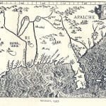
6. 1597 – Wytfliet Map of North America
This is one of the earliest maps to contain the names of some of the Native towns visited by Hernando de Soto between 1539 and 1543. Most of the geographical names are Spanish words. Evidently, the cartographers main sources were Spanish. It also mentions a province mentioned by René de Laudonniére, Aymay. The outlet of the Altamaha River is labeled the Capo de Santa Cruz. The lower Altamaha River is labeled the Secco River, while the Savannah River is labeled the Sola River. They are shown to be two outlets of the same river that flows from the Appalachian Mountains. The Santee-Catawba River System is labeled the Jordon River. Although the St. Helena River is labeled, this map does not mention either of the settlements at St. Augustine or Santa Elena.
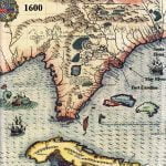
7. 1600 – map of North America (probably by de Bry)
This map appears to be a slight update of de Bry’s 1590 map, and may in fact, be by him. It is far more legible than the 1590 map, however. Fort Caroline is shown on the south side of the May River inland from present day Darien, GA. In a Latin inscription southwest of Fort Caroline, the map states that “Laudonniére named this place.” Beneath the Latin name for Cape François (Promitorium Gallicum) is a Latin inscription stating “Ribault found this place.” There is no mention of St. Augustine, but the Timucua village where it was located, Seloy, is labeled. The Apalachee Indians are show living in the mountains north of the headwaters of the May (Altamaha) River. In fact, one of the tributaries of the Altamaha River is the Apalachee River. The map shows the St. John River as a major tributary of the Altamaha that flows from a lake in central Florida. The map provides detailed information about the ethnic groups in southeastern Georgia and northeastern Florida.
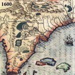
8. 1600 – detail view of map probably by de Bry
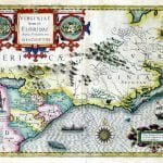
9. 1606 – Mercater – Hondius Map of Virginia and Florida
This map appears to be based on the de Bry map, but contains more accurate information for the coastline and of the Mid-Atlantic Region. St. Augustine is on the map. Charlesfort and Santa Elena are shown to be located on Parris Island, SC. The Altamaha River is labeled the May River, but the map does not mention either Fort Caroline or Fort San Mateo. This map continues to show the St. Johns River to be a southern tributary of the Altamaha River. The Native American provinces recorded by de Laudonniére are denoted by separate colors.
This is the earliest widely published map that contains the names of the Indian provinces around the unsuccessful Roanoke Island Colony at the northern end of the Outer Banks of North Carolina. It is also the first to contain a reasonably accurate portrayal of the Outer Banks.
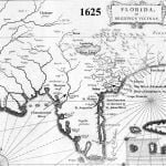
10. 1625 – French Map – Florida et Regiones Vincinae (Florida and Neighboring Regions)
This map contains many corrections to the de Bry map’s description of the Altamaha Basin. Here we see the Timucua village of Seloy located in what is now Camden County, GA near St. Marys, GA – not at St. Augustine. Lake Sarope is shown approximately where the Okefenokee Swamp is today, but the map does not show the St. Marys River flowing out of it. The delineation of the Florida Peninsula is not much more accurate that previous maps.
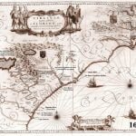
11. 1640 – Official French Royal Map – Virginiae et Floridae
The Kingdom of France continued to claim what is now Georgia and South Carolina even though there is no record of any French settlements in the region after 1568. By issuing this map, the King of France also recognized the legitimacy of the Virginia Colony. The coat of arms of Great Britain are placed upon that section of North America. By this time, France had also established permanent settlements in Quebec and was claiming all of present day Canada, except for Newfoundland.
This map is the first one to provide an accurate description of the South Atlantic Coast. It includes the Virginia Colony, and the various tribes living around the Chesapeake Bay. The Altamaha River is named the May River. The St. Marys River is named the Dolphin River. The village of Seloy, where the Spanish set up a base camp before attacking Fort Caroline, is in present day Camden County, GA near St. Marys. This is also the first map to correctly show the St. Marys River originating in the Okefenokee Swamp.
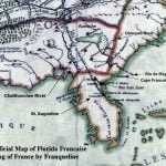
12. 1684 – Official Map of Florida Française by Franqueline
This map was first to describe a province that would later be called Louisiana. It does not include the detailed descriptions of Native American towns, but continues to call the Altamaha River, the May and the Chattahoochee River, the Holy Cross. The town of San Mateo is still give equal importance to Saint Augustine and is still located somewhere on the St. Marys River. Note that by this time, the Chattahoochee River had been fully explored, all the way to its source on the flanks of Brasstown Bald Mountain. Several towns are noted in the vicinity of the Nacoochee Valley at the Chattahoochee’s headwaters, but their names are not legible. The Great Lake in central Georgia is still shown as existing.
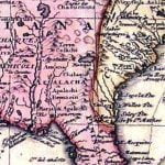
13. 1703 – Official French map of Louisiana and northern Mexico by Guillame DeLisle
DeLisle is considered one of the greatest mapmakers of the colonial era. By the time this map was published, French marines, surveyors and engineers had explored the Alabama, Coosa, Tennessee, Little Tennessee, French Broad River and Chattahoochee Rivers to their sources. All of these river basins were claimed by the King of France. The claimed territory of the new Province of La Louisiane included western North Carolina and all of Georgia
DeLisle’s map does not name the Altamaha River. There is no mention of either the Charlesfort or Fort Caroline colonies. Apparently, the attention of the government of France had shifted to the interior of North America where the soils were more fertile and the climate less tropical.
French maps contain information that contrast sharply with official North Carolina history also. Western North Carolina was shown to be occupied by the Apalachee, Shawnee and the Tuskegee Creeks. Northwest Georgia was occupied by the Conchakees (Apalachicola) and the Kusa. The Chalaque were now located in east central Georgia. There was no mention of the Charkees or Cherokees.
14. 1718 – Official French map of North America by Gullame DeLisle
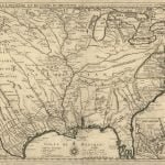
The 1718 map utilized about the same delineations of the land and rivers of the Southeast as the 1703 DeLisle Map, but included some stark changes in its ethnic landscape. Delisle noted the presence of large numbers of Koweta Creek towns along the May River (Altamaha River) in central Georgia and labels the Ocmulgee River north of there as the R. de Caouetes (River of the Koweta Creek Indians.) Unlike his earlier map, DeLisle placed Fort Caroline near the mouth of the May (Altamaha River) and Charlesfort on Parris Island, SC. DeLisle included a note that large numbers of French Huguenots had settled along the Santee River in South Carolina.
The Chattahoochee River was no longer called the Santa Crux River. DeLisle’s map contains a note which labels it as either being the Chatahuce River or Appalachian River.
The French had established trading posts and forts along the Tennessee and Cumberland River. One was near present day Nashville, TN, while another was on Hiwassee Island near Dayton, TN.
DeLisle accurately showed that that by 1718 the Yamassees had moved southward to settle on a river near St. Augustine. The year before, they had lost a bloody two year long war with the Colony of Carolina. There was no South and North Carolina then.
The biggest change between 1703 and 1718 is the appearance in the Southeast of a tribe named Charaqui. Where before had been shown Creek and Shawnee towns, DeLisle labeled the area Charaqui. The territory of the Rickohockens in SW Virginia and NE Tennessee was now labeled Charaqui also. At this time, all of Georgia was shown occupied by various branches of the Creek Indians.
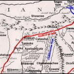
15. 1718 – Detail of French Map of North America by Gullame DeLisle
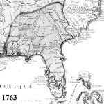
16. 1763 – Official French map of the Southeast
This map is obviously based on the 1718 DeLisle map, but contains a few changes which added the locations of French colonies such as Mobile Bay, AL, Fort Toulouse, AL, Biloxi, MS and New Orleans, LA. The Altamaha River is still called the May River. France now claimed all of the Southeast, west of the Ashley River, which flows into Charleston Harbor. By the end of 1763, however, France would have no territory in North America, as a result of losing the French and Indian War. The King of France had traded all of France’s possessions in North America in order to keep Martinique and Haiti, where the French made great profits from growing sugar cane, tropical fruits and spices.
