Will the Real Sequoya Please Stand Up?

Sequoyah

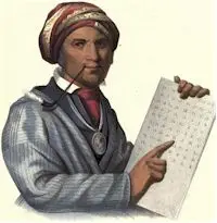
Will the Real Sequoya Please Stand Up? The preponderance of biographical information online and published in manuscripts concerning Sequoyah conflicts. Author Richard Thornton jovially delves into the conflicting information and tries to establish the true identity of this man called the “inventor of the Cherokee Alphabet.”

Who Really are the Cherokees?

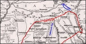
1718 French Map of North America - Detail

In 1976, while writing his dissertation for a Ph.D. in Anthropology, Archaeologist Bennie Keel was under heavy pressure to state that the Cherokees had lived in western North Carolina for at least 1000 years. That was a new policy adopted by the State of North Carolina. What Keel did say was that only three probable Cherokee structures in North Carolina had produced radiocarbon dates before the 1720. Keel noted that there was a century long gap between the archaeological record of large towns with multi-roomed rectangular houses, large plazas and pyramidal platform mounds, and the small villages typical of the … Read more

What Happened to the Sephardic Jewish Colonists?

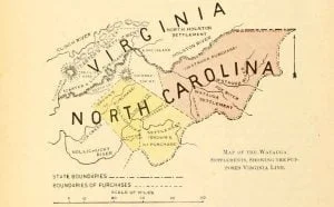
Map of the Watauga Settlements

There has never been a scientific study to determine the post-colonial history of the Sephardic communities in the Southern Piedmont and Appalachians. Anything that can be said must be in the realm of speculation, based on the known cultural history of the Southeast during the Colonial and Antebellum Eras. The only significant religious-based persecution in the Lower Southeast was between the Sephardic Jews and the Ashkenazi Jews from Eastern Europe. A Protestant minister in Savannah wrote, “Some Jews in Savannah complain that the Spanish and Portuguese Jews should persecute the German Jews in a way no Christian would persecute another … Read more

Things Your History Teacher Didn’t Tell You

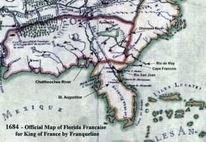
1684 Official Map of Florida Française by Franqueline

American history textbooks typically provide a cursory chapter on the period of the 16th century Spanish explorers of the Southeast and a few sentences to the attempts of French Huguenots to establish a colony in the region. They jump to the failed attempt to establish an English colony on Roanoke Island, North Carolina, then lavish attention on Jamestown, VA and Plymouth Plantation, Massachusetts. The texts then proceed to describe the founding of the various colonies which became the original United States. Very little, if anything, is said about the French and English explorers who ventured into the interior of the Southeast between 1568 and 1700. University level Colonial History courses might go into more detail on these intrepid people, but the general public in the United States never learns about them. Author Richard Thornton shares some interesting facts your history teacher didn’t tell you about early colonial America.

The United Provinces of the Netherlands

Dutch East India Ship

Because the peoples of the Netherlands and the United States have always had the warmest of relations, contemporary American historians have typically overlooked the less than benign role that Dutch entrepreneurs played in the early development of the Virginia Colony. During the reign of Queen Elizabeth I, England and the rebelling peoples of the Low Countries were close allies. The Dutch rebels were dependent on English sea power to maintain access to the North Sea. That was to change.

The Rickohockens

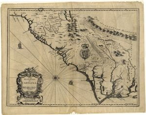
A New Description of Carolina

The word, “Rickohocken,” appeared suddenly in the discussions of the Virginia House of Burgesses in 1644, and was frequently mentioned thereafter until 1684. No word similar to Rickohocken appeared on Virginia maps before 1644, while such southwestern Virginia tribes as the Tomahitan, Saponi and Occaneechi did. The Rickohockens were shown on British maps to control southwestern Virginia, southeastern Kentucky, northeastern Tennessee and northwestern North Carolina until the early 1700s.

The Relation of Pedro Morales a Spaniard

1591 Floridae Americae Provinciae Map

The relation of Pedro Morales a Spaniard, which sir Francis Drake brought from Saint Augustine in Florida, where he had remained six years, touching the state of those parts, taken from his mouth by Master Richard Hakluyt in 1586.

The Relation of Nicholas Burgoignon

1591 Floridae Americae Provinciae Map

The relation of Nicholas Burgoignon, alias Holy, whom sir Francis Drake brought from Saint Augustine also in Florida, where he had remained six years, taken from his mouth by Master Richard Hakluyt in 1586.

The Melungeons: The Resurrection of a Proud People

The year was 2005.  It was a time when the internet for me was rapidly evolving from a new-fangled medium on which to send communications and find romance to a serious research tool.   The Muscogee-Creek Nation had retained me to create an electronic book on the Native American history of the Southeast. This innovative book was an early experiment in web-based publishing. Google’s search engines were exploding the amount of knowledge on the internet. A world was opening up that had been formerly confined to the environs of university libraries and the Library of Congress. While working on the section … Read more

The Lost Silver Mine

By mid-May of 2011, my camp site on Lake Santeetlah had been attacked at night several times by small groups of local patriots carrying baseball bats.  Apparently, they wanted to drive the supposed sexual predator-crazy man with three dogs out of the county.  Then one night about 1:30 AM a long line of pickups was headed toward my campsite. There were far too many patriots coming for me to fight off. I threw my rifle and sleeping bag in the car, screaming at the dogs to jump in.  We took a loop road around the convoy just as they arrived … Read more

The Battle of Taliwa

Battle of Taliwa

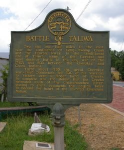
Georgia historical markers and history books proudly proclaim the Great Cherokee Victory at the Battle of Taliwa, where they won all of North Georgia! The description of the conflict describes an attack on the Creek town of Taliwa by brave Cherokee warriors. They were supposedly outnumbered 3:1 and were led to victory by a teenaged Cherokee girl named Nancy Ward. The Cherokees immediately established the town of Long Swamp Creek to confirm their conquest.

Sir William Berkeley and Native American Slavery

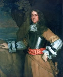
Flagmen of Lowestoft - Vice-Admiral Sir William Berkeley, 1639-66

Sir William Berkeley was a highly educated courtier in the regime of Charles I, then twice governor of Virginia. As governor, he stacked the Council and House of Burgesses with Royalist planters then institutionalized race-based slavery in 1661 and 1662.  Prior to that time in Virginia, Native American and Africans were theoretically forced laborers; legally classified as indentured servants like their European counterparts, who would be supposedly set free after seven years of work for a master.  After passage of this law, Native American and African servants were human chattel, who could remain slaves all their lives and whose children … Read more

Richard Stewart’s DNA Results

Map of Known Human Migrations

Richard Stewart (Shawnee or Cherokee Descendant) My name is Richard Stewart.  I have had several ethnicity DNA tests done, but I find myself less than satisfied with the results.  I will attempt to find other test results in my archived mail.  My first DNA test showed 8% NA but came out East Asian as is often the case. Another test showed three NA matches out of a total of 20.  Below is the last test I’ve taken.  This was done in part to determine a baseline for Melungeons.  I do not strongly identify as a Melungeon.  I was born and raised … Read more

Prayer We Will Give . . . and often

It was April 2010. I was homeless and living in the Western North Carolina Mountains. A couple had invited me to camp out inside their unoccupied vacation cabin in the Tuskeegee community near Fontana Lake.  Tuskeegee is in Graham County, North Carolina.  Graham is a breathtakingly beautiful place, completely walled in by some of the Eastern United State’s highest mountains.  Its county seat, Robbinsville, is closer to seven other state capitals than it is to Raleigh, North Carolina’s capital. After moving from a tent in the Nantahala Mountains into the cabin on the side of a small mountain, my immediate … Read more

Opechancanough and Don Luis

Opechancanough

Jamestown was founded in 1607 on land recently conquered by the Powhatan Confederacy. Movies about Pocahontas have given the impression that the “Powhatan Indians” were concentrated on the Chesapeake Bay.  They were not. The villages on the coastline of the Chesapeake were the vassals of the Pamunkey Indians, who forged the confederacy. The capital of the confederacy, Werowocomoco, was originally on the north side of the York River, not near Jamestown. Note that the town’s name ends with “moko” which is very similar to the Itza Maya title for king, mako, which was also used as a suffix by Itsate Creek … Read more

Mysterious Cherokee Raiders

1591 Floridae Americae Provinciae Map

The Early History of Jackson County, GA describes a Cherokee tribe in the region northeast of present day Metropolitan Atlanta, known as the Bohurons. The book, created from the writings of a self-educated civic leader in the mid-1800s, contains many Bohuron personal names. None of them are Native American words. They are Spanish, Portuguese, Arabic, French and Dutch names. The name of the tribe means “Nobility” or “Nobles” in Arabic. The name of the chief’s horse, “Al Buraq” means “Lightning” in Arabic and was the name of the horse that took Mohammed to heaven from Jerusalem. In 1770 the Bohurons … Read more

Melungeons

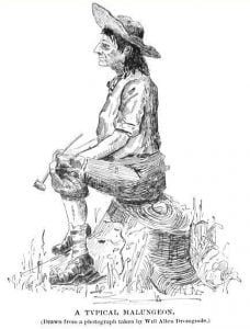
A cartoon mocking the typical Melungeon.

The word, Melungeon, dates at least back to the late 1700s and has several interpretations. The most obvious is that it is frontier derivation of the French word, mélange, which means “blend.”

Map Making, from Majorca to Appalachia

From the moment that Europeans learned that a New World existed across the waters of the Atlantic, map makers in Western Europe began turning maps of that New World. At first these maps were grossly inaccurate and assumed the either the Americas were part of the Orient or merely consisted of islands off the shores of Asia. As more and more log books and navigation charts were returned to Spain, Portugal, France and England by explorers, the maps grew more precise.

Jewish Pioneers on the Virginia Frontier

The experience of getting to know Brent Kennedy brought back a memory from the exact same year that Brent discovered his Melungeon heritage – 1988.  The loan closing documents for purchasing what my former wife and I thought was a long abandoned “Civil War Era” farm house in the Shenandoah Valley produced two big surprises.  The plat for the farm was drawn in 1755 and had as its draughtsman and surveyor, the big initials, GeoW . . . that’s George Washington.  The giant oak tree at the entrance to the farm’s driveway had displayed the same initials until the 1940s … Read more