Leading Citizens of Spokane Falls Washington

Among the leading citizens of Washington, in addition to those mentioned elsewhere in this volume, the following residents of Spokane Falls are worthy of note: J. N. Glover, a Missourian by birth, and, it may he said, the founder of the city, settling there, or rather on its site, in 1873, and purchasing from two squatters named Downing and Scranton the tract of land on which their shanties were then the only buildings. First as the owner of a saw-mill, next as a contractor, then as the leading organizer and president of the First National Bank, and finally as mayor … Read more

Jefferson County, Montana 1870-1888

Jefferson County, lying north of Madison, and divided from it by the Jefferson fork of the Missouri, contained 5,000 square miles and 2,500 inhabitants. It was, after mining, chiefly a dairying county, though there several farming settlements sprang up in the valleys of Prickly Pear, Boulder, Crow, Pipestone, and other streams. In 1878, 50,000 lbs of butter and 20,000 lbs of cheese were produced. The farmers raised 50,000 bushels of grain, and there were about 10,000 acres of improved lands. The sawmills in the county cut about 1,500,000 feet of lumber. The stock of the county consisted of 25,000 range … Read more

Indian Reservations of Washington

The Indian reservations of Washington occupy land as follows: There were five reserves belonging to one agency, the Puyallup, covering altogether about 29,000 acres. The reservation situated on this river contained over 18,000 acres, for the most part heavily timbered. The aggregate of land under cultivation was in 1885 less than 1,000 acres, though over 150 homesteads had been taken, chiefly in forty-acre lots. Nisqually Reservation, on that river, contained 4,717 acres. The Chehalis Reservation, half of which was good agricultural land, contained 4,224 acres. On Shoalwater Bay were reserved 340 acres. The Squoxin Reservation covered an island in Mason … Read more

Indian Fight of the 7th, 8th, and 9th of December of 1858

Indian Fight of the 7th, 8th, and 9th of December of 1858. See: Washington Indian Wars, 1855-1856 for context of this list. Killed: Capt. Charles Bennett of Company F, the same who was connected with James Marshall in the discovery of gold in California 2d Lieut J. M. Burrows, Company H Simon S. Van Hagerman, Company I. Mortally wounded, who lived but a few hours: E. B. Kelsey, Company A Henry Crow and Casper Snook, Company H Joseph Sturdevant, Company B Jesse Flemming, Company A Dangerously wounded: Capt. Layton Privates T. J. Payne, Nathan Fry F. Crabtree, Company H J. … Read more

Indian Captives of Washington from the Vessel Georgiana

The names of the rescued captives, and vessel’s crew: William Rowland, captain Duncan McEwen, mate Benjamin and Richard Gibbs, sailors Tamaree, an Hawaiian cook Passengers Asher Sargent E. N. Sargent Samuel D. Howe Ambrose Jewell Charles Weed Daniel Show Samuel H. Williams James McAllister John Thornton Charles Hendricks George A. Paige John Remley Jesse Ferguson Ignatius Colvin James K. Hurd William Mahard Solomon S. Gideon George Moore B. F. McDonald Sidney S. Ford Jr Isaac M. Browne Mr. Seidner I find, besides the reports made at the time by S. D. Howe, George Moore, Captain Rowland, and subsequently by Charles … Read more

Idaho Political Affairs, 1862 – 1866

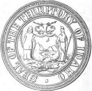
Idaho Seal

On the 22d of September, 1863, more than four months after the passage of the Organic Act of the territory, William H. Wallace, late delegate to congress from Washington, appointed governor of Idaho by President Lincoln July 10th, issued his proclamation organizing the Territory of Idaho, with the capital at Lewiston. Owing to the shifting nature of the population and the absence of mail facilities, the fact of this organization was not known in the mines till late in the spring. Meanwhile the laws of Washington were held to be in force. Much irregularity had prevailed in municipal affairs since … Read more

Idaho Mines

Some of the first discovered veins, already mentioned in a previous chapter, retained their productiveness. The Gold Hill mine was sold in 1869, since which time to 1884 it produced $2,800,000. It was not until 1878 that the Banner district, north of Quartzburg, in Boise County, began to be really developed. The mines of War Eagle Mountain, in Owyhee County, continued productive. Oro Fino, the first discovery, yielded $2,756,128 in six years, without any considerable cost to its owners. The Elmore, later called the Bannack, in one month in 1868 yielded $500,000, the ore being crushed in a twenty-stamp mill. … Read more

Idaho Lost Diggings Miners

Their names were: Michael Jordan A. J. Miner G. W. Chadwick Cyrus Iba William Phipps Joseph Dorsey Jerome Francisco John Moore J. R. Cain W. Churchill H. R. Wade A. J. Reynolds James Carroll William Duncan Dr A. F. Rudd F. Height W. L. Wade John Gannon M. Conner C. Ward H. W. Prindall D. P. Banes O. H. Purdy J. G. Boone W. T. Carson P. H. Gordon L. G. Gehr and 3 others. In the Silver City Owyhee Avalanche of Jan. 8, 1876, is a notice of the death of Alexander Eddington, an Englishman aged 60, a ‘pioneer … Read more

Idaho Legislature 1884 – 1888

The legislature of 1884-5: Councilmen; George Pettingill, Ada County T. C. Galloway, Ada and Washington County Benjamin Wilson, Boise County E. C. Brearly, Boise and Alturas County James E. Hart, Bear Lake County Charles A. Wood, Custer and Lemhi County R. L. Wood, Cassia and Owyhee County S. C. Poage, Idaho County H. W. Smith and George W. Crawford, Oneida County S. G. Isaman, Nez Pereé County S. W. Moody, Nez Percé, Shoshone, and Kootenci County Representatives: Charles I. Simpson, D. W. French, M. H. Goodwin, D. L. Lamme, Ada County J. K. Watson, Alturas County W. N. B. Shepperd, … Read more

Idaho Indian Wars, 1874 – 1878

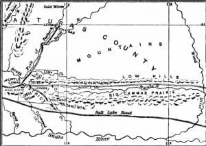
Camas Prairie and Volcano District

After the close of the Modoc War, General Davis ordered a march by the cavalry of 700 miles through the country threatened by dissatisfied tribes, in order to impress upon their minds the military force of the United States. But the reservation set apart for Joseph and his non-treaty followers remained unoccupied, and he continued to roam as before. The settlers on the Wallowa were impatient to know whether their indemnity money was to be paid, or what course the government would pursue, and wrote to their representative in congress, who replied that the commissioner of Indian affairs had assured … Read more

Idaho Geology

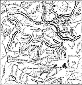
Map of Idaho, 1863

The territory of Idaho was set off by congress March 3, 1863. It was erected out of the eastern portion of Washington with portions of Dakotah and Nebraska, and contained 326,373 square miles, lying between the 104th and 117th meridians of longitude, and the 42d and 49th parallels of latitude. It embraced the country east of the summits of the Rocky Mountains to within fifty miles of the great bend of the Missouri below the mouth of the Yellowstone, including the Milk River, White Earth, Big Horn, Powder River, and a portion of the Platte region on the North Fork … Read more

Idaho Federal and Territorial Officers, 1864-1884

1864: Governor, W. H. Wallace, resigned to become a delegate Secretary, W. B. Daniels Auditor, B. F. Lambkin Treasurer, D. S. Kenyon Marshal, D. S. Payne Chief Justice, Sidney Edgerton Associate Justices, Samuel C. Parks and Alex C. Smith Attorney of 1st District, Thomas M. Pomeroy 2nd District, George C. Hough 3d, vacant Clerk of Court, J. C. Henly, 1865: Governor, Caleb Lyon of N. Y. Secretary, C. De Witt Smith Delegate, E. D. Holbrook Judiciary same as in 1864 Clerk of Court, E. C. Mayhew. 1866: Governor and Superintendent of Indian Affairs, Caleb Lyon Secretary, H. C. Gilson of … Read more

Idaho Council Members, 1864-1867

The following were members of the council of 1864: J. Miller and E. Smith, Boise County E. B. Waterbury, Nez Percé County S. Capps, Shoshone County S. S. Fenn, Idaho County S. B. Dilly, Alturas County J. Cummins, Owyhee, president Members of the house: H. C. Riggs, W. H. Parkinson, J. B. Pierce, and J. McIntosh, Boise County E. C. Latta and Alexander Blakely, Idaho County George Zeigle and T. M. Reed, Nez Percé County E. C. Sterling and Solomon Hasbrouck, Owyhee County W. A. Goulder, Shoshone County W. H. Howard, Alturas and Oneida County Blakely, speaker. Members of the … Read more

Hudson’s Bay Company Forts in Washington

In Stevens’ report is found a list of all the forts of the H. B. Co., with their rank and value, and the amount of cultivated laud, making the whole foot up no more than $300,000, whereas they received twenty years later more than double that amount. The other information contained in the report relates to the segregation of the land claimed by the companies into donation lots, with the names of the squatters, and is of interest in the history of the early settlement of the country. The following are the names of the so-called trespassers: At Fort Vancouver, … Read more

History of Washington, Idaho and Montana

Bancroft’s extensive work on the history of the Northwest Coast meticulously chronicles the development of the region encompassing Washington, Idaho, and Montana up until 1846, marking the end of the fur company era and the resolution of territorial boundaries between Great Britain and the United States. His writings provide a comprehensive account of how these regions evolved from being parts of Oregon into separate territories, detailing the intricate relationships and historical overlaps among them. Bancroft’s approach includes a broad spectrum of sources such as printed materials, public documents, newspapers, and firsthand accounts from early settlers and prominent figures, ensuring a thorough narrative of the region’s historical landscape. This article aims to present the interconnected histories of these territories, emphasizing their significance in the broader context of North American history.

History of Transportation in Washington

Frequent reference has been made in the narrative of Washington history to the opening of roads to give the Puget Sound region land communication with other parts of the country, and open a way for the mails. In 1832 the only means of access from the Columbia River was by a cattle trail, while immigrants and their luggage were conveyed in canoes up the Cowlitz River, after which they were compelled to take to the rude trail cut by the immigrants of 18-15. Warbass & Townsend, storekeepers at Monticello, advertised in Dec. 1852 to forward passengers and freight, saying that … Read more

History of Railroads in Washington

From the day the people of Washington learned that congress had appropriated money for a survey terminating on Puget Sound, their constant expectation was fixed upon a transcontinental railway. The territorial charter of the Northern Pacific Railroad Company was granted by the legislature Jan. 28, 1857, to 58 incorporators, the road to be commenced within three and completed within ten years after the passage of the act; the capital stock to be fifteen millions of dollars, which might be increased to double that amount. It does not appear that the company took any immediate steps to raise the necessary capital. … Read more

History of Idaho, Bancroft Works

  Idaho Geology Map of Idaho, 1863 Early Settlement of Idaho, 1862-1866 Map of Boise Basin Map of Jordan Creek Idaho Lost Diggings Miners Overland Travel to Idaho Idaho Political Affairs, 1862-1866 Idaho Highway Robberies and other Crimes Idaho Council Members 1864 – 1867 Federal and Territorial Officers 1864-1884 Nez Percé and Shoshone Indian Lands in Idaho Idaho Indian Wars, 1874 – 1878 Eastern Oregon Map Camas Prairie and Volcano District The Lolo Trail Map Mining Gold and Silver in Idaho, 1865-1885 Idaho Mines Owyhee Mines previous to 1865 Mines between 1865 and 1880 Southwestern Idaho Map Wood River Mineral … Read more

Historic Schools of Washington

A school was opened in Olympia, Nov. 22, 1852, by A. W. Moore, first teacher and postmaster on Puget Sound after its settlement by American colonists. Moore died in 1875, aged 55 years, having always labored for the best interests of society. The first schoolhouse, it is claimed, was on the Kindred farm, on Bush prairie, and was erected by the Kindred family and their neighbors. Phillips first taught in this place. During the winter of 1852-3 a tax was levied on the Olympia precinct, and money collected to erect a public schoolhouse, which was demolished by the heavy snow … Read more