Montana Towns and Pioneer Sketches, 1862-1864

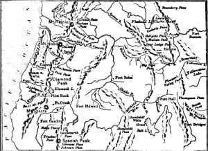
Gulches and Lodes Map - 1865

Among these detained in Beaverhead Valley because wagons could not go through from Lemhi to Salmon River was a party of which John White and John McGavin were members. This company, about the 1st of August, 1862, discovered placers on Willard or Grasshopper Creek, where Bannack City was built in consequence, which yielded from five to fifteen dollars a day to the hand. White, who is usually accredited with the discovery, having done so much for his fame, has left us no other knowledge of him or his antecedents, save that he was murdered in December 1863. Almost at the … Read more

Montana Territorial Appointments 1864-1888

Territorial Secretaries: Henry P. Torsey, commissioned June 22, 1864 John Coburn, March 3, 1865 Thomas F. Meagher, Aug. 4, 1865 James Tufts. March 28, 1867 Wiley S. Scribner, April 20, 1869 A. H. Sanders, July 19, 1870 James R. Callaway, Jan. 27, 1871 James H. Mills, May 10, 1877 Isaac D. McCutcheon, 1881 John S. Tooker, April 21, 1884 William B. Webb, 1886-8 Louis A. Walker, 1889 Territorial Treasurers John J. Hull, 1864-6; John S. Rockfellow, 1866-7; William G. Barkley, 1867-71; Richard O. Hickman, 1871-5; Daniel H. Weston, 1875-87; W. G. Prewitt, 1887-9. Territorial Auditors John S. Lott, 1864-6 John … Read more

Montana Settlement, Geology, Exploration, 1728-1862

General View of Mountain Passes

Montana, mountainous or full of mountains is a name, as herein used, no less beautiful than significant. From the summit of its loftiest peak – Mount Hayden – may be seen within a day’s ride of each other the sources of the three great arteries of the territory owned by the United States – the Missouri, the Colorado, and the Columbia. From the springs on either side of the range on whose flanks Montana lies flow the floods that mingle with the North Pacific Ocean, the Gulf of California, and the Gulf of Mexico. The Missouri is 4,600 miles in … Read more

Montana Prospectors and Farmers

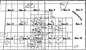
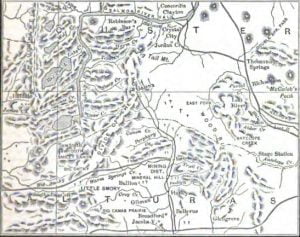
Map of Butte and Summit Valley Mining District

The two primary elements of Montana’s grand development were gold and grasses. In a rough country of apparently few resources, the discovery of Alder gulch, resulting in $60,000,000 of precious metal, which that ten miles of auriferous ground produced in twenty years, was like the rubbing of an Aladdin lamp. It drew eager prospectors from Colorado, Utah, and Idaho, who overran the country on both sides of the upper Missouri, and east and west of the Rocky Mountains, many of whom realized, to a greater or less extent, their dreams of wealth. The most important discovery after Alder gulch was … Read more

Montana Politics, Legislation and Reform

Having discharged the onerous duties of his office for a few months, Governor Smith returned to the states, and Meagher again came to the front. Once more he proclaimed a special session of the legislature, the motive of which was that a law had just been passed by congress and approved by the president convening the 40th congress on the 4th of March, whereas the election law of Montana, which fixed the day of general election on the first Monday of September, would leave the territory without a delegate from March until September. Not that a delegate had ever been … Read more

Montana Justices 1886-1889

Montana Justices 1886-1889 1886 Decius C. Wade, Chief Justices of Montana J. H. McLeary, Associate W. G. Galbraith, Associate T. C. Bach, Associate 1887 N. W. McConnell, Chief Justices of Montana J. H. McLeary, Associate W. G. Galbraith, Associate T. C. Bach, Associate 1888 Stephen De Wolfe, Chief Justices of Montana Moses J. Liddell, Associate T. C. Bach Associate 1889 Henry N. Blake was Chief Justice of Montana Bach, Associate De Wolfe, Associate Liddell, Associate W. J. Galbraith was born in Freeport, Pennsylvania, in 1837, and educated at Dartmouth College, N. H., graduating in 1857. He studied law at Pittsburg, … Read more

Montana Indians and Indian Wars, 1855-1882

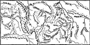
Map of Bozeman Route

With the resident Indian tribes of Montana the government had treaties of amity previous to the period of gold discovery and settlement. The Blackfoot nation, consisting of four divisions – the Gros Ventre, Piegan, Blood, and Blackfoot proper – occupied the country beginning in the British possessions, bounded on the west by the Rocky Mountains, on the south by a line drawn from Hellgate pass in an easterly direction to the sources of the Musselshell River, and down that stream and the Missouri to the mouth of Milk River, where it was bounded on the east by that stream. To … Read more

Montana Gold Discoveries and First Settlers

The existence of gold in Montana was not unknown to the Jesuit fathers, but they had other motives than the gathering of earthly treasure, and they would not risk the souls of their ‘dear Indians’ for the glittering metal. As early as 1852 a half-caste from the Red River settlements, named François Finlay, but known as Benetsee, and who had been to California, prospected on a branch of the Hellgate River, finding the color, but no paying placers. The stream became known as Benetsee Creek; but in 1853 a member of the railroad exploring expedition took out of this stream, … Read more

Montana Expansion, Labor, Transportation and Citizens

The progress of Montana in mining, as indicated in the previous chapter, had received a partial check from about 1870 to 1880. The reason of this was that surface mining had declined, the placers being exhausted, and deep mining had not yet been sufficiently developed to give equal returns. There were other causes operating at the same time, such as the great cost of transportation of machinery, and the financial crisis resultant upon the suspension of Jay Cooke & Co., with the consequent embarrassments of the Northern Pacific railroad company, to whose advent in the territory all eyes had been … Read more

Montana Constitutional Convention Members 1889

The following persons were members of the constitutional convention: William A. Clark, Walter M. Bickford, J. F. Brazelton, Peter Breen, E. U Aiken, Simon R. Buford, William Mason Bullard, Walter A. Burleigh, Alex. F. Burns, Andrew J. Bums, Edward Burns, James Edward Cardwell, B. Piatt Carpenter, Milton Canby, William A. Chessman, Timothy E. Collins, Charles E. Conrad, Walter Cooper, Thomas F. Courtney, Arthur J. Craven, W. W. Dixon, D. M. Durfee, William Dyer. William T. Field, George O. Eaton, J. E. Gaylord, Paris Gibson, Warren C. Gillette, O. F. Goddard, Fielding L. Graves, R. E. Hammond, Charles S. Hartman, Henri … Read more

Montana Cattle Ranching

I will give here an account of the methods of cattle-growers in Montana and the adjoining country. The land belonging to the government, which made no charge for pasturage, and the cattle requiring little if any care during the winter, the cost of keeping them was trifling, and consisted mainly in the wages paid to a few herders. Formerly all cattle were permitted to mix promiscuously, being distinguished only by their brands. They separated into bands, and sought favorite localities, as men do, being governed in their choice by the quality of their feed, water, shade, and the prevailing winds. … Read more

Missoula County, Montana 1870-1888

Beginning with Missoula, the first settled and organized, and the most western, it contained about 30,000 square miles, distributed in forest crowned mountains and sunny valleys, affording a charming variety of scenery, and a fortunate arrangement of mineral, agricultural, and grazing lands. About 36,000 acres were occupied, and 5,196 cultivated. Its principal valley, the Bitterroot, contained 500 farmers, and would support four times as many. It had 8,000 horses, 19,000 cattle, and 13,000 sheep. It produced in 1884 124,226 bushels of wheat, and 281,312 bushels of oats; made 30,000 pounds of butter, and raised large quantities of all the choicest … Read more

Mining Gold and Silver in Idaho, 1865-1885

Map of Wood River Mineral District

From 1865, when quartz mining was very promising in Idaho, to 1876, a fair degree of prosperity was enjoyed by the owners of mines. Prospecting was, however, much retarded by the Indian troubles from 1865 to 1868, an account of which has been given in my History of Oregon. Expensive milling machinery had been hastily introduced in the first excitement of quartz discoveries, which lessened the profits without much increasing the results of reducing the ores in arastras. But the straw which broke the camel’s back was the defaulting of the secretaries of three of the richest mining companies in … Read more

Miners of Silver Bow District and Gulches, Montana

The men who uncovered the riches of Silver Bow District were, after the original discoverers, W. R. Coggeswell Peter Slater Vernon & Co. C. Solomon M. Johnson Dennis Driscoll J. Baker Robert McMinn Thomas Flood W. R. Crawford Sherman & Co. Henry Rust M. Prettyman Lester Popple W. E. Harris J. La Clair L. Thayer George Popple A. M. Smith C. S. Warren James Beattie George McCausland Wolf & Cowan From the gulches opened by these men was taken, between 1864 and 1869, $l,894,300. Of the Gulches, which lay too high to be worked before the completion of the Pioneer … Read more

Members of the 4th – 14th Legislature of Montana

Members of the 4th Legislature The council consisted of: Charles S. Bagg, president John W. Corum, W. E. Cullen, Alexander Davis, Sample Orr, Jasper Rand, Thomas Watson Secretary, Thomas B. Wade Asst. Secretary, C. C. Menaugh Clerks, H. H. Showers, D. B, Jenkins Sargeant-at-Arms, Stephen R. Elwell Doorkeeper, John Thompson The members of the lower house were: Wellington Stewart, Speaker J. M. Anderson, N. C. Boswell, H. R. Comly, W. H. Edwards, James Gallaher, H. A. Kennerly, F. E. W. Patton, J. W. Rhodes, John A. Simms, W. Tennant, J. R. Weston, Samuel Word Clerks, H. A. Barrett, F. A. … Read more

Meagher County, Montana 1870-1888

Meagher County extended from the Missouri River on the west to the Musselshell River on the east, and was sandwiched between Gallatin and Choteau Counties. It contained 20,000 square miles, embracing mountain ranges clothed in forest, and veined with mineral deposits, high grazing lands, and low agricultural lands. The valleys of the Judith, Musselshell, Smith, and Missouri Rivers aggregated 2,000 square miles. The population of the county in 1880 was 2,743. In 1884 its livestock was valued at 7,000.000; $750,000 being in horses. The mines of Meagher County by 1886 produced over $10,000,000 in gold from the gulches, while the … Read more

Madison County, Montana 1870-1888

Madison County, rendered forever famous as the district of country containing the Alder gulch of worldwide renown, 4,900 square miles in extent, had also a population of not more than 4,000 at the last census. It is a county rich in resources, chiefly mineral, although agricultural to a considerable degree. Its chief export was gold, while silver, copper, lead, iron, marble, coal, and other valuable minerals abound. The county owned in 1884 cattle, horses, and sheep valued at $1,800,000, and had 10 sawmills cutting 1,000,000 feet of lumber yearly, 2 grist-mills making 6,000 sacks of flour annually, besides raising 100,000 … Read more

Lumber and Ship Building in Washington

Map of Puget Sound

The manufactured products exported are: first, lumber, the chief article of commerce; lime, a valuable product on account of its almost entire absence over a great extent of Oregon and California; barrels, staves, wooden pipe, the proper trees for which manufactures abound in the small valleys about the Sound; canned fish, and coal-if that may be named with manufactures. The other products exported are wheat and other grains, flour, wool, hides, livestock, potatoes, and hops. Puget Sound, from its position, extent, depth of water, and its contiguity to the materials required, should be one of the greatest shipbuilding stations in … Read more

List of Early Montana Farmers

E. S. Banta, born in Missouri, Sept. 2, 1832; brought up a fanner; immigrated to California in 1862, with his own team; remained there one year, and came to Montana, first to the Bitterroot Valley, then to Gallatin City, and finally to Willow Creek in Madison County, where he obtained 196 acres of land, and raised stock. He married, in 1861, Mary Foster. William McKimens, a native of Pennsylvania, was born Oct. 20, 1835, and raised a farmer. Removed to Illinois at the age of 19, and soon after to Kansas. In 1858 he went the Pike’s Peak country, and … Read more

Lewis and Clarke County, Montana 1870-1888

Lewis and Clarke County, occupying a central position, although comparatively small in extent, having only 2,900 square miles, was the second in population, its inhabitants numbering about 13,000, and its assessed valuation being in 1884 over $8,000,000. Its mines have already been spoken of. From 135 farms in Prickly Pear Valley was harvested, in 1878, 25,000 bushels of wheat, 40,000 bushels of oats, 15,000 bushels of barley, or an average of over 500 bushels of grain to every farm. Besides the grain crop, 7,000 tons of hay were harvested, over 300 tons of turnips and cabbages, 40,000 bushels of potatoes, … Read more