Geology

The Saco River

Last Updated on November 12, 2020 by Dennis Here, in the deep primeval forest, the brave aboriginal inhabitants searched for those medicinal treasures stored in the pharmacy of nature, and from these compounded the curative preparations for which the tribe has long been renowned. Here, upon the Saco river bank, the Sokokis built his bark

The Saco River Read More »

Early Human’s Presence around Lake Okeechobee

Anthropologists believe that mankind has lived somewhere in southern Florida for at least 12,000 years. Its sub-tropical climate, abundance of water and fertile peat soils produces a diverse range of animal and vegetative food sources for humans year round. However, to date no Paleo-American artifacts have been discovered in or along the shores of the lake. Such evidences of the past are probably buried deep under the peat in scattered locations. They have been found in abundance about 88 miles (110 km) to the northwest in two natural springs near Sarasota, FL.

Early Human’s Presence around Lake Okeechobee Read More »

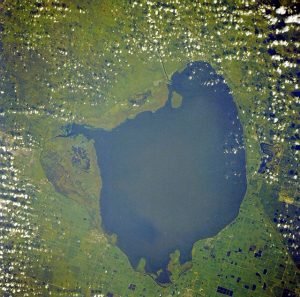
Lake Okeechobee Geology

Okeechobee is the Anglicization of the Itsate Creek (Miccosukee) words Oka chopi, which mean “Water Big.” Its aboriginal inhabitants called the lake either Maya-imi, which apparently means “Maya Water or Mayakaa, which means Maya People in several northern South American tongues. The Spanish called it Laguna de Mayaco or on some maps Laguna de Espiritu Santo. However, that name more typically applied to the Apalachicola-Chattahoochee River. In 1821, when Florida was ceded to the United States, the earliest English language maps generally retained the Mayaco name, but some called it Macaco.

Lake Okeechobee Geology Read More »

Manitou Springs

Last Updated on August 14, 2013 by Dennis Dr. Edwin James, botanist and historian of Long’s expedition, who visited the Pike’s Peak region in 1820, says of the principal spring at Manitou: The boiling spring is a large and beautiful fountain of water, cool and transparent and aerated with carbonic acid. It rises on the

Manitou Springs Read More »

Geological Agencies

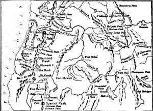
Last Updated on June 30, 2013 by In General it may be said that the mountain ranges of Idaho are volcanic upheavals, the mighty bending upward of the crust of the earth’s surface when its inborn fires were lashed to unwonted fury in some stormy age of old eternity. The valleys were doubtless formed by

Geological Agencies Read More »

Mineralogical and Geographical Notices

Last Updated on April 2, 2013 by Dennis Mineralogical And Geographical Notices, Denoting The Value Of Aboriginal Territory. 1. Wisconsin and Iowa Lead Ore A correspondent, engaged in the practical working of these ores, remarks: “By the box of specimens transmitted, you will be able to judge of the character of these valuable ores. The

Mineralogical and Geographical Notices Read More »

Idaho Geology

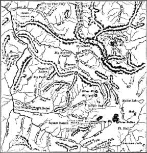
Last Updated on March 11, 2023 by Dennis The territory of Idaho was set off by congress March 3, 1863. It was erected out of the eastern portion of Washington with portions of Dakotah and Nebraska, and contained 326,373 square miles, lying between the 104th and 117th meridians of longitude, and the 42d and 49th

Idaho Geology Read More »

Scroll to Top