Barnwell

B Surnames – Walpole Massachusetts Marriage Records to 1850

BABBITT, Betsey and Samuel G. Clap, Mar. 8, 1843. Sarah P., 21, d. Willard and S., and Luther Hayward, widower [publishment of intention of marriage, omits widower], May 29, 1848. Sophia and George Copeland, Apr. 10, 1842. BACON, Alfred of Dover, and Harriett Perry, Nov. 27, 1834. Anna of Dedham, and William Kindall 1st, publishment […]

B Surnames – Walpole Massachusetts Marriage Records to 1850 Read More »

Brown Genealogy

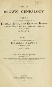
In 1895, Cyrus Henry Brown began collecting family records of the Brown family, initially with the intention of only going back to his great-grandfathers. As others became interested in the project, they decided to trace the family lineage back to Thomas Brown and his wife Mary Newhall, both born in the early 1600s in Lynn, Massachusetts. Thomas, John, and Eleazer, three of their sons, later moved to Stonington, Connecticut around 1688. When North Stonington was established in 1807, the three brothers were living in the southern part of the town. Wheeler’s “History of Stonington” contains 400 records of early descendants of the Brown family, taken from the town records of Stonington. However, many others remain unidentified, as they are not recorded in the Stonington town records. For around a century, the descendants of the three brothers lived in Stonington before eventually migrating to other towns in Connecticut and New York State, which was then mostly undeveloped. He would eventually write this second volume of his Brown Genealogy adding to and correcting the previous edition. This book is free to search, read, and/or download.

Brown Genealogy Read More »

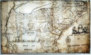
Map of part of North America from Cape Charles to the Mouth of the River Mississipi

Captain John Barnwell, otherwise known as Tuscarora Jack, was a well known frontier settler who was active in the 1711 Tuscarora War. His travels throughout the Southeast enabled him to draw a relatively accurate map of the area of his travels and exploration, some from second hand information, but most from first hand. For researchers of the Southeast this map is critical, and never before seen online in such a large form as to be able to read the hand writing and personal descriptions and historical details as outlined by Barnwell. In order to view this map in a form that made it legible you had to travel to one of the two locations the actual versions exist.

Map of part of North America from Cape Charles to the Mouth of the River Mississipi Read More »

Pin It on Pinterest

Scroll to Top