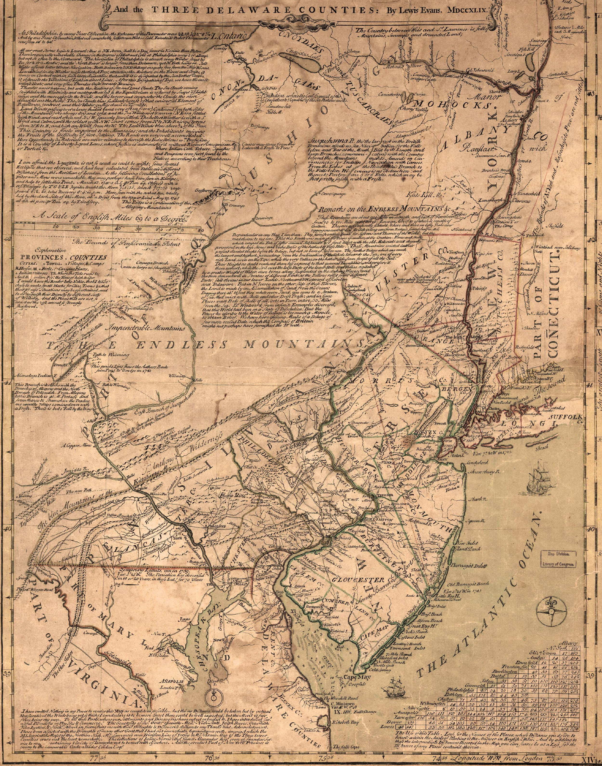
Leaving To-ri-wa-wa-kon and the grave of Shikellamy, the Mohawks traveled up the great river Susquehanna until they arrived at Lewisburg. Here they visited an ancient Indian village site which was an earlier residence of the noted Oneida chief Shikellamy. Continuing still north up the river the warriors arrived at still another of Shikellamy’s towns. Here the great chief also resided, just south of the Village of Milton, Pennsylvania. From this village site the Mohawks traveled over a road that was once called, The Sheshequin Path. This ancient Iroquois trail was used by Conrad Weiser and Shikellamy on trips through this region of beautiful hills to the six Nations Capitol at Onondaga. This Indian trail connected the Iroquois country and the Shamokin area and is spoken of as, The Peace Path. Many an ancient Iroquois traveled over this beautiful trail coming from or going to the Land of the Ho-de-no-sau-ne.
Still traveling north up the great river, the warriors ‘north of Towanda, Pa.’ came to the meeting place of the Indian trails, the plans where the trail joined the Iroquois Country and the Shamokin Area. Still traveling up this Indian path, the Sheshequin Path, the Mohawks arrived in the vicinity of Athens, a town of Pennsylvania. In this location many important events of Indian history took place. This was also known as Tioga Point and several important councils of the Six Nations were held here. This was the site of the ancient Indian Village of Tioga. This was the Indian gateway from New York into Pennsylvania and had been an important Iroquois highway for generations. At Athens they saw, the Carring Path, the Indian voyager down the Chemung River lifted his canoe and carried it a hundred and ninety yards across the neck to ascend the Susquehanna River. This area around Athens was known by the whites as the “Pine Plains.” In 1790 near this spot Timothy Pickering met Red Jacket and his Senecas. They were on their way to the Peace Council at Tioga Point. Just south of here was Queen Esther’s Town. Near Green’s Landing, on the terrace below, lived this French-Indian woman, Esther Montour. Near here stands Spanish Hill, ancient village site of the Andante Indians’ who were an Iroquoian people, of the Six Nations. The Mohawks visited the Tioga Point Museum at Athens where they were fortunate enough to meet a woman of Indian blood, Elsie Murray, director of the museum. This woman, an Indian authority, gave the Mohawks the history of the region.
Leasing Tioga Point, the Mohawk left the main trail and heading west they arrived at the Village of Knoxville. Here, in Iroquois days, was a noted Seneca Iroquois village known as “Mingo Town.” This Seneca sentinel village, located here at the eastern end of “The Forbidden Trail” during the mid-18th century, was the place where the white man was forbidden to pass. All white travel westward was halted here. Post, provincial agents, was turned back at this point in 1760. It is interesting to know, that at the head of a stream near here, Cowanesque Creek, is a short trail that led to where the Village of Raymond is now located. There it met the head-waters of the Allegany River down which it was possible to travel either by canoe or by a well-worn trail to the distant Monongahela River, 352 miles away and places farther down the Ohio River. This early route to the Mississippi Valley was used by the Iroquois for generations.
Leaving Pennsylvania the warriors headed down the Chemung River to the Seneca Village site of Newtown near Elmira, N. Y. At the City of Owego they saw a marker that had the following inscription: “Ka-nau-kwis, known as Captain Cornelius. In time of need here, he supplied venison and corn flour to family of pioneer, Benanuell Beuel.” They recognized the Indian name as an Onondaga name and the thought came to them that there were many other instances of Iroquois hospitality and friendship to the early white settlers, occasions that deserved memorials and markers so that Americans of today would know that here in this beautiful country of America once lived a people who possessed of many characteristics that are admired today.
Heading north through a beautiful hill country the Mohawks arrived again at Onondaga, Capitol of the Six Nation Iroquois Confederacy. From here they headed north for the thousand Island Bridge. Crossing this they were again in Canada. Traveling south along the shore of Lake Ontario they were soon in the Thendinaga Mohawk Reservation.
