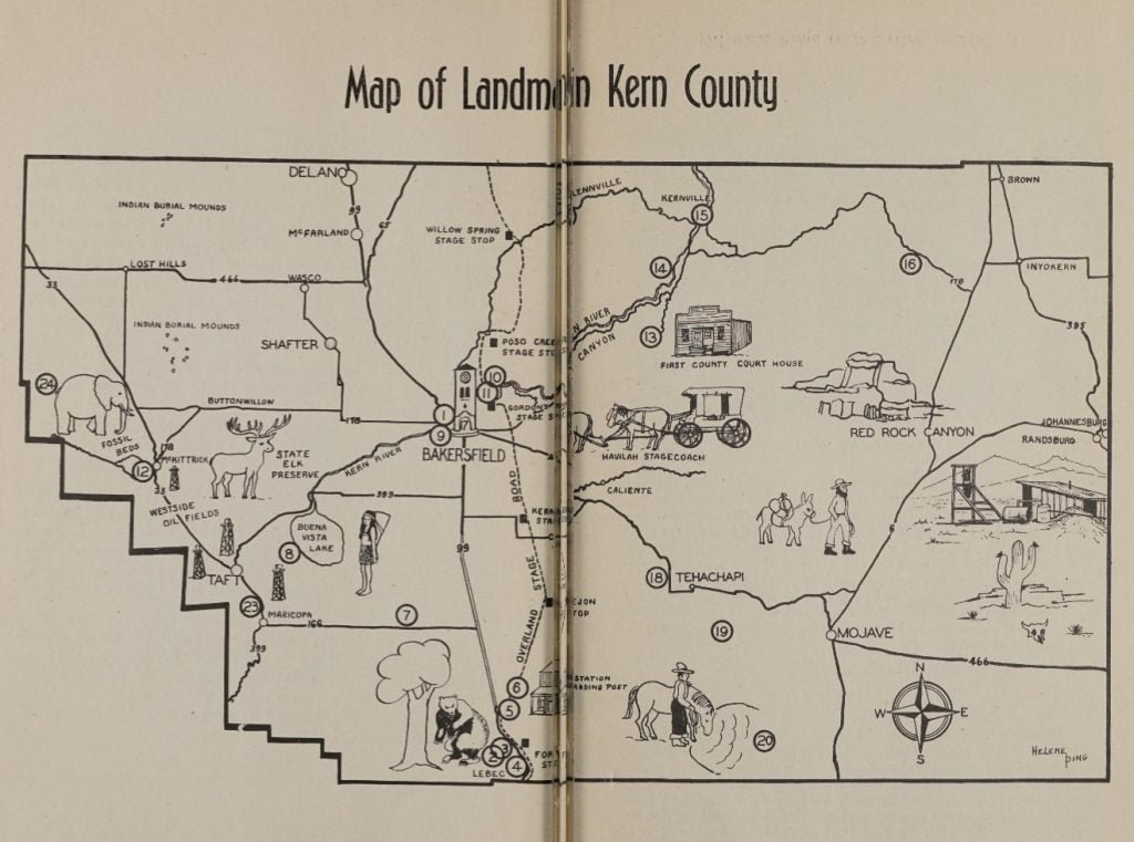
Our Historic County of Kern by Glendon J. Rodgers, published by the Kern County Historical Society in 1949, served as a guide to the landmarks and historical sites within Kern County, California. This second edition, while slightly revised from the original, continued to provide a brief but complete account of the county’s notable landmarks.
The pamphlet acknowledges the support of various individuals and organizations in its creation. Notably, the Kern County Board of Supervisors and the Chamber of Commerce provided initial assistance, while Mr. Frank Latta of the Kern County Museum contributed valuable knowledge and materials. Miss Helene Bing is credited for the illustrated map and landmark placement. Additional contributions were made by Mrs. Georgia Sanders, Dr. P. N. Root, and Mr. Lawrence McClure.
The guide includes a historical map with numbered landmarks, which correspond to descriptions throughout the text. This feature aims to accompany readers in exploring Kern County’s historic sites.
Our Historic County of Kern is structured to offer insights into significant locations such as Fort Tejon, the Peter Lebec Tree, and the Westside Oilfields, among others. The pamphlet is designed to be both informative and accessible, encouraging readers to explore and appreciate the historical landmarks of Kern County.
Table of Contents
Foreword, p. 3
Padre Francisco Garces, p. 5
Fort Tejon, p. 6
Peter Lebec Tree, p. 7
Fages Marker, p. 8
Sebastian Indian Reservation, p. 8
Florafaunium, p. 8
Rose Station, p. 10
Fages-Zalvidea Crossing, p. 10
Yokuts Indian Cemetery, p. 11
Colonial Thomas Baker, p. 13
Historical Map, p. 14-15
Discovery Well, p. 16
Gordon’s Ferry, p. 16
Westside Oilfields, p. 17
Havilah, p. 19
Keysville, p. 20
Kernville, p. 20
Walker’s Pass, p. 21
Beale Memorial Tower, p. 23
Old Town- Tehachapi, p. 24
Oak Creek Pass, p. 25
Desert Mining Area, p. 25
unofficial Landmarks, p. 26
Red Rock Canyon, p. 27
“Passing Dates,” p. 28 – Timeline of history in Kern County

