The memoir of French explorer, René Goulaine de Laudonniére state that the predominate flow of trade in the Lower Southeast in the late 1500s was north-south. Greenstone, gold, ocher, mica, crystals, precious stones and silver that was mined in the Southern Highlands, were traded for salt, shells, grain, skins, furs, colorful clays, dried fish and dyes obtained from lower altitudes. He emphasized that the desire to control the cargos of greenstone and gold from the mountains was the cause of many wars.
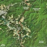
A major trade route passed through Track Rock Gap, but it was not the most important one. The two most important trade routes ran through the Appalachian Valley in northwestern Georgia and the Savannah River Basin – Unicoi Gap – Dillard Gap in northeastern Georgia. These were the only portals through the Southern Highlands that offered a reasonably level passage from one side of the mountains to the other. The major trail paralleled the Savannah River up to the confluence of the Tugaloo and Seneca Rivers. One branch cut westward to the Nacoochee Valley and then northward through the Unicoi Gap to the Hiwassee River. The other branch followed the Tugaloo River northwestward to the nearby source of the Little Tennessee River. It then went through Dillard Gap and followed the Little Tennessee all the way to the Tennessee River.
The Great White Path or Etowah Trail apparently developed after a large town was founded on the Etowah River about 100 BC. Its location is two miles west of Etowah Mounds. The trade route began on the Etowah River near Etowah Mounds and followed the river to its source in Lumpkin County, GA. It then shifted northeastward and followed the base of the Blue Ridge Mountains to the vicinity of Dahlonega, the followed the route of present day U.S. Highway 19-129 over Neels Gap into the Nottely River Valley. The trail then passed over Track Rock Gap before again following the route of U.S. 129 to the Smoky Mountains.
