
Pennsylvania Indian Forts

A commission, appointed in 1893 by Governor Pattison, aimed to assess the importance of marking the historical forts erected by early Pennsylvania settlers against Native Americans before 1783. The committee divided the state into five districts and investigated numerous forts, many of which had been forgotten or unrecognized by the public. Key sites include Fort Augusta, Fort Jenkins, and Fort Muncy, among others. The report emphasizes historical significance and acknowledges contributions from local historians and archeologists in locating these forts.

Mysterious Fort Mountain, Georgia

The stone structures on Fort Mountain, Georgia, likely served as supports for timber palisades. Early settlers encountered a variety of fieldstone constructions, including cairns and enclosures, with possible origins dating back to the Late Archaic or Early Woodland period. While Cherokees attributed their construction to earlier inhabitants, including the Creeks, various legends emerged. Archaeological evidence suggests these sites had ceremonial and potentially military functions, although they lacked the fortification capabilities typically expected. Further research remains necessary to understand their true purpose and historical significance.

16th Century French Exploration of North America

Arx Carolina

Between 1562 and 1763, France established the region known as Florida Françoise, encompassing parts of South Carolina and Georgia, although it notably excluded the St. Johns River Basin. Led by figures like Captain René Goulaine de Laudonniére and Admiral Gaspard de Coligny, French expeditions aimed to claim lands for King Charles IX and provide refuge for Huguenots amidst religious persecution in France. Their efforts included the construction of Charlesfort and Fort Caroline, but conflicts with indigenous tribes and the Spanish ultimately hindered their colonial ambitions.

Fort Hartsuff

Fort Hartsuff, established in 1874 near Ord, Nebraska, aimed to protect Loup Valley settlers from Indian attacks and outlaws. However, its remote location rendered it ineffective. In 1876, treaties were signed with Sioux leaders Red Cloud and Spotted Tail, leading to their relocation to South Dakota reservations. Despite monthly provisions and land grants, the Sioux frequently violated treaty terms. Consequently, the U.S. government sent troops to ensure the security of settlers, encouraging further influx into North Central Nebraska.

Fort Niobrara

In 1879, General Crook selected a site near the Niobrara River for a new fort, leading to the establishment of Fort Niobrara on April 22, 1880, under Major Upham. Initially staffed by three companies of the 5th U.S. Cavalry and one company of the 9th Infantry, the fort’s structures were largely built of adobe and supplied by freighting outfits from Neligh. Abandoned in 1907, one building remains as part of the U.S. Game Preserve, continuing the area’s historical legacy.

The Non-Search for Fort Caroline and a Great Lake

The claim that Fort Caroline was located on the St. Johns River near Jacksonville, Florida, is critically examined in the context of historical maps and descriptions. Most accounts overlook that the Fort Caroline National Memorial is an unverified reproduction, and no artifacts from the French colonial period have been definitively linked to Jacksonville. Descriptions from early explorers suggest an alternate location near the Altamaha River in Georgia, where a significant lake was reported. The article emphasizes that the historical narrative surrounding Fort Caroline may be based on misconceptions reinforced by local interests rather than solid archaeological evidence.

What If’s

The 16th-century colonization efforts by France faced numerous setbacks that transformed potential success into tragedy. Despite well-laid plans, various missteps led to their downfall, including inadequate military support, a lack of necessary supplies, and a series of poor decisions by leaders like Jean Ribault and René Goulaine de Laudonniére. Had the French established stronger defenses, accepted offers for assistance, or managed better alliances with Native Americans, the outcome might have been significantly different, allowing them to resist Spanish encroachment and potentially dominate North America.

Fort San Mateo

The capture of Fort San Mateo by Captain Dominique de Gourgue in 1568 marked a significant retaliation against Spanish forces for earlier massacres of French settlers at Fort Caroline. De Gourgue, aided by Native American allies, attacked the unprepared Spanish garrison, executing its members and leaving a symbolic sign denouncing their actions. Despite initially being honored by the public in France, he faced ostracism from King Charles IX and lived in poverty before eventually being restored to favor. Fort San Mateo was intended as a strategic site for Spanish mission efforts.

Two Massacres at Matanzas

After surviving a shipwreck near St. Augustine, Jean Ribault’s group of about 100 men sought water and aid, only to be captured by Spanish forces under Menéndez. Refusing to convert to Catholicism, they were executed, with an estimated 350 Protestants murdered. A smaller group of survivors escaped into the woods, but those captured faced a similar fate. The fate of many others who sought refuge with the Timucua remains unknown, though some likely integrated into the tribes to avoid Spanish retribution.

Don Pedro Menéndez de Avilés Arrives at Fort Caroline

On September 2, 1565, Don Pedro Menéndez de Avilés led a Spanish fleet to confront the French at Fort Caroline, aiming to oust the heretical colonists. Jean Ribault’s poor strategic decisions weakened the French position, as he left behind most of the soldiers and vital supplies. The Spanish attacked the fort on September 20, overcoming the ill-prepared occupants, primarily non-combatants. Survivors, including men, women, and children, faced captivity, with many executed after refusing to convert to Catholicism.

Jean Ribault Arrives at Fort Caroline

On August 28, 1565, Jean Ribault arrived at Fort Caroline with a fleet of seven ships and 800 colonists. He had returned to France after attempting to gain English support for the fort. Upon arrival, he learned of allegations against de Laudonniére, but after investigation, Ribault deemed him innocent and offered him a position as second-in-command, which de Laudonniére declined. Natives visited to inquire about the new arrivals, and gifts included what was believed to be gold. Ribault soon began to store food supplies awkwardly, raising concerns about security.

Geography Around the Coastal Region of Fort Caroline

Southeast Topographic Map

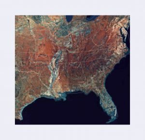
Captain René de Laudonniére’s choice for France’s first permanent colony in North America was influenced by the geography of the Southeast coast. The St. Johns River’s shallow and treacherous mouth deterred colonization attempts during Spanish rule. In contrast, the Altamaha River displayed a more navigable system, complemented by rich farmland in the region. De Laudonniére’s encounters with local tribes further solidified the area’s potential, linking the May River with the Altamaha and suggesting it as a suitable site for establishing a capital for New France.

Where was Fort Caroline?

Fort Caroline’s precise location remains uncertain due to inconsistent historical accounts and maps. Artist depictions and descriptions by René de Laudonnière suggest it was triangular, near navigable water sources. Key historical ports like the Altamaha and Satilla Rivers in Georgia had better conditions for ships than Jacksonville’s shallow St. Johns River, which only became a significant harbor after extensive dredging. Archaeological efforts over a century have yielded no conclusive evidence of Fort Caroline’s site, necessitating further exploration along Georgia’s coast.

Second Voyage Commanded by René Goulaine de Laudonniére

In 1562, Captain Jean Ribault led a French expedition to explore the South Atlantic coast, claiming territory and establishing Charlesfort, which ultimately failed due to starvation and poor leadership. By 1564, René Goulaine de Laudonniére commanded a second expedition to resettle the region, arriving at the mouth of the River May, likely the St. Johns River. Despite his observations on local ecology, Laudonniére faced challenges with hostile natives and lack of essential resources while establishing Fort Caroline, which ultimately became a focal point for future French endeavors in North America.

History of Charlesfort

Charlesfort - Vector Image 1

Charlesfort, established by René Goulaine de Laudonniére, was a triangular earthen fort in South Carolina, primarily built by local Native Americans. It included essential structures like a warehouse, commander’s house, and barracks, but offered little defense against attacks. Relations between the French settlers and Native tribes were initially friendly, but deteriorated due to food shortages and harsh leadership. After a devastating fire, the garrison attempted a perilous return to France, facing starvation and navigational challenges, ultimately leading to their desperate circumstances and eventual rescue.

Unanswered Questions Concerning Charlesfort

Charlesfort - Vector Image 1

Captain René Goulaine de Laudonniére’s brief stay at Charlesfort in 1562 raises questions about the subsequent journeys made by the 28 men left behind. While maps suggest exploration up the Savannah River, there’s no archival evidence confirming such travels. After a fire and food shortages, some men likely sought aid from King Ouede, a local leader. Furthermore, historical records indicate the presence of the Apalache Indians in Georgia’s mountains, though their significance has been largely overlooked by historians concerning French exploration.

The French Colony of Charlesfort

Archaeologists believe they have located Charlesfort on Parris Island, SC, where French artifacts were discovered beneath a Spanish fort. Established in 1562, Charlesfort faced challenges after Ribault’s return to France amidst the French Wars of Religion. A garrison of twenty-eight men struggled with starvation, poor leadership, and a devastating fire that destroyed their supplies. They ultimately built a boat to escape but faced disastrous conditions at sea. The remaining survivors were rescued by English ships before returning to France, but many feared repercussions for their survival tactics.

First Voyage Commanded by Jean Ribault – 1562

On February 15, 1562, France sent Captain Jean Ribault to explore the South Atlantic Coast and establish a colony. This well-planned expedition, supported by the French Crown, aimed to create a major ship-building center in the New World. Arriving around April 15, the expedition identified a geographical landmark called Cape François, likely near Cape Canaveral. On May 1, Ribault reached the River May, possibly the St. Johns River, where he erected a marble column. By May 15, he arrived at Port Royal Sound, SC, establishing a camp on a peninsula.

Western Forts

Fort Phil Kearney, established in 1848, served as a crucial outpost during the Sioux War and was significant for protecting emigrant trains on the California Overland route. It became notorious due to the Kearney Massacre in December 1866, where Colonel Fetterman and his men were overwhelmed by a large force of Sioux warriors. The fort, typical of its era, was abandoned after the Union Pacific Railroad’s arrival and eventually burned by Native Americans. Other forts like Leavenworth, Fetterman, and Bridger followed similar narratives in the turbulent West.

Strongholds of the Past

Cape Breton Island, once the formidable site of Louisburg, stands today as a tranquil bay. This once-great fortress, a colossal effort of French engineering, succumbed to deteriorating conditions and the zeal of New Englanders during the War of the Austrian Succession. After overcoming a garrison weakened by mutiny, Louisburg fell, marking a shift in power dynamics in North America. The story continues with the establishment and eventual downfall of pivotal forts throughout the region, illustrating the ever-changing landscape of colonial conflict.