Agriculture of the Coastal Native Americans

Anthropological literature from Florida is awash with statements that presume the coastal peoples of Georgia and South Carolina were primarily fishermen, hunters and gatherers.  This may have been the case for many ethnic groups in the coastal regions of the Florida Peninsula, but was not true for many areas of the Georgia and South Carolina coast. The primary reason listed by René Goulaine de Laudonniére for not placing a French colony on the coast of the Florida Peninsula was that the soil was infertile and the climate, hot.  On the first voyage he had noticed that the coast was sparsely … Read more

Geography Around the Coastal Region of Fort Caroline

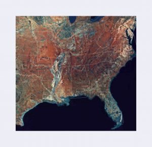
Southeast Topographic Map

To understand why Captain René de Laudonniére would be drawn to either the Satilla, St. Marys or Altamaha Rivers as the location of France’s first permanent colony in North America, one has to first look at the “ground level” geography, i.e. what the officers would have seen from a mile or so out to sea. Maps of the Florida and Georgia coast are included with this article. The mouth of the St. Johns River would appear to be that of small, shallow river flowing through marshes. The outlet of the river was often blocked with dangerous sand bars until it … Read more

Where was Fort Caroline?

A very important historical fact should be considered with evaluating alternative locations for Fort Caroline. The cities of Darien, Brunswick and St. Marys on the Georgia coast were booming ports for many decades before Jacksonville, FL even existed. Their harbors were naturally deep enough to handle sea going vessels.  At that time the St. Johns River was so shallow in places that cattle could be driven across; hence the city’s original name, Cowford. It was only after the U.S. Army Corps of Engineers dredged and widened the St. John River’s outlet that the port of Jacksonville was able to attract … Read more

Second Voyage Commanded by René Goulaine de Laudonniére

In early 1562 the government of France dispatched Captain Jean Ribault with a small fleet to explore the South Atlantic Coast; claim it for the King of France; and identify potential locations for colonies. Ribault brought along with him three stone columns displaying the coat of arms of the King of France.  He placed one of these columns at the mouth of the River May, which contemporary scholars assume to be the St. Johns River.  Ribault’s fleet then sailed northward along the coast, mapping the islands and river outlets, until it reached was is now assumed to be Port Royal … Read more

History of Charlesfort

Charlesfort - Vector Image 1

René Goulaine de Laudonniére described Charlesfort as a simple, triangular earthen fort, reinforced with vertical timbers and bales of faggots (small limbs.)   It contained a fairly large timber-framed warehouse in the center, plus a small house for the commander, a somewhat larger house for the officers and a barracks for the enlisted men.  Much of the construction of the buildings was done by local Natives.  Presumably, these buildings resembled Native American structures of the region. There was also a cooking shed, an outhouse, a covered oven, well and a woodshed. Charlesfort would have given little protection from a warship, a … Read more

Unanswered Questions Concerning Charlesfort

Charlesfort - Vector Image 1

Late 16th and 17th century maps published in France, the Netherlands and Germany stated that Captain René Goulaine de Laudonniére journeyed up what appears to be the Savannah River to the Blue Ridge Mountains in 1562 and claimed the gold-bearing lands for the King of France.  De Laudonniére was only at Charlesfort for less than a month in 1562, before returning to France. He does not mention making any long journeys. However, prior to leaving he was given a gold chain that was made in these mountains. He was also given a chunk of silver ore that supposedly came from … Read more

The French Colony of Charlesfort

South Carolina archaeologists currently believe that they have found the location of Charlesfort on Parris Island, SC, within the U.S. Marine Reservation. The location matches the description of Charlesfort’s landscape, provided by de Laudonniére.  French-made artifacts were found in the lower levels of a fort constructed by the Spanish. The Spanish burned the French fort in 1565, but apparently rebuilt it in 1566. The launch of the first colonial voyage occurred a month before the beginning of the French Wars of Religion.  In March of 1562, troops employed by the Duke of Guise massacred an unarmed Huguenot congregation inside their … Read more

Where were Cape François and the May River?

Scholars have long assumed that Cape François was either present day Cape Canaveral They have also assumed that the May River was the St. Johns River.  However, the distances between these points and Beaufort, SC (Port Royal Sound) don’t seem to correlate with the time that French fleet spent to travel. De Laudonniére’s memoirs state that the fleet sailed directly from Cape François to the outlet of the May River in two weeks.  They spent two weeks more exploring a series of islands and rivers between the May River and Port Royal. They stopped to explore inlets and rivers. Late … Read more

First Voyage Commanded by Jean Ribault – 1562

On February 15, 1562 the government of France dispatched Captain Jean Ribault with a small fleet to explore the South Atlantic Coast, claim it for the King of France, and identify potential locations for colonies. Unlike colonial expeditions sponsored by Spain and England in that century, the French expedition was extremely well planned, at least on paper. It was financed by the French Crown, whereas Spanish and English colonial attempts were privately capitalized.  The members of the expedition included all skills necessary to survive in the New World, including carpenters and ship builders. Admiral de Cologny intended French Florida to … Read more

The Inland Route to the Fort Ticonderoga

My reasons in favor of the mouth of the Salmon River as the point of departure for the interior are as follows: First. It is the southernmost and last point on the lake in the direct line of travel between Stony Point and the foot of Oneida Lake. The mouth of Salmon Creek lies west of that line, requiring a detour that would increase the travel without affording any corresponding advantage. Second. The mouth of Salmon River-the Otihatangué of the early French maps -has always been a noted place in Indian history. It is mentioned on the oldest Ms. maps … Read more

The Starting Point of the Expedition on Lake Ontario

The narrative states that the expedition descended what is now known as Trent River, which empties into Lake Ontario, and after short days’ journeys, reached the border of Lake Ontario. It then proceeds. I give the original French, as Champlain’s works are quite rare, and copy from the edition of 1619, modernizing the old French orthography: “où etans, nous fimes la traverse en l’un des bouts, tirant a. l’orient, qui est l’entrée de la grande rivière St. Laurens, par la hauteur de quarante-trois degrés de latitude, où it y a de belles iles fort grandes en ce passage.” Where then … Read more

The Landing on the South Shore

I suggested in my article that the expedition probably landed in the secluded cove now known as Henderson Bay, sheltered by Stony Point. Not that the text or map of Champlain indicates that, or any other particular place with any certainty, but First. Because it appeared a convenient and appropriate locality. It did not seem probable that Champlain, accompanied by so large an army, would boldly land on an enemy’s shore, exposed to observation for twenty miles in two directions, with scarcely a hope of successfully concealing the canoes, which were so essential for his return voyage. Second. Because Henderson … Read more

1822 Congressional Report on Indian Affairs

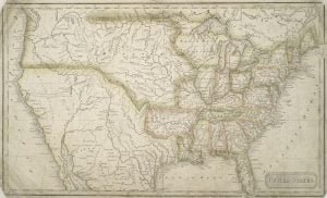
1824 Map by Jebediah Morse

Jedediah Morse’s 1822 report to Congress of his travels through Indian Territory on behalf of the office of Secretary of War – Jedediah was tasked by a resolution of Congress to report of his travels amongst the tribes throughout the United States. Acknowledging that he did not visit all of the tribes, and that he relied on known facts and materials for the body of text he provided, Jedediah presented a large collection of tabular data and descriptive content. This data was then used by Congress to shape it’s policies as it dealt with expansion further west, and specifically tribal relations.

The Route Across the Lake

If I am right in fixing the starting point opposite Point Pleasant, it would follow, both from the text and the map, that the route extended southerly, between that point and Amherst Island, to the False Ducks, and along the Main Duck, Gallo, and Stony Islands, which stretch across the lake in the direction of Stony Point. That this was the course pursued may be inferred from the following considerations: First. On examining the Champlain map, the line indicating the route starts from the northern shore of the lake, and passes directly south between Point Pleasant and the first island … Read more

Reply to Dr. Shea and General Clark

The first number of this magazine (Jan., 1877) contains an article on the Expedition of Champlain against the Onondagas, in 1615. It was founded on a communication read before the New York Historical Society in March 1849, in which I had discussed the evidences, which exist as to the route of the expedition, and the site of the Iroquois fort, which it besieged. My position having been questioned by several eminent historians, who claimed a more western location for the fort, the main object of my last article was to fortify my former conclusions. In it I endeavored to trace … Read more

The Location of the Fort Ticonderoga

It is utterly impossible, from the Champlain text and map, aided by the best modern charts, and an accurate knowledge of the country, to establish, with any certainty, the exact position of the Iroquois fort. The location which I suggested was on or near Onondaga Lake, 4 leagues or 10 miles from the great Iroquois fishery at the foot of Oneida Lake. The limits of this article forbid my presenting at this time my reasons for this conclusion I will therefore confine myself to an examination of General Clark’s position. He locates the fort on Nichols Pond, in the north-east … Read more

Jesuit Doblon’s traveled the Route Twice

It may be interesting, in this connection, to compare Champlain’s statements with those of the Jesuit Dablon, who traveled twice over the same route in 1655 and 1656, under much more favorable circumstances for correctly estimating the distances. He informs us that, in company with Father Chaumonot, he left Montreal on the 7th day of October, 1655, for the Onondaga country, and reached ” Otihatangue” (the mouth of Salmon river) by canoe on the 29th of the same month. That he landed the next day, and prepared to go on foot to Onondaga. That on the first day of November, … Read more

The March on the Beach

Champlain says: ” Les sauvages cachèrent tous leurs canaux dans les bois, proche du rivage. Nous fimes par terre quelques quatre lieuës sur une plage de sable, ou je remarquai un pays fort agreable et beau, traversé de plusieurs petits ruisseaux, et deux petites rivières, qui se dechargent au susdit lac, et force etangs et prairies.” ” The Indians concealed all their canoes in the woods near the shore. We proceeded by land about four leagues over a sandy beach, where I observed a very agreeable and beautiful country, intersected by many small brooks and two small rivers which empty … Read more