Custer County Oklahoma Cemeteries
A complete list of available online transcriptions and gravestone photos for Custer County Oklahoma cemeteries.
Up to 1851, the immense uninhabited plains east of the Rocky Mountains were admitted to be Indian Territory, and numerous tribes roamed from Texas and Mexico to the Northern boundary of the United States. Then came the discovery of gold in California, drawing a tide of emigration across this wide reservation, and it became necessary, by treaty with the Indians, to secure a broad highway to the Pacific shore. By these treaties the Indians were restricted to certain limits, but with the privilege of ranging, for hunting purposes, over the belt thus re-reserved as a route of travel.
One of the best known, and since the death of the renowned Kit Carson, probably the most reliable guide on the Western frontier, is William Cody, otherwise known as “Buffalo Bill.” His exploits have been the theme of a dozen novelists, and in the year just past (1870-72) his movements have been as accurately and …
William Cody – “Buffalo Bill” His Life and Adventures – Indian Wars Read More »
Dr. O. G. Libby, of University, N. D., and Dr. A. B. Stout, of the New York Botanical Garden, who ten years ago examined this old Cheyenne village site on the Sheyenne River, most kindly consent that I should announce the results of their work there; and Dr. Melvin R. Gilmore, Curator of the Historical …
Explanation of Plot of Cheyenne Village Site on Sheyenne River – Tributary of Red River Read More »
Information as to the region occupied by the Cheyenne in early days is limited and for the most part traditional. Some ethnologists declare that Indian tradition has no historical value, but other students of Indians decline to assent to this dictum. If it is to be accepted we can know little of the Cheyenne until they …
Researchers who believe they are descended from the Cheyenne will be limited in their research to the amount of records available which provide specific names, and even further, those records which provide proof of relationships. The first source for Cheyenne genealogy should be the Free US Indian Census Schedules 1885-1940 as they cover the years of …
Otter Creek flows north into Montana out of the highlands in Wyoming and empties into the Tongue River at Ashland. Capt. Calvin Howes developed one of the earliest ranches on Otter Creek. He arrived in Montana in the early 1880’s and established the Circle Bar O Ranch on the lower Powder River. In 1884, Captain …
In January 1881, all of the Northern Cheyenne that were sent to Fort Keogh were eventually allowed to move south and take homesteads near the Tongue River and on Rosebud and Muddy Creeks under the Indian Homestead Act of 1875. However, in 1900, the Northern Cheyenne families were removed or agreed to move under duress …
On the night of November 28, 1864, about seven hundred and fifty men, cavalry and artillery, were marching eastward across the plains below Fort Lyon. There was a bitter, determined look on their hard-set features that betokened ill for some one. For five days they had been marching, from Bijou Basin, about one hundred and …
It is equally certain that the desire of punishing these Indians was increased, with loyal people, by the belief that their hostility was produced by Southern emissaries. How far their hostility was so produced will never be definitely known, but there was reason for the belief, without doubt. Soon after the beginning of the war …
But were the Cheyennes responsible for all this? Quite as much so as any of the tribes. They began stealing stock early in the spring, and, on April 13, a herdsman for Irving, Jackmann, & Co. reported that the Cheyennes and Arapahoes had run off sixty head of oxen and a dozen mules and horses …
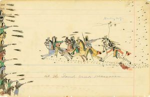
Were the Cheyenne Responsible for the Sand Creek Massacre? Read More »
In 1856, eight years after our last look at the eastern edge of the Mountain country, there had not been much alteration in its appearance in the matter of settlements. There still remained the two pueblos on the Arkansas, one at the mouth of the Fontaine Que Bouille, the present city of Pueblo, Colorado, and …
It would be interesting to know who were the occupants of the Pike’s Peak region during prehistoric times. Were its inhabitants always nomadic Indians? We know that semi-civilized peoples inhabited southwestern Colorado and New Mexico in prehistoric times, who undoubtedly had lived there ages before they were driven into cliff dwellings and communal houses by …
Third session, Thursday morning, October 17 Rev. Frank Wright, a Choctaw Indian, was introduced as the next speaker. Rev. Frank Wright. With the Choctaws the land question is, When shall we get hold of our land? All we want is the land. We were the first of the five tribes to agree to take it …
Amusements and gambling are represented in collections by many curious devices. Adults rarely played for amusement, leaving such pastime to children; they themselves played for stakes. Most American games are more widely distributed than many other cultural traits; but a few seem almost entirely peculiar to the Plains. A game in which a forked anchor-like …
Oklahoma Land Patents – Cheyenne Tribe
Colorado Land Patents – Cheyenne Tribe
Articles of agreement and convention made and concluded at Fort Wise, in the Territory of Kansas, on the eighteenth day of February, in the year of our Lord one thousand eight hundred and sixty-one, by and between Albert G. Boone and F. B. Culver, commissioners on the part of the United States, and the following …
Articles of a treaty made and concluded at Fort Laramie, Dakota Territory, on the tenth day of May, in the year of our Lord one thousand eight hundred and sixty-eight, by and between the undersigned commissioners on the part of the United States, and the undersigned chiefs and head-men of and representing the Northern Cheyenne …
Articles of a treaty and agreement made and entered into at the Council Camp on Medicine Lodge Creek, seventy miles south of Fort Larned, in the State of Kansas, on the twenty-eighth day of October, eighteen hundred and sixty-seven, by and between the United States of America, represented by its commissioners duly appointed thereto, to …