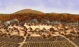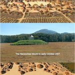
One of Georgias most beloved landmarks, the Nacoochee Mound, has a fascinating history
For generations of Georgians, and now the endless line of Floridians seeking cool nights, the Nacoochee Mound has announced to passersby that they are REALLY in the mountains. It is the gateway to Helen, GA a tiny lumber mill hamlet that was remade into an alpine village and now is an international tourist attraction. One senses that mankind has been in the Nacoochee Valley a long, long time. It has that feeling of a place with history. Its true history will surprise you.
There is a Georgia State Historical Marker that informs tourists that the Nacoochee Mound was built by the Cherokee Indians; was the Cherokee town of Guasile; was visited by Hernando de Soto in 1541, and was excavated by archaeologists from the Heye Foundation in 1915.
The only statement on the marker that is true, is about the Heye Foundation. Those archaeologists specifically stated that the mound was built by ancestors of the Creek Indians no Cherokee artifacts were uncovered. Guasile was actually spelled Guaxile in the chronicles of the de Soto Expedition. However, it is a Creek word, meaning Southerners. Guaxile was probably either in modern day Franklin or Cullowhee, North Carolina.. It is highly unlikely that de Soto passed through the Nacoochee Valley. There is a strong possibility, however, that Spanish explorer Juan Pardo passed through the valley.
Meanings of the Native American place names in the Nacoochee Valley

There is a Georgia State historical marker in the Nacoochee Valley that explains that Nacoochee was a beautiful Cherokee princess, who fell in love with a handsome Chickasaw brave named Saute. Because the two tribes were at war, the Cherokee elders refused to let Nacoochee marry Saute. Therefore, both lovers jumped off the cliffs of Yonah Mountain!
Most tourists assume the historical marker is factual because it has the Great Seal of Georgia on it. Most scholars assume that every detail of the story is hogwash, because everyone knows that the Chickasaws lived 300 miles east of the Cherokees.
Native American scholars have studied early colonial maps. To their complete shock, the area immediately east and south of the Nacoochee Valley (in Habersham and White Counties) was occupied by CHICKASAWs until the American Revolution. The area southeast of the Nacoochee Valley (in Stephens County was occupied by APALACHEE & YUCHI Indians until the American Revolution. Immediately south of the Chickasaws (in Hall County) were CATAWBA Indian villages. The words Nacoochee and Saute have nothing to do with star-crossed lovers.
The original name of the town around the mound was Nokose the Creek Indian word for bear, which is pronounced n?-koo-she. The Cherokees pronounced the word, n?-gu-chee. The earliest European settlers wrote down the Nacoochee. They did not know that only a few decades before, Creek Indians had occupied the valley. Therefore, they assumed that the word, Nacoochee, was a Cherokee word, whose meaning had been lost.
Chattahoochee is a Hitchiti-Creek word which means Red River. When the Alabama Creeks were forced to relocate to the Indian Territory (Oklahoma) they named the largest river in their territory, the Red River.
The village of Saute gets its name from the Sawate branch of the Creeks, who spoke the Hitchiti-Creek Language, The word in English means Raccoon People. Raccoon People, who spoke the Muskogee-Creek language called the place, Sawakee.
The Soque River gets its name from the Soque People of northwestern South Carolina and northeast Georgia. They were probably related to the Zoque (Olmecs) of Mexico, since they had the same physical appearance and practiced many Mesoamerican customs. The Soque were one of the most powerful ethnic groups in the region until the late 1600s, when they were decimated by plagues and slave raids sponsored by the Colony of Virginia. The survivors allied themselves either to the Creeks or the Cherokees. Many of their descendants live today among the Snowbird Cherokees of Graham County, NC.
The unusual geology of the Nacoochee Valley

The Chattahoochee River bursts out of the Blue Ridge Mountains at Unicoi Gap, and then races down the steep slopes to a few hundred yards north of the Nacoochee Mound. There is abruptly turns east and enters the fertile Nacoochee Valley. About ¼ mile into the valley, the river flows past the feet of an ancient volcano, now known as Yonah Mountain. Yonah is the Cherokee word for bear, The Chattahoochee flows gently through the Nacoochee Valley for about five miles before turning abruptly southeast and dropping into a geological rift (crack in the earth) created by an ancient fault line that runs from Hot Springs, NC to Columbus, GA.
A chain of volcanoes during the age of dinosaurs deposited gold and several types of semi-precious stones on the mountains. However, the altitude of Georgias mountains at that time was so high, that most animals could not survive. It is estimated that the peeks reached to the same height as the Himalayas too cold for dinosaurs! Over the eons since then, the gold has washed down the sloped of the mountains and been deposited in alluvial sands, The ancestors of the Creek Indians knew about gold, but thought it too soft to be a practical metal for weapons and tools. A copper allow, similar to brass, was their preferred metal for both practical and artistic objects. Europeans, though, esteemed gold far beyond its practical usage. Because they did not corrode, gold and silver were the preferred media of exchange in commerce. It was only after the arrival of Europeans that the Nacoochee Valley itself, was esteemed for anything more than a beautiful place to live and a key corridor for regional trade.
Early history of the Nacoochee Valley

For millions of years, the Nacoochee Valley was a favorite grazing area for large mammals. By 10,000 BC or earlier humans had arrived in the valley to hunt. When the big game animals became extinct, small bands of humans occupied the valley and lived off hunting a variety of animals, gathering wild vegetables, roots, fruits and nuts. Groups of bands gathered certain times of year on the river to fish and harvest freshwater mussels. This pattern of seasonal migration continued until about 2000 years ago.
The Southern Highlands is one of five regions in the world where agriculture began independently. Wild squash, sunflowers and Jerusalem artichoke were three of the earliest indigenous plants to be domesticated around 3500 BC. They still grow wild in the vicinity of the Nacoochee Valley. By around 400 BC extensive regional trade routes intersected in the Nacoochee Valley and the residential population began to grow. The people of the valley raised a variety of vegetables in gardens, but much of their nutrition was still obtained directly from the surrounding forests, meadows and rivers. They did begin to build small mounds as burial grounds and landmarks for seasonal gatherings of families. In the period between 0 AD and 600 AD the people adapted the pottery styles and cultural traditions of what we call now the Swift Creek Culture. Several more dome-shaped mounds were built during this era. The potters of the Swift Creek Culture produced beautiful pottery by stamping ornate designs on the wet clay with carved wooden paddles.
The number and size of villages collapsed after 500 AD. It is theorized that raiders from the Caribbean Sea or Yucatan Peninsula began making slave raids on the towns that could be reached directly from the ocean. Much of Georgias Coastal Plain became nearly uninhabited in a very short time. Simultaneously, the bow and arrow was introduced to the region, which made warfare more deadly, while the introduction of Mexican crops such as corn and beans made farming more productive.
