
Alabama Land Cessions Map
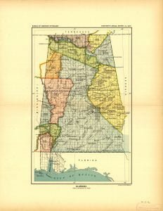
The Alabama Land Cessions map, created by A. Hoen Company in 1896, documents 16 specific land cessions made through treaties and agreements between the United States and various Native American tribes prior to that year. It serves as a reference for Charles C. Royce’s compilation of Indian land cessions across the U.S., providing insights into historical land negotiations involving the Choctaws, Cherokees, and Chickasaws. Each cession is linked to treaties, detailing boundaries and land relinquishments throughout Alabama.