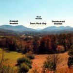
During the earliest part of this Paleo-Indians period, an ice sheet covered the portion of North America above the Ohio River. Brasstown Bald probably had a permanent ice cap, while permafrost characterized its upper elevations. No evidence of glaciers has been found. The valleys around Brasstown Bald would have been similar in appearance to those near the mountains of New England and Southern Quebec today.
This Late Sub-Boreal Period evolved into an Isothermal Period in which northern and southern plant species grew in proximity. Vegetation grew throughout much of the year. This made possible the large mega-fauna populations. Around 10,000 years ago, the climate became sub-borial again then began a steady warming trend. When the permafrost melted, massive landslides occurred, which filled the valleys with soil from the tops of the mountains.
It is known that at the beginning of this period, large mammals such as mastodons, giant sloths, giant elks, giant bison, sabertooth cats, etc. roamed the river valleys of the region. Their fossils were found in Ladds Cave in Cartersville, GA. Mastodon teeth have been found in several valleys of northern Georgia. By 9,000 BC all the megafauna species in the region had disappeared.
No Paleo-Indian Period occupation sites within a 50 mile range of Track Rock Gap have been professionally studied. Artifacts associated with this period, principally Clovis and Dalton points, have been discovered in the region. It is impossible to discern any particular ethnic association with these artifacts. No skeletal remains from this time have been found in Georgia.
Archaic Period (c. 8,000 BC – c. 1000 BC)
The climate steadily warmed until by around 6,000 BC it became similar to that today. Perhaps the only difference from today in the vegetation would have been the presence of balsam fir and red spruce trees on Brasstown Bald and the preponderance of chestnut trees in the other forests. Chestnuts composed almost half the trees in the Georgia Mountains until the late 20th century, when they were wiped out by a European blight.
Early Archaic (c. 8,000 – c. 6,000 BC): Very few artifacts dating from the Early Archaic Period have been found in the Georgia Mountains. Stone weapons and tools from the period beginning around 6,000 are a bit more common, but apparently the human population was not significant. It is quite possible that throughout the Early and Middle Archaic Periods, extended families or tribal bands only entered the more mountainous regions to harvest nuts and wild blueberries, or hunt deer and bear.
Middle Archaic (c. 6,000 BC – c. 3,500 BC): Beginning around 3,500 BC humans in river valleys of the Georgia Mountains began domesticating some indigenous plants. People began to congregate seasonally at shoals on the rivers where fresh water mussels were abundant. The earliest mounds in the region developed as detritus and shell accumulated at the seasonal occupation sites.
The surface rocks of Brasstown Bald Mountain and Track Rock Gap are primarily soapstone. The oldest known soapstone bowl found in Georgia dated from around 2,200 BC. However, this is after the oldest known pottery in Georgia, which apparently was the first place in North America that pottery was made. It is quite likely that soapstone cookware and ornaments were made much earlier in the mountains.
Late Archaic (c. 3,500 BC – c. 1,000 BC): Major cultural changes began appearing in the Southern Highlands during this period, especially after around 1,600 AD. Gardens made more sedentary villages possible. Perhaps people rotated from permanent village sites seasonally. Pottery became increasingly abundant, even though many other regions of the continent did not even have pottery. Regional trade developed. Minerals such as quartz crystals, rubies, mica and red ocher from the Southern Highlands were found in Late Archaic settlement sites in other parts of Eastern North America. Seashells and ocean salt were traded to the mountains.
The ethnic composition of the Georgia Mountains during the latter half of the Late Archaic Period remains a major unanswered question. The Yuchi Indians claim to be the aboriginal people of the Southern Highlands and also linked to the Duck River Culture in central Tennessee and Adena Culture in the Ohio Valley. However, some of the petroglyphic boulders found at Track Rock Gap, plus other petroglyphic boulders found along trade routes east, southeast, south and southwest of Brasstown Bald Mountain are very similar to those found in County Kerry on the southeastern tip of Ireland. The Reinhardt Petroglyphic Boulder, found on a cliff overlooking the Upper Etowah River, is virtually identical to a boulder located on the Dingle Peninsula in County Kerry.
The Dingle Peninsula petroglyphs have been dated to the Bronze Age (c. 1,600 BC – 500 BC.) A possible cultural connection between the Georgia Mountains and Bronze Age Ireland is especially intriguing because the original occupants of Ireland were black haired, bronze skinned and according to Celtic tradition had faces very different that the Celtic invaders. The word “Kerry” is an Anglicization of the Gaelic word for “dark skinned.”
County Kerry was the last location where the aboriginal Irish lived. According to tradition they were expert sailors, who one day sailed away from Ireland to escape the Celtic newcomers.
Some Canadian anthropologists have theorized that American Indians once occupied the North Atlantic rim and shared a Pan-North Atlantic Culture. There is extensive artifact and architectural evidence for this theory in Canada. Great stone circle ceremonial sites existed for at least 500 years in Canada before they appeared in the British Isles.
Woodland Period (c. 1000 BC – c. 900 AD)
Early Woodland Period (c. 1,000 BC – c. 100 BC): The Early Woodland peoples living near Brasstown Bald Mountain were not significantly different, culturally, than the Late Archaic peoples. They may or may not have been the same ethnic groups.
During this period, villages became increasingly permanent, pottery became increasingly sophisticated, agriculture provided an increasing proportion of nutrition and artistic items became increasingly prevalent. Some of the earliest permanent agricultural villages appeared in the Etowah River Valley, southwest of Brasstown Bald, around 400 BC. It is quite possible that the same culture appeared in the river valleys immediately around Brasstown Bald, but its environs have not been so thoroughly studied by archaeologists as the Etowah Valley. The petroglyphs that look so similar to those of southwestern Ireland may date from the Early Woodland Period.
Middle Woodland Period (c. 100 BC – c. 750 AD): Around 200 BC a small, permanent town with a pyramidal platform mound began developing on the Chattahoochee River, southwest of Atlanta. About a hundred years later, a much larger town, with large platform mounds, began developing on the Etowah River, about two miles southwest of the better known Etowah Mounds in Cartersville. The Etowah River site is known today as Leake Mounds. Pottery styles associated with the Leake Mounds town site has been found at village sites along rivers on all sides of Brasstown Bald. These include the Cartersville and Swift Creek types of ceramics.
The appearance of permanent towns with pyramidal mounds probably marks the arrival of the first Muskogeans to northern Georgia. From 100 BC forward there is a steady evolution of ceramic and artistic styles to the Colonial Period when branches of the Creek Indians occupied the region.
The town at Leak Mounds cultivated crops on a large scale, but apparently did not grow maize (Indian corn) or beans. Some varieties of squash are indigenous to the Southern Highlands. Sunflowers were cultivated and it is likely that a domestic sweet potato was a staple crop.
About 600 AD, the time that the public buildings in Teotihuacan, Mexico were burned, the population of the Iarge towns with mounds in Georgia began dropping. By 750 AD all of the large towns had been abandoned. In contrast, the Swift Creek Culture of southern Georgia appears to have moved northward into the mountains of Georgia and North Carolina. The Swift Creek Culture thrived in northeast Georgia and western North Carolina as late as 1000 AD.
Late Woodland Period (c. 750 AD – c. 1000 AD):
After 750 AD all of the major Middle Woodland Period town sites in the Georgia Piedmont and Coastal Plain were abandoned. This was time when the bow & arrow came into general use, and more productive varieties of maize from Mexico and Central America were being adapted to the temperate climate of the Southeast’s interior.
Napier Culture
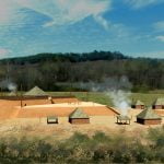
A new culture appeared in the Georgia Piedmont, central Georgia Mountains and western North Carolina that archaeologists label the Napier Culture. It was typified by a stamped pottery composed of Mesoamerican geometric motifs and large five-sided platform mounds. The largest Napier mounds were in the Nacoochee Valley, immediately southeast of Brasstown Bald (Kenimer Mounds) and near Gainesville, GA in the Blue Ridge Foothills (Summerour Mounds.) Therefore, it is presumed that the Napier Culture originated in that region of Georgia. However, Napier Culture villages have been found as far south as the Macon, GA Metropolitan Area.
The Napier Culture people built five-sided mounds like those of the Itza Mayas in southern Mexico. However, to date, archaeologists have not found evidence of large towns being associated with these mounds until after 1250 AD, when the Etowah town site was influencing a large region of the Southeast. The Napier Culture people did grow corn, beans and squash, but not at the large scale of later Southeastern towns.
The Loubser Report discussed archaeological evidence around Cullowhee, NC in detail and labeled these sites as being Cherokee. That in turn was used as justification for labeling Track Rock Gap’s pottery as being proto-Cherokee. In fact, even though Cullowhee is 56 miles northeast of Track Rock Gap, archaeological excavations conducted by North Carolina state archaeologist, David Wood, at village and mound sites in the city of Cullowhee, found the early ceramics to be primarily Napier. Later occupation of these sites also produced typical Georgia styles of pottery such as Etowah I, Etowah II and Lamar. Since the late 20th century, however, North Carolina archeologists have labeled Etowah and Lamar Culture pottery as being “Pisgah” and ancestral to the Cherokees, but it is very similar to the pottery in the Georgia Mountains, which is known to have been produced by the Creek’s ancestors.
See Further: Salvage Archaeology at the Cullowhee Valley School, Cullowhee, Jackson County, SC
Woodstock Culture
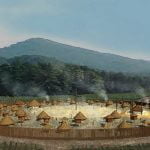
Around 900 AD a new culture appeared briefly along a corridor in the Georgia Mountains and western North Carolina. It has been labeled the Woodstock Culture after an archaeological site in Woodstock, GA. Most of the Woodstock towns are located within the Georgia gold-bearing lands. The greatest concentration of Woodstock towns is along the Etowah River in the Georgia Mountains and Foothills.
Woodstock ceramics are less ornate than Swift Creek or Napier pottery. Woodstock towns consisted of rectangular houses encircling a plaza that were protected by timber palisades. Until that time, towns in Georgia were not fortified. This defensive architecture suggests that warfare became endemic during the tail end of the Late Woodland Period.
In recent years, North Carolina archaeologists have labeled Woodstock and Napier pottery on their side of the state line as being produced by the “Late Connestee Culture.” The purpose was to make their Late Woodland pottery appear to be ancestral to the Cherokees. However, Conestee is an Itsate Creek Indian word meaning “Skunk People.”
In 2008 the North Carolina Museum of History opened a new exhibit entitled “People of One Fire: 4000 years of Cherokee Pottery.” The exhibit claimed that the Cherokees “invented” Swift Creek pottery. The museum did not mention that the ancient Stallings pottery in the exhibit came from central Georgia; that Swift Creek flows through Macon, GA: and that “People of One Fire” is the original name of the Creek Indian Confederacy.
Southeastern Ceremonial Culture
Anthropologists often label the fluorescence of Native American societies in the Southeastern United States, the Mississippian Culture. This term might be relevant to the Mississippi Valley, but not at all to Florida, Georgia and western North Carolina. The traditional artistic motifs associated with the “Mississippian” Culture appeared in the Lake Okeechobee Region of southern Florida several hundred years before they appeared in the Mississippi Valley. The Ocmulgee site in central Georgia contained “Mississippian” mounds and “Mississippian” houses about 150 years before they appeared at the town of Cahokia on the Mississippi River.
Ocmulgee Culture
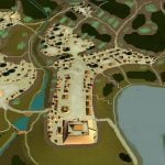
Newcomers appeared at Fall Line of the Ocmulgee and Chattahoochee Rivers in Georgia around 900 AD. At the Ocmulgee River location, they leveled a terrace overlooking the river and began construction of a large town with Mesoamerican cultural traits, such as three diameter ceramic trays for drying salt brine. They made a utilitarian style of ceramics that was almost identical to Maya Commoner Redware. They also introduced the Mesoamerican calendar, which begins on the Winter Solstice. Ocmulgee’s principal temple mound was oriented to the sunset on the Winter Solstice. Prior to that time, major mounds in Georgia usually faced the southeast . . . the sunrise of the Spring Equinox.
The Ocmulgee town site was 132 miles from the ocean. The Maya salt trading city of Waka was on a terrace at the fall line of a river, 132 miles from the Caribbean Sea. It was permanently abandoned about 10-20 years before Ocmulgee was founded. There was a Creek village named Waka in the vicinity of the Ocmulgee site, when English traders first entered the region.
Around 925 AD, the Ocmulgee newcomers built a trading post on Hiwassee Island in Tennessee. To date, archaeologists have not found evidence of the presence of Ocmulgee type artifacts in the Georgia Mountains. Hiwassee Island is 183 miles north of the Ocmulgee town site. That great town was, in turn, 183 miles north of the nearest edge of the Gulf of Mexico on Apalachicola Bay.
The style of pottery produced at Ocmulgee involved the forming of a dark, gritty clay body. The finished forms were then painted with a bright red clay. Some pottery pieces were tempered with crushed mussel or sea shells. Inclusion of the shells made it possible to vitrify the clay into ceramic ware at lower temperatures. Maya Commoner Redware was almost identical, but its potsherds are so endemic in the suburbs of Maya cities, that it is seldom even discussed at Maya Culture specialists.
The Ocmulgee or Maya Commoner Redware is seldom found in the Piedmont of Georgia, outside of the trading towns established at the Fall Lines of the Ocmulgee and Chattahoochee Rivers. However, it is quite common around Brasstown Bald in the Georgia and North Carolina Mountains. Both Napier and Redware potshards were found in the terrace fill soil of a test pit at Track Rock Gap. Johannes Loubser labeled these potsherds as being “Cherokee,” but dated them to a period spanning 750 AD to 1000 AD.
Etowah I Culture (c. 1000 AD – c. 1200 AD)

Around 990 AD villages were founded on the Etowah River in northwest Georgia and two miles south of the acropolis of Ocmulgee which produced a different style of pottery than typical of Ocmulgee. Both villages were built inside horseshoe bends of rivers. The people who settled these villages, seemed to be a continuation of the Swift Creek Culture traditions, but their architecture was very different. The occupants of these villages lived in rectangular houses, unlike the round Swift Creek houses. Unlike Ocmulgee’s acropolis, they did not initially build large mounds. They did grow corn, beans and squash at a large scale. The settlement on the Etowah River was probably called E-tula or Tula – Archaic Itsate for “big town” and “town.”
By around 1100 AD, Etowah I mounds were being constructed at regular intervals along a trade route that ran from Etowah Mounds in northwest Georgia to the Smoky Mountains in North Carolina. Only one Etowah I mound still stands in form and height similar to its original condition. It is the Tallulah Mound on US 129 in Graham County, NC. The mound is a square pyramid that apparently was only 10 to 15 high, but had a sufficiently wide surface to support several buildings. The mound’s ramp is attached to the southwest face, which is oriented to the sunset of the Winter Solstice.
There is a continuous ceramic, architectural and cultural connection between the Etowah I communities and the modern day Creek Indians. In that Etowah I pottery styles clearly evolved from Swift Creek pottery styles, it can be logically assumed that this continuum reaches back to the Swift Creek Culture.
Etowah I villages, mounds and ceramics can be found as far north as Graham County, NC in the Great Smoky Mountains and the upper French Broad River Basin near Hendersonville, NC – about 25 miles southeast of Asheville. In 1991 USFS archaeologist Jack Wynn reported in his book, The Mississippian Archaeology of Northern Georgia, that there was a relatively dense Etowah I population along the rivers in the vicinity of Brasstown Bald Mountain, both in Georgia and North Carolina. Some Etowah I sites in the Southern Highlands were not reoccupied until the Lamar Period that began around 1400 AD in the mountains.
Track Rock Terrace Complex (c. 1000 AD)

The single test pit dug in a Track Rock agricultural terrace revealed that the first layer of fill soil had been applied around 1018 AD. However, this does not mean that the site was first occupied around 1000 AD. A single test pit in a archaeological zone covering over a half square mile cannot be used as absolute finding. Loubser did mention finding Napier, Woodstock and Redware potshards in the fill soil, along with charcoal. The charcoal provided the radiocarbon date, but Napier ceramics were produced as early as c. 750 AD, perhaps earlier. Loubser mentioned the possible age of the Napier ware.
The presence of charcoal and potshards in the fill soil at Track Rock is highly significant. Charles Mann in his best-selling book, 1491, emphasized the importance of charcoal and potsherds being added to sterile Amazonian soil to make it fertile. Spanish and Portuguese speaker call this improved soil, tierra preta. The presence of tierra preta in a terrace complex in the Georgia Mountains adds further evidence to the ethnicity of its builders being immigrants from the south.
The year, 1014 AD, has special significance in geological history. In that year a large meteor or comet struck the North Atlantic Ocean. It caused massive tsunamis on both the shores of Europe and North America. Many thousands of people were killed in Europe. A chain of islands that formerly lay off the coast of North Carolina, were destroyed. The Outer Banks is the residue of those islands.
See: Catastrophic Natural Disasters
Nacoochee Valley

In 1916, archaeologists with the Heye Foundation excavated the Nacoochee Mound in the Nacoochee Valley, southeast of Brasstown Bald Mountain. At the ground level and in the oldest layers of the mound, the archaeologists discovered 32 stone box graves. Stone box graves are sarcophagi, which have been lined on all sides with flagstones.
At that time, there was no technology available for dating skeletons. However, the pottery found with oldest graves is similar to Etowah I – Early Phase ceramics. Much of the pottery was decorated with single bar ladder based motifs. This appears to be an evolution of Napier style pottery.
Stonebox Grave Culture
Many cemeteries and low mounds, containing stone box graves have been found in the Upper Southeast and Midwest. Their greatest concentration is on the Cumberland River near Nashville, TN. They are typically associated with Early and Middle Mississippian sites. The Maya Commoners almost always buried their dead in stone box graves. Often these graves were adjacent to the deceased house or under the floor of his/her house.
Construction stopped on the acropolis at Ocmulgee around 1150 AD. Most of the satellite towns continued occupation. Achese, on the horseshoe bend two miles south of the acropolis, began to expand more rapidly.
Etowah II Period (c. 1250 AD – c. 1375 AD)
A massive rainstorm or perhaps even a hurricane swept through Georgia around 1200 AD. The Ocmulgee River cut through the horseshoe bend where Achese was located. The Etowah River cut through the horseshoe bend where E-tula was located. Archaeologists typically state that the town was abandoned for 50 years. However, not being from the Etowah Valley, they are not aware that the owners of the land south of the Etowah River did not want to sell their property to the State of Georgia in the 1950s, and therefore bulldozed several mounds.
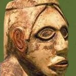
In the past decade the portion of Etowah Mounds on the south side of the river has been subdivided. Some new owners have allowed access to their property by archaeologists. Apparently, the portion of the town on the southside was equally as large. Occupation may have continued there, as long as the south side was swampy.
In his book on the Mississippian archaeology of the Georgia Mountains, Jack Wynn stated that many of the Etowah I town sites in the vicinity of Brasstown Mountain, stayed abandoned during the Etowah II Period. At least, there was no mound construction. Meanwhile, the population in and around Etowah Mounds exploded. Many satellite towns with single mounds were founded. It is not known what was happening at Track Rock Gap, but apparently it remained occupied.
The Etowah II Period in northern Georgia represents one of the highest levels of artistic sophistication achieved by North America’s indigenous peoples. The capitals artisans were skilled at sculpture of stone, ceramics and wood, copper work, weaving and architecture. The principal mounds in each town of this culture were five sided and oriented to the sunset of the Winter Solstice. This orientation indicates that they were using the Maya calendar, which begins on the Winter Solstice.
Around 1300 AD, newcomers were allowed by the leaders of E-tula (Etowah) to settle at the confluence of the Coosawattee and Conasauga Rivers in northwest Georgia. They called themselves the Kvse, which pronounced “Kaushee” and means “Forested Mountains” in Itza Maya.
Lamar Culture (c. 1375 AD – 1650 AD)
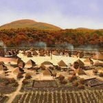
A major political change swept through Georgia during the late 1300s. Currently, it is not clear whether it was a revolution against the elite classes of provinces, a new religion, or imperialism. No more large mounds were built. New temple mounds faced the east or west, not the southeast azimuth of the Winter Solstice. This is when the current Creek calendar and the celebration of Poskita began. Those two customs were introduced into the Lower Southeast at some time after 1250 AD by the Tamauli (Tamatli,) when their homeland, Tamaulipas, was overrun by Chichimec barbarians.
A remnant population of Tamauli refugees still lives in Chiapas State, Mexico. They have become cultural mixed with the Cho’ti Mayas, but are still the only indigenous people in Mexico who eat corn on the cob, begin their new year on the Summer Solstice, and celebrate the Green Corn Festival.
Artifacts and architecture, associated with the Lamar Culture can be found in the northern 2/3 of Georgia, western North Carolina, western and southern South Carolina, southeastern Tennessee and eastern Alabama. The cultural practices are directly ancestral to the Creek Indians. The Muskogee Creek Confederacy began forming during the latter part of the Lamar Period.
Lamar Culture ceramics are a continuation of proto-Creek styles, but are highly refined in form and construction. Crushed mussel shells were used to “mass produce” utilitarian wares, but clay bodies requiring higher temperatures were utilized for prestigious ceramics.
Archaeologist Jack Wynn believed that the indigenous population swelled in the Brasstown Bald Mountain area during the Lamar Period. Several village sites with Etowah I occupations on the Nottely, Hiwassee and Chattahoochee Rivers were re-occupied during the Lamar Period. This was a time when the Kvse (Coosa) dominated a massive province that stretched from present day Knoxville, TN to Childersburg, AL. Much of the construction of the Nacoochee Mound occurred during this time. A survey of the site in 2006 by the LAMAR Institute delineated a large village that probably contained over 500 inhabitants. Less is known about the mounds in the Upper Nottely and Hiwassee Valleys because they were severely reduced by 19th century agricultural activities.
Kashita
The Migration Legend of the Kashita People provides specific geographical and ethnic information that can be matched to known town sites and rivers in the Southern Highlands. Their migration into Georgia occurred at some point in time between 1400 AD and probably about 1675 AD. After arriving in northwest Georgia, the Kashita first dwelled among the Kvse (Coosa.) They then traveled up the Tennessee River Valley and then up the Talasee (Little Tennessee River.) They dwelled among the Talasee Creeks for a short time then headed south, crossing two rivers. At that time, the Talasee lived on the Little Tennessee River immediately west of the current Tennessee-North Carolina line. The main body of Talasee left the region in the early 1700s, while some stayed and joined the Cherokee Alliance.
The Kashita journeyed to a recently abandoned town at the intersection of what is most likely the Hiwassee River with the Great White Path. This Native town was probably the one where Downtown Murphy, NC is located. The Great White Path is now US 19-29-129. They were at the boundary of a powerful province dominated by a great town on the side of a mountain. The mountain was described as being the tallest in that area. Drumming sounds could be heard from the top of the mountain.
The German translator of the original English translation of the original Creek words, stated that the Kashita called the great town on the side of a mountain, Miramel. The text does not say what the occupants called their town. Miramel is very close to a Creek adjective that refers to a waving of a flag or a pulsating sound.
The Kashita asked the leaders of the great town to give them food. They refused. The Kashita then claim to have sacked the town and killed everyone but two men and a white dog. They then traveled southward to some lower mountains where the Palache lived. The Palache gave them food and sanctuary. Every since then, the Palache and Kashita have been close friends. At the time that the Migration Legend was presented to the colonial leaders of Georgia, the Palache or Palachicola had relocated to southeast Georgia, west of the Savannah River.
Palache is the Creek word for Biloxi. Actually, Biloxi is the French mispronunciation of Palache. Obviously, the main body of Biloxi Indians was in the Georgia Mountains, and the small Biloxi village on the Gulf Coast of Mississippi was a break-away band or trading post.
The Palache (or Biloxi) are believed to have been Siouans, whose culture and language had been significantly altered by a Muskogean elite. Apalache and Palache are very similar words. They were obviously the same people.
European Contact Period
(1521 AD – 1674 AD)
Spanish explorers began making contact with Georgia’s and South Carolina’s natives in 1521. Already diseases were beginning to spread from the coast to the interior. There is little doubt that European explorers send crewmen to gather water, fuel and food on the coast on many occasions that are not documented in government archives. Most surviving documents were from government sponsored expeditions to explore the Southeast or establish colonies.
Narvaez Expedition: The first mention of the Apalache Indians was in a report submitted by one of the survivors of the Narvaez Expedition (1527-1528) – Álvar Núñez Cabeza de Vaca, Alonso del Castillo Maldonado, Andrés Dorantes de Carranza, and his enslaved Moor Estevanico. The colonizing expedition originally included over 600 men. The survivors made their way to Mexico over a 10 year period. In 1542 Álvar Núñez Cabeza de Vaca submitted is “Relacion” (notarized report) to the king. He stated that when the expedition was searching for food at villages on Tampa Bay, the natives mentioned that the Apalache, who lived far to the north, had plenty of food and much gold.
The Spanish assumed that the indigenous people living in northwest Florida were the only Apalache. That label continued throughout the existence of the Province of Florida. That presumption continues today with Florida academicians. The problem is that the Muskogean ethnic group, Apalachicola, could have been the ones referred to. Apalachicola means “Apalache People” in the Lower Creek language. It gets more complicated. There were Florida Apalachee villages named Apalachen and Apalache, but the province did not call itself Apalache.
Hernando de Soto Expedition: In 1540, when Hernando de Soto’s Expedition was departing what the Spanish called the Province Apalache, he asked the natives where he could find large cities and gold. They told him that far to the north in the mountains lived the Apalache. The capital of the Apalache was named Yupaha. There was much gold in Yupaha.
The 1939 De Soto Trail Commission placed de Soto’s route through the northern edge of Georgia. However, late 20th century scholars
After the survivors of the de Soto Expedition returned to Spain, European maps began placing the label Apalache both in the mountains and in northwestern Florida. That practice continued to the end of the Yamassee War in 1717, when the new Cherokee Alliance had conquered most of western North Carolina.
René Goulaine de Laudonniére: The first direct contacts between the indigenous people of the Georgia Mountains and Europeans occurred in 1564 and 1565. Captain René Goulaine de Laudonniére dispatched several expeditions from Fort Caroline up the Altamaha River to the Oconee River and Blue Ridge Mountains.
The Mountain Apalachee lived in the Blue Ridge Mountains. The French traders returned with gold, greenstone, feathers, copper and silver art. De Laudonniére planned to build the capital of New France on the Oconee River, somewhere near present day Athens, GA. He named the Southern mountains, Les Apalachiens, in the Apalachee’s honor. The Apalachee River is a tributary of the Oconee River, west of Athens. However, his garrison was massacred by the Spanish in September of 1565.
De Laudonniére stated that the Apalache controlled the distribution of valuable commodities mined in the mountains. He also mentioned another powerful province in northeastern Georgia that controlled exports of commodities from the mountains. He called them the Houstanaula. They are obviously the same Chickasaw-speaking people, who were called the Ustanauli in the 1700s. The Ustanauli eventually moved to northwest Georgia and then to western Tennessee.
Juan Pardo Expedition 1567-1568): The chronicles of the Juan Pardo mentions the names of several villages which were known to have been in northeast Georgia or adjacent areas of North Carolina. These include Nukase (Nokase ~ Nacoochee Valley,) Echoe, Kauche, Tokele (Tugaloo,) and Kanasee (Quanasee.) Since he was traveling to Kusa from South Carolina, it is only logical that he passed through the Georgia Mountains. However, a team of North Carolina anthropologists and historians have created an alternative route which arches an additional 400 miles to pass through the northern North Carolina Mountains and northeastern Tennessee. The chronicler makes no mention of the Apalache or Palache.
Pedro Moreles and Nicholas Burgiognon: These two former residents of Santa Elena, SC confirmed the existence of both the Apalache Indians and a great city on side of a mountain that was rich with gold. Under oath they stated that between 1566 and 1587, several Spaniards made expeditions to the Apalache to trade for gold. The Apalache were involved with mining of gold from streams, using large river cane tubes to separate the sand from the gold. The Apalache also acted as middlemen for other valuable commodities that could be obtained from the Georgia and North Carolina Mountains.
The Apalache were described by Moreles and Burgiongnon as being vassals of a mysterious, powerful people living in a great city that was hidden in the mountains north of where the Apalache. This city was called Grande Copal (Great Copal) by the Spanish. The Apalache refused to tell the Spanish where the city was. Several Spaniards had died trying to find it. This statement might explain the discovery of 16th Spanish weapons and breastplates at several locations south of Blood Mountain and Brasstown Bald Mountain. De Soto Falls gets its name from the Spanish armor found there.
Thus, we can be certain that the Track Rock Terrace Complex was occupied until at least the 1580s. A terrible plague swept through the Southern Highlands around 1585 which caused the abandonment of both Etowah Mounds and the capital of Kusa. This may be the time period, when the Track Rock terraces were abandoned.
French maps: French maps from the late 1600s and early 1700s provide much more detailed ethnic information about the Southern Highlands than was available from the English and Spanish. During this period, the French dispatched parties of surveyors, civil engineers and traders up all the rivers that flowed out of the west and southern sides of the Southern Highlands.
The first French maps show the Southern Highlands occupied by the Apalache. Notes on the maps state in Latin that the “Apalachien” mountains contain gold and silver . . . and that they were claimed for the King of France by René Goulaine de Laudonniére in 1562. The “Houstanaula” Indians were shown to occupy the mountains and foothills of extreme northeastern Georgia. The region south of the mountains was labeled “Mayacoa,” which means “Maya People” in several dialects of coastal South Carolina and Georgia.
After French expeditions went up the Tennessee River and its tributaries in the early 1690s, other ethnic groups appeared on French maps. The Little Tennessee River in North Carolina was occupied (as one travels eastward) by the Talasee Creeks, Tuskegee Creeks and Shawnee. The Hiwasee River Basin and more northerly Georgia Mountains were occupied by the Apalache. The Conchakee occupied the Etowah River Basin all the way to its source near Dahlonega, GA. These maps contain a note that the Spanish call the Conchakee, the Apalachicola Indians. The same maps showed the remainder of northwestern Georgia and southeastern to be occupied by the Cousheta. Cousheta is the French word for the Kusa (or Upper) Creeks. The Cohuita (Koweta) Creeks controlled the upper and middle Chattahoochee Valley. The Okonee Creeks controlled northeastern Georgia.
Until 1718 French maps showed the headwaters of the Tennessee River occupied by the Abeika (Apeke.) Heading downstream were the Tuskegee, Tali, Caskenampo (Koasati,) Hogeloge (Yuchi) and Cousheta (Upper Creeks.) At that time, a French fort and trading post was located on Hiwassee Island, TN.
Until 1720, official British maps showed southwestern Virginia, the northeastern tip of Tennessee, northwestern North Carolina and southeastern Kentucky occupied by the Rickohocken Indians. Official British maps of the Carolinas during that period showed the Sara (Cheraw,) Keowa, Saluda (Shawnee) and Tamasee Indians occupying the southern face of the Blue Ridge Mountains and the Upper Piedmont. If the maps extended into the mountains, they showed the Southern Highlands occupied by the Apalachee.
Some sketched maps by Carolina traders, that were made in the first two decades of the 1700s do place the ethnic label, Chorakees, around the headwaters of the Savannah River. The tribes of western North Carolina are labeled Apalachee and “allies of the Chorakees.” Chorakee means “splinter group in the Muskogee-Creek language.
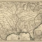
In 1718 a map by Guiliame DeLisle was the first European map to identify the Cherokee Indians. Labeled the “Charaqui,” they were shown to occupy the lands formerly labeled “Rickohocken” and also the headwaters of the Savannah River. The Apalachee no longer occupied the Hiwasee River Valley in North Carolina. They and the Yuchi were driven out of the region by a people that would soon be known as the Valley Cherokees. The Apalachees continued to be on the Apalachee River, a tributary of the Oconee River in northeast Georgia, and along the Upper Savannah River. The displaced Hogeloge-Yuchi’s now lived along the Savannah River and Upper Oconee River.
All French maps continued to show the same occupants of northwestern and north-central Georgia until 1763. The Cousheta occupied Coosawattee River Basin northward. The Conchagui occupied the Etowah River Basin. The Cohuita Creeks occupied the mountains east of the Great Appalachian Valley. Later, English draftsmen Anglicized the label on these mountains to be Cohuta. Thus, the Cohutta Mountains’ name is not derived from a Cherokee word, but rather is from the French name for the Koweta-Creek Indians.
English maps after 1763: France lost all of the Province of Louisiana in the French and Indian War. Thus, from 1764 onward, British maps are the only reliable source for ethnic information. Apparently, most of the Conchaqui (Apalachicola) left NW Georgia in 1764. They moved to the Pensacola Bay area. From 1764 to 1780 all British maps showed the Upper Creeks controlling all of the northwest and north-central mountains of Georgia. The Coweta Creeks controlled most of northeast Georgia during that period. The Cherokees controlled the northeast corner of the province. Brasstown Bald Mountain was the western boundary. Yonah Mountain, south of the Nacoochee Valley, was the southern boundary. British maps show only 3 to 5 Cherokee villages in this area. They were all destroyed by the Koweta Creeks in 1754. From 1755 to 1785, the Koweta Creeks controlled almost all of northeast Georgia.
Territorial changes by the United States: In 1785 the United States government gave all of northern Georgia from north of Yonah Mountain to the Cherokees for hunting territory. The Creeks were given most of Alabama in compensation. In 1793 the Cherokees and the United States signed another treaty which allowed the Cherokees to move the bulk of their population into northern Georgia. Massive Cherokee migration had already occurred though. Nevertheless, it can be safely assumed that no Cherokees occupied Track Rock Gap prior to 1785. In 1838, all Cherokees were theoretically removed from northern Georgia. Some Cherokees managed to hide out, while many more remained because they were married to white men.
