The Natural History of Ocmulgee Bottoms
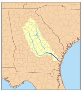
Ocmulgee Bottoms is a corridor of the Ocmulgee River Flood Plain in the central region of the State of Georgia that begins at the Fall Line in Macon, GA and continues 38 miles southward to near Hawkinsville, GA. This region is located in Bibb, Twiggs, Houston, Bleckley and Pulaski Counties. The Ocmulgee River’s velocity slows dramatically upon entering the Bottoms and has a serpentine channel. Over the eons, the river here has meandered frequently across the breath of the flood plain, leaving hundreds of ponds and swamps, plus a deep layer of rich, alluvial soil. On top of the alluvial soil is from one to ten feet or red clay that was deposited during the period when cotton was cultivated in the Piedmont, upstream.


