The Education of Indian Females and Intermarriages Between Indian and White People

I connect these subjects, because, in contemplating the latter, the former should be kept in view. While Indians remain in their present state, the minds of civilized people must revolt at the idea of intermarrying with them. It is natural, and decent, that it should be so. Intermarriages, however, in the present state of the Indians, or, that which amounts to the same thing, have taken place to a great extent, and this too by many men of respectable talents and standing in society. More than half the Cherokee nation, a large part of the Choctaws and Chickasaws, and I … Read more

Persons and Character of Indians

Indians, generally, are about the size of the white people. The Osage, and some other tribes, who are of remarkable height, and fine figure, are exceptions to this remark. In these respects they exceed any equally large body of white people known among us. In the shape of their limbs, and their erect form, Indians have evidently the advantage over the whites. Some, whom I have seen, would be perfect models for the sculptor. Instances of deformity are rare. In bodily strength they are inferior to the whites; as b true of all savages; civilized man being always superior in … Read more

The Nature of the Indian Titles to Their Lands

The relation which the Indians sustain to the government of the United States is peculiar in its nature. Their independence, their rights, their title to the soil which they occupy, are all imperfect in their kind. Each tribe possesses many of the attributes of independence and sovereignty. They have their own forms of government, appoint their own rulers, in their own way, make their own laws, have their own customs and religion, and, without control, declare war and make peace, and regulate all other of their civil, religious and social affairs. The disposal of their lands is always done by … Read more

Increase of Indians within the Extended Limits of the United States

By the treaty with Spain, of 1819, the Territory of the United States is extended from the Atlantic, to the Pacific Ocean j and a host of Indian tribes, in consequence, has been brought within our national limits. Many of these tribes, in point of numbers, rank among the largest in our country. These tribes are shut up within their present continually narrowing limits. They can migrate neither to the north, nor to the south; neither to the east, nor to the west. The cold and barren region, spreading from our northern boundary, in lat. 49 north, to the Frozen … Read more

An Act to Provide for the Allotment of Lands, Approved, February, 8, 1887

Section I. Be it enacted by the Senate and House of Representatives of the United States of America in Congress assembled, That in all cases where any tribe or band of Indians has been, or shall hereafter be, located upon any reservation created for their use, either by treaty stipulation or by virtue of an act of Congress or executive order setting apart the same for their use, the President of the United States be, and he hereby is, authorized, whenever in his opinion any reservation or any part thereof of such Indians is advantageous for agricultural and grazing purposes, … Read more

16th Century French Exploration of North America

Arx Carolina

An AccessGenealogy Exclusive: Richard Thornton’s study of the Sixteenth Century French Exploration of North America – replete with maps and images – Much of the research in this report was drawn from two books by former Congressman Charles Bennett of Florida, which were interpolated with the author’s personal knowledge of Georgia coast – while fishing, canoeing, sailing and camping in the region between Darien, GA and Jacksonville, FL. The author was born in Waycross, GA, is a Creek Indian and is an expert on Muskogean culture. The first book by Bennett, Three Voyages, translated the memoirs of Captain René Goulaine de Laudonniére. The second book by Bennett, De Laudonniére and Fort Caroline, translated the memoirs and letters by other members of the French colonizing expeditions. These books are supplemented by the English translation of Jacques Le Moyne’s illustrated book, Brevis narratio eorum quae in Florida Americai provincia Gallis acciderunt,” Le Moyne was the official artist of the Fort Caroline Colony, and one of the few who survived its massacre by the Spanish.

Historical Maps of Southeast United States

1.  1550 – Dutch map of the Western Hemisphere This map shows the accurate description of the shape of the Florida Peninsula before the late 1600s.  Later maps described its shape as being triangular.  Even though the survivors of the de Soto Expedition returned to Mexico City in 1543, this map does not show any information about the interior.  Note that Japan (Zimpango) is shown off the coast of North America.     2. 1562 – French map of the Western Hemisphere This map contains many of the rivers along the coast of North America and the Gulf Coast, but … Read more

The Non-Search for Fort Caroline and a Great Lake

Most history books and online encyclopedia sources state unequivocally that Fort Caroline was built on the St. Johns River in present day Jacksonville.  They state that the May River named by de Laudonniére, was the same as the San Juan (St. Johns) River named by the Spanish. Virtually none of the articles tell you that Fort Caroline National Memorial is a reproduction of what some people “think” the fort looked like, constructed at a location that was good for tourism.  No artifacts have been found in the Jacksonville area that can be definitely tied to French colonial activities in the … Read more

What If’s

An incredible series of “things gone bad” turned the 16th century colonization efforts of the French government into a tragic disaster.  French efforts were far better planned than their Spanish or English counterparts in the 16th century.  At the start, France seem destined to be the dominant power in North America.  If any one of many decisions had been made differently, the French Colony may have succeeded.  Here are some of the “what if’s.” If Jean Ribault and René Goulaine de Laudonniére had brought along a couple of fishing boats from Brittany on their voyages, the colonists would have had … Read more

Florida Françoise

The Kingdom of France continued to claim the region between the Santee River in present day South Carolina and the St. Marys River in present day Georgia until the Treaty of Paris in 1763, when ceded all its territory in North America to Great Britain. Most European maps, except those of Great Britain labeled this “wannabe” province Florida Françoise.  However, France did not officially participate in any further colonization efforts in the region after 1565.  It is important to note that France never claimed the St. Johns River Basin and always on its official maps, labeled the Altamaha River as … Read more

Fort San Mateo

Don Pedro Menéndez de Avilés simultaneously built fortifications in Saint Augustine Bay and at La Florida’s planned capital of St. Elena on Parris Island, SC. Next he repaired and strengthened Fort Caroline, renaming it Fort San Mateo.  Efforts were made by the Spanish in 1566 to bribe Indian tribes within the interior of Florida to turn over the Frenchmen, who avoided execution in 1765.  Apparently, the Natives could not be bribed. Fort San Mateo was to be the center of a planned mission system run by the Jesuits. The excellent harbor near Fort Mateo was to be a place where … Read more

Two Massacres at Matanzas

Survivors of Jean Ribault’s fleet staggered onto the beach south of St. Augustine with nothing but their torn clothes.  Eventually, the castaways clustered into two groups. One, numbering about a hundred were under the command of Ribault.  A smaller group came together on a beach farther south.  Neither group had food or water.  Apparently, none knew how to catch fish in tidal pools or which coastal plants were edible. Ribault’s party staggered northward in search of potable water.  Eventually, the desperate men encountered a small search party dispatched by Menéndez to look for survivors of the French fleet.  Ribault assumed … Read more

Don Pedro Menéndez de Avilés Arrives at Fort Caroline

One September 2, 1565, just after Ribault had sailed in three of his small ships to Fort Caroline, six large Spanish ships appeared at the entrance to the May River.  It was the force commanded by Don Pedro Menéndez de Avilés that the king of Spain had ordered to drive out the heretic French colonists.    The Frenchman, who had elected to stay behind at Charlesfort had been captured by the Spanish.  He had told the Spanish approximately where the other colony was located. Many of the tribes may have been in cahoots with the Spanish, not knowing that the Spanish … Read more

Jean Ribault Arrives at Fort Caroline

On August 28, 1565 the two ships at Fort Caroline’s dock prepared to hoist anchors and sail for France.  Then sails were seen on the horizon.  It was Jean Ribault’s large fleet of at least seven ships, carrying 800 colonists.  Ribault had finally returned to France from England in June of 1565.  While in England he had almost been successful in convincing Queen Elizabeth to send a English colonists to Fort Caroline. Those colonists, who returned to France after the fort was constructed, told authorities that de Laudonniére was a tyrannical commander, who would resist militarily any attempt by other … Read more

Early Explorers in the Interior Coastal Region

La Roche Ferriére is our primary candidate for making direct contact with the gold-mining Indians of northern Georgia. The native peoples on the coast specifically told de Laudonniére that the most valuable export products from the mountains (to them) were the polished stone wedges used for splitting trees.  Greenstone does not exist in either Florida or southern Georgia. A small party that de Laudonniére trusted sailed up the Georgia coast to the province of King Oueda. Oueda still thought fondly of the Frenchmen.  He sent them food supplies and invited them to relocate their colony in his province. Pierre Gambie, … Read more

Gold, Silver, Copper and Greenstone

In many sections of his book, René Goulaine de Laudonniére discussed being given or seeing gold chains, gold sheets, gold nuggets, slabs of silver and silver ore.  The valuable metals were always in the possession of the provincial leaders or town chiefs.  Both at Charlesfort and Fort Caroline, the former owners of the gold and silver consistently stated that these precious commodities came from the mountains to the north.   This is exactly what the Natives in the Florida Panhandle told members of the de Soto Expedition and South Carolina Natives told Spanish Captain Juan Pardo in 1567. By late 1564 … Read more

Ethnicity and Political Divisions of Coastal Tribes

Ribault - Jacques le Moyne

In recent years, several anthropologists have criticized the paintings of French Huguenot artist Jacques le Moyne because “the Indians look like they are from Brazil.”  That is exactly what the indigenous linguistics recorded by René de Laudonniére on the South Atlantic Coast suggest.  Most of these ethnic groups were not Muskogeans.  Most used a political title for king associated with the Moche culture; parcusi or paracusa.  Some worshiped a sun god named Toya like the Calusas.  Others spoke languages that contained Arawak elements.  South American anthropologists currently believe that the Arawaks originated in either the northern Amazon Basin or the … Read more

Agriculture of the Coastal Native Americans

Anthropological literature from Florida is awash with statements that presume the coastal peoples of Georgia and South Carolina were primarily fishermen, hunters and gatherers.  This may have been the case for many ethnic groups in the coastal regions of the Florida Peninsula, but was not true for many areas of the Georgia and South Carolina coast. The primary reason listed by René Goulaine de Laudonniére for not placing a French colony on the coast of the Florida Peninsula was that the soil was infertile and the climate, hot.  On the first voyage he had noticed that the coast was sparsely … Read more

Geography Around the Coastal Region of Fort Caroline

Southeast Topographic Map

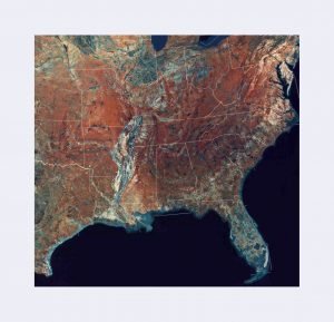
To understand why Captain René de Laudonniére would be drawn to either the Satilla, St. Marys or Altamaha Rivers as the location of France’s first permanent colony in North America, one has to first look at the “ground level” geography, i.e. what the officers would have seen from a mile or so out to sea. Maps of the Florida and Georgia coast are included with this article. The mouth of the St. Johns River would appear to be that of small, shallow river flowing through marshes. The outlet of the river was often blocked with dangerous sand bars until it … Read more

Where was Fort Caroline?

A very important historical fact should be considered with evaluating alternative locations for Fort Caroline. The cities of Darien, Brunswick and St. Marys on the Georgia coast were booming ports for many decades before Jacksonville, FL even existed. Their harbors were naturally deep enough to handle sea going vessels.  At that time the St. Johns River was so shallow in places that cattle could be driven across; hence the city’s original name, Cowford. It was only after the U.S. Army Corps of Engineers dredged and widened the St. John River’s outlet that the port of Jacksonville was able to attract … Read more