Second Voyage Commanded by René Goulaine de Laudonniére

In early 1562 the government of France dispatched Captain Jean Ribault with a small fleet to explore the South Atlantic Coast; claim it for the King of France; and identify potential locations for colonies. Ribault brought along with him three stone columns displaying the coat of arms of the King of France.  He placed one of these columns at the mouth of the River May, which contemporary scholars assume to be the St. Johns River.  Ribault’s fleet then sailed northward along the coast, mapping the islands and river outlets, until it reached was is now assumed to be Port Royal … Read more

History of Charlesfort

Charlesfort - Vector Image 1

René Goulaine de Laudonniére described Charlesfort as a simple, triangular earthen fort, reinforced with vertical timbers and bales of faggots (small limbs.)   It contained a fairly large timber-framed warehouse in the center, plus a small house for the commander, a somewhat larger house for the officers and a barracks for the enlisted men.  Much of the construction of the buildings was done by local Natives.  Presumably, these buildings resembled Native American structures of the region. There was also a cooking shed, an outhouse, a covered oven, well and a woodshed. Charlesfort would have given little protection from a warship, a … Read more

Unanswered Questions Concerning Charlesfort

Charlesfort - Vector Image 1

Late 16th and 17th century maps published in France, the Netherlands and Germany stated that Captain René Goulaine de Laudonniére journeyed up what appears to be the Savannah River to the Blue Ridge Mountains in 1562 and claimed the gold-bearing lands for the King of France.  De Laudonniére was only at Charlesfort for less than a month in 1562, before returning to France. He does not mention making any long journeys. However, prior to leaving he was given a gold chain that was made in these mountains. He was also given a chunk of silver ore that supposedly came from … Read more

The French Colony of Charlesfort

South Carolina archaeologists currently believe that they have found the location of Charlesfort on Parris Island, SC, within the U.S. Marine Reservation. The location matches the description of Charlesfort’s landscape, provided by de Laudonniére.  French-made artifacts were found in the lower levels of a fort constructed by the Spanish. The Spanish burned the French fort in 1565, but apparently rebuilt it in 1566. The launch of the first colonial voyage occurred a month before the beginning of the French Wars of Religion.  In March of 1562, troops employed by the Duke of Guise massacred an unarmed Huguenot congregation inside their … Read more

Where were Cape François and the May River?

Scholars have long assumed that Cape François was either present day Cape Canaveral They have also assumed that the May River was the St. Johns River.  However, the distances between these points and Beaufort, SC (Port Royal Sound) don’t seem to correlate with the time that French fleet spent to travel. De Laudonniére’s memoirs state that the fleet sailed directly from Cape François to the outlet of the May River in two weeks.  They spent two weeks more exploring a series of islands and rivers between the May River and Port Royal. They stopped to explore inlets and rivers. Late … Read more

First Voyage Commanded by Jean Ribault – 1562

On February 15, 1562 the government of France dispatched Captain Jean Ribault with a small fleet to explore the South Atlantic Coast, claim it for the King of France, and identify potential locations for colonies. Unlike colonial expeditions sponsored by Spain and England in that century, the French expedition was extremely well planned, at least on paper. It was financed by the French Crown, whereas Spanish and English colonial attempts were privately capitalized.  The members of the expedition included all skills necessary to survive in the New World, including carpenters and ship builders. Admiral de Cologny intended French Florida to … Read more

Strongholds of the Past

The tourist on the coast of Cape Breton Island, Nova Scotia- for in summer hundreds of people seek out this pleasant land for its cheerful climate – may come upon a little bay on the easternmost verge of the land where is a deep landlocked inlet protected from elemental fury by a long rocky arm thrust out from the shore into the sea. He will not be able to surmise from the present aspect of his surroundings that this was the site of mighty Louisburg, the greatest artificial stronghold (Quebec being largely a work of nature) that the French ever … Read more

Historic and Quaint Forts of North America

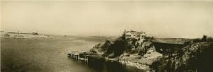
Panorama of Newport Harbor

Historic and Quaint Forts of North America. An account of the most famous fortifications of North America is, in realty, a cross section of the military history of the continent; and whatever ingenuity there may be in this method of presenting the conspicuous deeds of valor of the American people will, it may be hoped, add interest to the following pages.

Forts Trumbull and Griswold

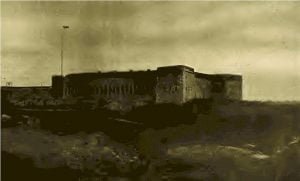
Fort Trumbull, New London

The sunny waters of the Thames at New London, Connecticut, present a smiling aspect, and from the high flagstaff of trig little Fort Trumbull the stars and stripes float gaily. Across the river on the hill above the little town of Groton is the State reservation containing the remains of Fort Griswold, with rough zigzag paths approaching the summit of the hill. Adjacent to Fort Griswold is the stone monument which commemorates the Fort Griswold massacre. Many sunny years will not wipe out the memory of the bloody deeds of that violent hour. Fort Trumbull is situated one mile from … Read more

Dakota Territory Frontier Forts Prior to 1902

Hale, Fort, Dakota – On Missouri River, at the Lower Brule Agency. Lower Brule Agency, Fort at Dakota – Fort Hale. Powder River Fort on Dakota – Fort Phil Kearny. Sully Fort, Dakota – On Missouri River, 5 miles above mouth of Cheyenne R and the new Fort Sully, 20 miles below mouth of Cheyenne River.

Narrative of Richard Lee Mason in the Pioneer West, 1819

In the late fall and early winter of the year 1819 Dr. Richard Lee Mason made a journey from Philadelphia to Illinois, through Pennsylvania, Ohio, Kentucky and Indiana. Some of his adventures were remarkable, and these, together with his observations on the country, the towns and the people whom he encountered, were recorded in a diary kept by him, which is now in the possession of his only surviving child, a daughter, who resides in Jacksonville, Ill. Dr. Mason was a remarkably intelligent observer, and his record of the people whom he encountered in Illinois more than three-quarters of a … Read more

Understanding the 1790 Census Questions

Due to it’s early nature the 1790 census provides the littlest of “meat” for the genealogist as it only names the head of the household and provides a range of ages for all other occupants of the house . The content of the census directly indicates the name of the head of household, and the location of the family, but indirectly can be used to direct future research.

United States Census Guide

The most popular use of the census is to trace family history. No other source matches the census record’s ability to place people in a certain place at a certain time or to provide such a detailed picture of lives and lifestyles at given intervals. The promise of that picture, and of seeing it clearly, keeps researchers going against all odds. Few, if any, records reveal as many details about individuals and families as do the U.S. federal censuses. The population schedules are successive “snapshots” of Americans that depict where and how they were living at particular periods in the … Read more