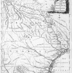
The 1779 map of Georgia remains unattributed to a specific cartographer, but it has considerable similarities to a map published just one year later by Bew, called A new and accurate map of the chief parts of south Carolina and Georgia.
Native American Research
This map is important for Muskogee and Cherokee research as it details the locations of many Indian towns and Indian Trails. One can determine by looking at the Indian towns on the map that there was little known by this cartographer concerning the interior of Georgia from the Atlantic coast to the Flint River. While he was able to identify known waterways and trails, he has minimal knowledge of Native villages, whether settled or not.
However, he does show two distinct area of settlement. One is in the North Carolina mountains and the other is along the southern portion of the Gr. Flint River (which is actually the Chattahoochee River).
