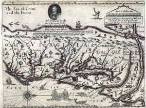
1650 map of the colonies of Virginia and Maryland. The cartographer, Farrer, drew an entirely new map that incorporated Maryland. It is the only Virginia map that mentions the Native American occupants of the Shenandoah Valley. It states that in 1578 Sir Francis Drake led a 10 day expedition up the James River to a valley beyond the mountains, filled with peaceful Indians. Note that Farrer showed the Pacific Ocean being located just beyond the Shenandoah Valley.

