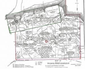
Tuscarora Reservation Map and Occupants, 1890
The Tuscarora Reservation, in Niagara County, New York, is formed from 3 adjoining tracts successively acquired, as indicated on the map. Their early antecedents as kinsmen of the Iroquois, their wanderings westward to the Mississippi, and their final lodgment at the head waters of the rivers Neuse and Tar, in North Carolina, are too much enveloped in tradition to be formulated as history, but courageous, self-supporting, and independent, after long residence upon lands owned by them in that colony, they first came into collision with white people, then with other tribes of that section, until finally, overpowered by numbers, they … Read more


