1910 Eastern Shawnee Census

1910 Eastern Shawnee Census – page 1

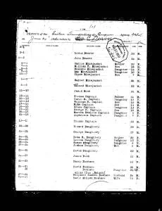
Pages of the 1910 Eastern Shawnee Census. Contains table showing the previous roll number, current roll number, Indian name if given, English name if given, Relationship, Age, and Sex. Also contains the original images of the census.

1914 Eastern Shawnee Census

The 1914 census record of the Eastern Shawnee Tribe from the Quapaw Agency was taken on June 30, 1914, in Indian Territory, which is now Oklahoma. The Eastern Shawnee Tribe primarily resides in northeastern Oklahoma, having separated from other Shawnee groups in the 19th century to establish their community in this region. Recognized as a federally recognized tribe, the Eastern Shawnee have their own government and tribal structure. The purpose of the 1914 census was to maintain an official record of the Eastern Shawnee Tribe members as part of the U.S. government’s broader efforts to document Native American populations. This census provides detailed information about individual tribe members, including their names, ages, sex, family relationships, allotment numbers, and roll numbers.

Cattaraugus Indian Reservation Map and Occupants, 1890

Theodore F. Jimerson (De-hah-teh), Cattaraugus Seneca

The Cattaraugus Indian Reservation, established in 1890, spans parts of Cattaraugus, Chautauqua, and Erie Counties, New York. It is primarily occupied by the Seneca Nation, claiming rights over land where white settlers reside. The area, a result of treaties in the late 18th and early 19th centuries, is characterized by fertile land, waterways, and a network of roads connecting it to nearby towns. Despite rich resources, the region struggles with legal disputes regarding land ownership and infrastructure inadequacies affecting transport and communication.