Acoma Pueblo

The Rock and Pueblo of Acoma, New Mexico

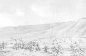
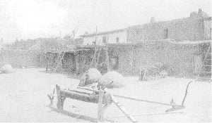
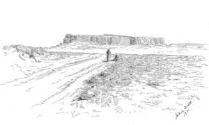
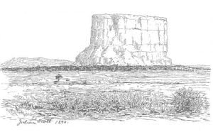
The Acoma Pueblo, perched atop a sandstone mesa nearly 400 feet high, offers a unique glimpse into the life and history of its inhabitants. Its strategic location provided protection against hostile tribes, while the pueblo’s architecture features terraced, adobe structures with narrow access paths. Visitors can observe children’s games and traditional practices, such as unique grooming methods used by locals. The pueblo, home to around 600 residents, maintains its cultural heritage amidst modern influences, reflecting a rich history since its first encounter with Europeans in 1540.
Laguna Pueblo

Mesa Encantado

On October 18, 1890, the narrator arrived at Laguna Pueblo, New Mexico, and was warmly welcomed by the principal men of the community. Situated on a sandstone ledge by the San Jose River, the pueblo features narrow, steep streets and adobe houses. Daily life includes children playing, women gathering water, and men farming. The narrator highlights the vibrant cultural scene, particularly a traditional dance with enthralling choreography and colorful costumes. The surrounding landscape is rich in historical significance, with ancient ruins and fertile lands pointing to Laguna’s enduring heritage.

The Tablita or Corn Dance

Male Pueblo Dancer

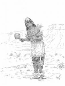
The Tablita or Corn Dance, held in San Domingo, New Mexico, serves as a ceremonial supplication for rain, showcasing the Pueblo’s vibrant culture. In August 1890, 200 dancers, adorned in elaborate costumes and painted with clay and colors, participated in this enduring ritual, marked by mass followed by traditional festivities. The dance emphasizes endurance and grace, with intricate movements synchronized to chants invoking clouds and rain. This communal event also features lighthearted clown performances and concludes with a spirited chicken race, celebrating cultural unity and resilience.

Observations of the Census of the Pueblo Indians, 1890

The statistics gathered from the Pueblo Indians in 1890 reveal significant inconsistencies and inaccuracies in agricultural data. Many small farms were overlooked, leading to inflated cultivation figures, particularly in several pueblos. The actual cultivated land was about 8,750 acres, with varying disparities in wealth among the communities. Legal protections, education, and agricultural practices remain pressing needs, as many Pueblos maintain a predominantly vegetarian diet, relying on limited meat and creatively preserving their produce. The social fabric reflects a tension between traditional lifestyles and external influences.

Picuris Pueblo

In a report from February 20, 1891, Mr. Frederick P. Midler described his visit to Picuris Pueblo, noting the harsh winter conditions and deep snow that hindered access. The pueblo cultivates 555 acres, with each family averaging 15 acres, but they have potential for 2,055 acres with adequate irrigation. The community struggles with poor sanitary conditions, lacks educational facilities, and shows a declining population. Their lifestyle is similar to that of Taos, though they are economically poorer, relying on farming and deer hunting for sustenance.

Isleta Pueblo

Pueblo of Isleta

The Pueblo of Isleta, distinguished by its single-story adobe homes, showcases a blend of traditional and Spanish-influenced architecture. The community practices unique customs, such as distinctive dress featuring trousers, broad-brimmed hats, and traditional bodices, while its agricultural activity includes extensive farming and orchards. The Catholic Church stands centrally, with various community institutions nearby. Notably, Isleta’s Fiesta de los Muertos highlights its rich cultural heritage, where residents honor the deceased with offerings. Overall, Isleta reflects a vibrant blend of historical customs and agricultural prosperity.

Sandia Pueblo

The Sandia Pueblo community, encompassing 24,187 acres, is bordered by the Mexican town of Bernalillo to the north. Although the pueblo land is underutilized, it includes pastures and areas for cultivation, primarily corn and wheat. The governor, while overseeing water management, exemplifies dedication despite the honorary nature of his role. The land sees efforts to raise water through innovative means, supporting grape culture and allowing some Mexican settlers to cultivate vegetables. Nearby islands could also be transformed into arable land, enhancing agricultural potential.

San Felipe Pueblo

Pueblo of San Felipe

The Pueblo of San Felipe, with its 34,767 acres, has extensive agricultural land, more than any other pueblo relative to its population of 554. Its modern town features a military-style layout surrounding a central plaza, with a prominent church and estufas. The cultivated lands extend along the river, while a significant portion remains idle. Despite the recent construction, infrastructure issues such as drainage problems persist. Historical remnants of the old pueblo sit atop a nearby mesa, contributing to the area’s rich cultural and agricultural heritage.

Santa Ana Pueblo

Santa Ana Pueblo is situated along the Jemez River, 9 miles from Zia, in a sandy, largely unproductive area. The town, with two parallel streets, has been mostly abandoned for summer due to its harsh conditions, with residents relocating for the season. A few men remain to guard and maintain the community. Surrounding the pueblo are orchards and vineyards, with cultivated lands along the river totaling approximately 750 acres. The pueblo has access to livestock, and a portion of the population engages in winter agricultural tasks. Santa Ana holds a land grant of 17,361 acres.

Zia Pueblo

Zia Pueblo is characterized by its striking gray-white buildings on a rocky promontory, with a Jesuit church occupying the highest point. The town’s structures, made of cobblestones and volcanic scoria, have fallen into disrepair, reflecting a shrinking population. Agriculture is minimal, with only a few acres cultivated for wheat, corn, and peppers. The local economy also relies on skilled pottery craftsmanship by women, producing significant designs tied to history and mythology. The community faces challenges, including livestock raids and a lack of support from neighboring pueblos.

Jemez Pueblo

Jemez Pueblo is located at the mouth of a picturesque canyon in New Mexico, featuring a narrow plaza surrounded by 85 houses. The community cultivates about 1,100 acres, primarily utilizing irrigation techniques. Recent advancements include the introduction of horse-drawn plowing and fertilization practices. While they have a reputation for hard work, the Jemez face challenges from invading livestock and disputes over land with Mexicans. Mineral discoveries have raised the potential for mining on their grant, originally designated for pasture use.

Cochiti Pueblo

Cochiti Pueblo, situated 95 feet above the river and flanked by fertile plains, comprises approximately 50 dwellings, primarily single-story structures. The town, founded in the 17th century, has seen multiple relocations due to conflicts with Spanish forces. Currently, it hosts both Cochiti and eight Mexican families who engage in communal irrigation work. While lacking orchards, the area supports grazing on a sandy island nearby. Characterized by well-built houses and an expansive plaza, Cochiti’s Catholic Church sees active participation from its Mexican residents. The pueblo spans 24,266 acres.

San Domingo Pueblo

San Domingo Pueblo, situated between Cochiti and San Felipe, has a population of nearly 1,000 and extensively utilizes its land, though much is left uncultivated due to concerns over flooding. Significant changes have occurred since 10 years ago, including the loss of homes to erosion. The community has a rich agricultural tradition, with common practices in grain harvesting and livestock management. The village itself lacks a formal plaza, and its residents face challenges related to living conditions and governance concerning land and resources. The pueblo’s land grant is substantial, spanning 74,743 acres.

Nambe Pueblo

Nambe Pueblo, situated along the Pojoaque River, is rarely visited due to its difficult access. The town supports a population of 79 and features approximately 300 acres of farmland, predominantly growing wheat and corn, with a focus on alfalfa. Though the community has a rich agricultural heritage, they face challenges from encroaching livestock and scant pasture. The pueblo’s structures show signs of decay, yet maintain neat interiors. Of archaeological interest, Nambe also contains ancient pottery and relics, underscoring its historical significance.

Tesuque Pueblo

Tesuque Pueblo (Indian Village) near Santa Fe, New Mexico

Tesuque Pueblo, located near Santa Fe, New Mexico, features a village built around a quadrangle, with two-story houses and a small church in poor condition. The community engages in farming with limited success, averaging 9.3 acres per individual, and cultivates various crops, though yields are modest. Pottery remains a notable industry, influenced by Santa Fe’s market. Traditional grinding methods for corn persist alongside simple household furnishings. Overall, Tesuque possesses a land grant of 17,471 acres, reflecting its agrarian lifestyle and cultural practices.

Pojoaque Pueblo

Pojoaque Pueblo originally encompassed 13,520 acres, but demographic decline has reduced its holdings to just 25 acres. Located a mile east of the Pojoaque and Tesuque Rivers, the pueblo now has a population of 20. Ongoing litigation for four years with two Mexican settlers over appropriated land has consumed significant time and resources. Presently, the pueblo’s assets include a small number of livestock and farming equipment, reflecting the challenges faced in maintaining their community and land rights.

San Ildefonso Pueblo

San Ildefonso Pueblo, located five miles south of Santa Clara, is situated at the confluence of the Pojoaque River and the Rio Grande. The village features a shaded plaza, unique among Pueblos, with buildings arranged around it. Over time, some Mexican families were allowed to settle and buy land within the pueblo, although no land has been sold in recent years. Currently, cultivable land is limited, with only a small strip available, primarily farmed by a widow known as the Mother of the Pueblo.

Santa Clara Pueblo

Santa Clara Pueblo, located near a drying river, faces significant agricultural challenges due to insufficient water supply. The community relies on a limited system of acequias and has cultivated approximately 350 acres mainly for corn, wheat, and vegetables, with few orchards. Economic hardships persist, with most residents earning low wages from railroad work and some engaged in pottery production. Land disputes involving litigation and grievances against outside parties complicate their situation. The pueblo’s grants total 17,360 acres, but many areas remain contested.

San Juan Pueblo

San Juan Pueblo, situated on elevated sand dunes beside the Rio Grande, is characterized by its rich agricultural landscape, with diverse crops cultivated in small fields. The community of 406, comprising 80 land-owning Indians, displays economic disparity amidst a largely vegetarian diet. Key agricultural practices include traditional wheat thrashing methods. The pueblo features adobe houses, a Catholic church, and a newly built chapel, alongside a school run by a Mexican educator. While 17,515 acres are held, land for grazing is limited, influencing livestock presence.

Taos Pueblo

Feast of San Geronimo

Taos Pueblo, located in northern New Mexico between the Rio Lucero and Rio Taos, benefits from reliable water sources for agriculture. The community grows corn and wheat across approximately 9 to 35-acre farms, achieving yields of up to 30 bushels per acre. The Pueblo maintains a strong independent status, facing legal disputes over land and irrigation rights. Its adobe structures feature primitive yet effective designs, while cultural practices and agricultural methods reflect a blend of traditional and modern influences. The Taosans adhere to their Tigua heritage, showcasing resilience and adaptability in a changing environment.