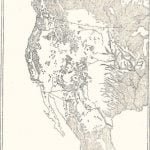
The shaded portions of this map mark the areas originally covered with trees. The true plains extend from north to south along the eastern border of the Rocky Mountains. On the west, trees are found on the sides of mountains; on the east, they stretch out into the plains along the margins of the streams. Reference to the tribal map shows how the typical group ranges in the open plains while the eastern agricultural Village group lives in the partially forested belt. On the west the Plateau group appears to range in the open stretches among the mountains.
Maps Usage
This map has been referenced on the following pages:
