A Fresh Look at Ocmulgee Bottoms

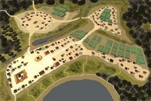
Ocmulgee in 1000AD

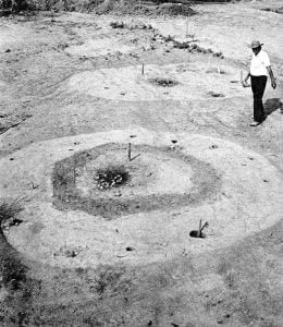
Many of the most fundamental assumptions by the Anthropology profession concerning the Pre-European history of the Lower Southeast were developed during the mid-20th century as a result of a massive, federally-funded excavation of archaeological sites near Macon, GA. While today, anthropologists, museums and the National Park Service present a united front stating that the body of knowledge, which resulted from the Ocmulgee Bottoms studies, was the result of comprehensive analysis, plus well-thought out consensus by some of the most brilliant men of their time, the truth is quite a bit different.

Southern Kith and Kin

Southern kith and kin; a record of my children's ancestors

“Southern Kith and Kin: A Record of My Children’s Ancestors” is a comprehensive four-volume genealogical record compiled by Jewel Davis Scarborough, first published in 1951. This detailed work traces the lineage and historical narratives of several families from the colonial period through the early 20th century, focusing particularly on their roles in American history and migration patterns.

The Natural History of Ocmulgee Bottoms

9Fu14-DrArthurKelly

Ocmulgee Bottoms is a corridor of the Ocmulgee River Flood Plain in the central region of the State of Georgia that begins at the Fall Line in Macon, GA and continues 38 miles southward to near Hawkinsville, GA. This region is located in Bibb, Twiggs, Houston, Bleckley and Pulaski Counties. The Ocmulgee River’s velocity slows dramatically upon entering the Bottoms and has a serpentine channel. Over the eons, the river here has meandered frequently across the breath of the flood plain, leaving hundreds of ponds and swamps, plus a deep layer of rich, alluvial soil. On top of the alluvial soil is from one to ten feet or red clay that was deposited during the period when cotton was cultivated in the Piedmont, upstream.

Native American History of Twiggs County, Georgia

Twiggs County is located in central Georgia and is part of the Macon, GA Metropolitan Statistical Area (MSA.) It is named after General John Twiggs (1781 -1820) – a leader of the Georgia Militia during the American Revolution. Its county seat is Jeffersonville. Twiggs is bordered on the northeast side by Wilkinson County and the northwest by Bibb and Jones Counties. Laurens County forms its southeastern boundary. Bleckley County forms its southern boundary, while Houston County forms its southwestern boundary. One of the larger Native American town sites in Georgia is located in Twiggs County. Labeled today by archaeologists as … Read more